Area Overview for RM11 1JP
Photos of RM11 1JP
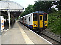
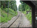
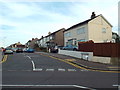
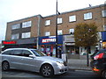
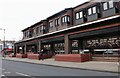
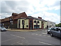
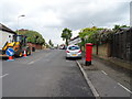
45 photos from this area
Area Information
Key information about the RM11 1JP including its size, population, and administrative classification.
- Area Type
- Postcode
- Area Size
- 8037 m²
- Population
- 1656
- Population Density
- 5544 people/km²
House Prices in RM11 1JP
29
Properties
£339,233
Average Sold Price
£98,995
Lowest Price
£525,000
Highest Price
Showing 29 properties
| Address | Type | Beds | Baths | Last Sale Price | Last Sale Date | |
|---|---|---|---|---|---|---|
| 131 Lyndhurst Drive, Hornchurch, RM11 1JP | Terraced | 3 | 1 | £415,000 | Mar 2024 | |
| 115 Lyndhurst Drive, Hornchurch, RM11 1JP | house | - | - | £515,000 | Nov 2022 | |
| 117 Lyndhurst Drive, Hornchurch, RM11 1JP | Terraced | 4 | 2 | £525,000 | Feb 2022 | |
| 111 Lyndhurst Drive, Hornchurch, RM11 1JP | house | - | - | £482,000 | Apr 2021 | |
| 85 Lyndhurst Drive, Hornchurch, RM11 1JP | house | - | - | £460,000 | Aug 2019 | |
| 93 Lyndhurst Drive, Hornchurch, RM11 1JP | Terraced | 3 | - | £435,000 | Feb 2017 | |
| 139 Lyndhurst Drive, Hornchurch, RM11 1JP | Terraced | 3 | - | £425,000 | Oct 2016 | |
| 107 Lyndhurst Drive, Hornchurch, RM11 1JP | Terraced | 3 | 1 | £385,000 | Feb 2015 | |
| 141 Lyndhurst Drive, Hornchurch, RM11 1JP | Terraced | 3 | - | £310,000 | Nov 2013 | |
| 129 Lyndhurst Drive, Hornchurch, RM11 1JP | house | - | - | £270,000 | Dec 2009 |
Page 1 of 3
Energy Efficiency in RM11 1JP
Amenities
Schools
| Rank | School | Type | Entry gender | Ages |
|---|
Explore more schools in this area
Go to Schools tabDemographics
Household Size
Family (3-5 people)
most common
Accommodation Type
Houses
most common
Tenure
88
majority
Ethnic Group
White
most common
Religion
N/A
most common
Household Composition
N/A
most common
Age
47
median
Adults (30-64 years)
most common
Household Deprivation
N/A
with no deprivation
NS-SEC
37
in Lower managerial occupations
Explore more demographic insights in this area
Go to Demographics tabPlanning
Planning Constraints
- Flood RiskPremium
- Ramsar Wetland SitesPremium
- Area of Outstanding Natural BeautyPremium
- Protected Nature ReservePremium
- Protected WoodlandPremium