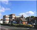
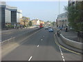
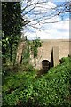
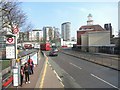
Area Overview for RM1 4FD
Photos of RM1 4FD


Area Information
RM1 4FD is a very small residential postcode in east London, covering an area of just 806 square metres. Despite its limited geographical spread, it serves around 2,045 people, resulting in an extremely high population density. You might find this cluster feels tight-knit or simply very compact depending on the surrounding homes. Living in this specific postcode means you are part of a dense pocket within the broader RM1 borough. The area is entirely residential, designed for housing rather than commercial activity or large open spaces. Daily life here revolves around managing proximity to neighbours while accessing the wider transport and shopping networks nearby. This small footprint makes it a contained lifestyle choice where every residence is close to another. The high density means resources like schools or local shops are shared tightly among the residents. You should expect a neighbourhood that functions efficiently but lacks the spacious green margins found in less dense suburban areas. The sheer number of people per square kilometre defines the character of living in this specific cluster.
- Area Type
- Postcode
- Area Size
- 806 m²
- Population
- 2045
- Population Density
- 4447 people/km²
Homes in RM1 4FD are dominated by traditional house types rather than converted flats or purpose-built apartments. With a 62% home ownership rate, the market is heavily skewed towards owner-occupiers who have made significant investment in the area. This high proportion of owners typically leads to lower vacancy rates and a more stable residential environment. When you view properties here, expect to find houses that accommodate the family needs of the 30 to 64 age group. The small physical size of the postcode means the total number of listings will be limited, creating a competitive local market. Buyers looking for rental properties will find fewer options compared to owner-occupied homes. The prevalence of houses suggests that the character of the street features driveways, gardens, and larger internal spaces. This contrasts with high-density rental blocks found elsewhere in London. The area appeals to those seeking permanence rather than short-term tenancies. You should plan your search carefully within this 806 square metre zone, as there may be few alternatives to inspect immediately.
House Prices in RM1 4FD
Showing 9 properties
Energy Efficiency in RM1 4FD
Living in RM1 4FD places you steps away from major retail and transport links. Tesco Romford and Asda Romford are within practical reach, offering your choice for weekly groceries and general shopping needs. Iceland Romford provides a convenient option for cheaper essentials or late-night items if you prefer that store. You also have excellent rail access, with Gidea Park Station, Emerson Park Station, and Harold Wood Station nearby to manage your daily commute. The DLR network supports your travel plans too, with Elm Park Station, Hornchurch, and London Bridge accessible for trips into the city centre. These stations ensure you can move freely across London without relying solely on the road network. The presence of five retail outlets, five rail stations, and five metro stations highlights the convenience of this location. You do not need to drive far to access these amenities. Your daily errands and commutes are designed for minimal travel time and maximum reliability. This integration of transport and retail makes life efficient for busy households.
Amenities
Schools
| Rank | School | Type | Entry gender | Ages |
|---|
Explore more schools in this area
Go to Schools tabDemographics
The community within RM1 4FD has a distinct demographic profile that reflects stability. The median age is 47, placing the area firmly in the hands of middle-aged adults. Currently, adults aged between 30 and 64 years represent the most common age range, creating a community focused on family life or established careers. Home ownership stands at 62%, which suggests a settled tenant base with a strong majority of residents owning their properties outright or with a mortgage. Most of the accommodation in this postcode consists of houses, indicating a preference for detached or semi-detached living over flats. The population is predominantly White, contributing to a fairly uniform ethnic composition compared to wider metropolitan areas. These figures indicate a stable, long-term resident population rather than a transient one. The high home ownership rate often correlates with lower turnover rates in the local estate market. You are likely to meet long-standing neighbours who have lived through various changes in the wider borough. This age structure supports local businesses but may see fewer young children or elderly couples compared to other diverse districts.
Household Size
Accommodation Type
Tenure
Ethnic Group
Religion
Household Composition
Age
Household Deprivation
NS-SEC
Explore more demographic insights in this area
Go to Demographics tabPlanning
Planning Constraints
- Flood RiskPremium
- Ramsar Wetland SitesPremium
- Area of Outstanding Natural BeautyPremium
- Protected Nature ReservePremium
- Protected WoodlandPremium