Area Overview for RM1 3QZ
Photos of RM1 3QZ
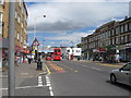
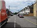
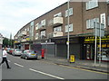
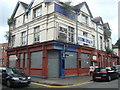
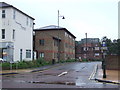
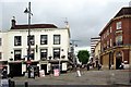
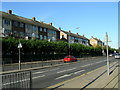
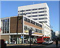
100 photos from this area
Area Information
Key information about the RM1 3QZ including its size, population, and administrative classification.
- Area Type
- Postcode
- Area Size
- 5629 m²
- Population
- 1767
- Population Density
- 7814 people/km²
House Prices in RM1 3QZ
40
Properties
£159,734
Average Sold Price
£90,000
Lowest Price
£290,000
Highest Price
Showing 40 properties
| Address | Type | Beds | Baths | Last Sale Price | Last Sale Date | |
|---|---|---|---|---|---|---|
| 21, Watermans, Junction Road, Romford, RM1 3QZ | Flat | 2 | 1 | £195,000 | Dec 2025 | |
| 7, Watermans, Junction Road, Romford, RM1 3QZ | Flat | - | - | £160,000 | Jun 2024 | |
| 16, Watermans, Junction Road, Romford, RM1 3QZ | Flat | - | - | £145,000 | May 2024 | |
| 9, Watermans, Junction Road, Romford, RM1 3QZ | Flat | - | - | £128,000 | Mar 2024 | |
| 33, Watermans, Junction Road, Romford, RM1 3QZ | Flat | - | - | £138,000 | Sep 2023 | |
| 36, Watermans, Junction Road, Romford, RM1 3QZ | Flat | 1 | 1 | £90,000 | Oct 2022 | |
| 30, Watermans, Junction Road, Romford, RM1 3QZ | Flat | - | - | £185,000 | Sep 2022 | |
| 37, Watermans, Junction Road, Romford, RM1 3QZ | Flat | 2 | 1 | £165,000 | Feb 2022 | |
| 5, Watermans, Junction Road, Romford, RM1 3QZ | Flat | - | - | £150,000 | Nov 2021 | |
| 19, Watermans, Junction Road, Romford, RM1 3QZ | Flat | - | - | £155,000 | Sep 2021 |
Page 1 of 4
Energy Efficiency in RM1 3QZ
Amenities
Schools
| Rank | School | Type | Entry gender | Ages |
|---|
Explore more schools in this area
Go to Schools tabDemographics
Household Size
One person
most common
Accommodation Type
Flats
most common
Tenure
53
majority
Ethnic Group
White
most common
Religion
N/A
most common
Household Composition
N/A
most common
Age
47
median
Adults (30-64 years)
most common
Household Deprivation
N/A
with no deprivation
NS-SEC
39
in Lower managerial occupations
Explore more demographic insights in this area
Go to Demographics tabPlanning
Planning Constraints
- Flood RiskPremium
- Ramsar Wetland SitesPremium
- Area of Outstanding Natural BeautyPremium
- Protected Nature ReservePremium
- Protected WoodlandPremium