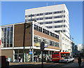
Area Overview for RM1 1HL
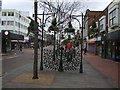
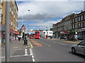
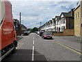
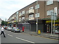
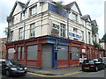
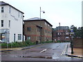
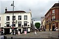
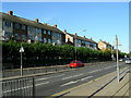
Photos of RM1 1HL


Area Information
RM1 1HL is a specific postcode area covering a small residential cluster within England. The location houses 2,110 residents, creating an immediate, close-knit environment where daily life revolves around proximity. Living in RM1 1HL means navigating a distinctively compact community rather than a sprawling suburb. The area functions as a contained neighbourhood where families and commuters intersect at a single point on the map. You will find a tight community structure here, defined by the small population count and the postcodes system. This concentration suggests a neighbourhood where events and local knowledge spread quickly. Prospective buyers enter a space with clear boundaries and a defined character. The area does not boast vast green spaces or sprawling estates; instead, it offers the convenience of a clustered settlement. Your daily routine will be shaped by this density. The scale of RM1 1HL dictates that destinations are measured in short distances or short transport links. The area serves as a functional base for residents who value direct access to wider networks without the noise of a large town centre. The simplicity of the layout defines the lifestyle experience.
- Area Type
- Postcode
- Area Size
- Not available
- Population
- 2110
- Population Density
- 5782 people/km²
The property market in RM1 1HL is defined by a specific accommodation type: Flats. This housing model dominates the local landscape, replacing traditional detached or semi-detached rows commonly found in other uptake areas. With only 38% of homes owner-occupied, the market relies heavily on the rental sector. This statistic reveals that the majority of the 2,110 residents rent their properties rather than purchasing freehold or leasehold estates. You are likely to encounter a high volume of second-hand rentals here. The concentration of flats implies a vertical living arrangement rather than a horizontal spread. Potential buyers must adjust expectations regarding garden space and privacy when viewing homes in RM1 1HL. The low ownership percentage signals a region where investors and landlords play a significant role in the housing supply. For anyone looking to purchase, the stock is constrained by the architectural style prevalent in this small residential cluster. Detached houses are unlikely to be the primary offering. The market operates on efficiency and density. Your competition will come from other renters seeking the specific apartment-style living this postcode provides. The data presents a clear picture of a rental-first environment.
House Prices in RM1 1HL
No properties found in this postcode.
Energy Efficiency in RM1 1HL
Living in RM1 1HL places you within a five-minute radius of major retail and transport hubs. Three large hypermarkets define your primary shopping destinations: Lidl Romford, Asda Romford, and Aldi Rom Valley Retail Park. These venues provide groceries, household essentials, and daily necessities without the need for a personal car. The 2,110 residents enjoy convenient access to essential services. Rail connectivity extends your lifestyle through five nearby stations, including Gidea Park and Emerson Park. The DLR network, stretching from Elm Park to Dagenham East, connects you to modern workplaces. You can integrate leisure trips and commuting into your morning routine seamlessly. The cluster of retail parks ensures that your daily needs are met locally. Your lifestyle is shaped by convenience. The names of the stores and stations confirm that major amenities are not far away. You do not need to travel into Romford town centre for supermarkets; the retail parks serve your postcode directly. The 5 stations mentioned provide redundancy in your travel plans. Sanitation and waste collection services, while not named, are assumed standard within this residential cluster.
Amenities
Schools
The educational landscape near RM1 1HL centres on Kings Oak Primary School, which is located in the independent sector. This private institution sits within practical reach of the 2,110 residents living in the postcode. No further schools are listed for this specific area in the available records. Families relying on this facility will need to consider independent school tuition fees as part of their household budget. You will not find state-maintained options immediately adjacent to this cluster. The gap in schooling data suggests limited public education provision directly marketed to this specific small cluster. Parents will need to verify catchment areas and fee structures for Kings Oak Primary School independently. The proximity of this single independent school shapes the local parental demographic, potentially aligning with residents who value independent education or are ineligible for state schooling. The lack of comprehensive school listings for RM1 1HL indicates that other educational establishments may lie further afield. Families must plan commutes carefully. The presence of only one named school suggests that residents might rely on a wider network for secondary options. This focus on independent provision defines the educational character of the immediate vicinity.
| Rank | School | Type | Entry gender | Ages |
|---|
Explore more schools in this area
Go to Schools tabDemographics
The community in RM1 1HL reflects a mature household profile, with a median age of 47 and most adults living between the ages of 30 and 64. Home ownership stands at 38%, indicating a predominantly renter market where many residents do not own their properties outright. Accommodation types are characterised by flats, reflecting a housing stock suited to multi-unit living rather than detached villas. You will encounter a population divided, with a significant portion of the 2,110 residents relying on rentals. The demographic skew towards adults in their working years influences the area's character. The predominant ethnic group is White, providing a clear social fabric for the neighbourhood. With fewer than 6,000 people potentially contributing to such metrics, the social dynamics are transparent and less volatile than in larger districts. This age profile suggests a need for reliable infrastructure and amenities tailored to established families and young professionals. The low ownership rate means fewer homeowners with children moving into the area versus long-term boarders. You live in an environment where neighbour interactions are common due to the high density of flats. The demographic data points to a stable but transient community in terms of ownership tenure.
Household Size
Accommodation Type
Tenure
Ethnic Group
Religion
Household Composition
Age
Household Deprivation
NS-SEC
Explore more demographic insights in this area
Go to Demographics tabPlanning
Planning Constraints
- Flood RiskPremium
- Ramsar Wetland SitesPremium
- Area of Outstanding Natural BeautyPremium
- Protected Nature ReservePremium
- Protected WoodlandPremium