Area Overview for RM1 1DA
Photos of RM1 1DA
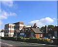

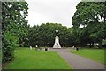
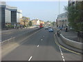
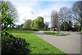

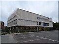
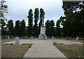
56 photos from this area
Area Information
Key information about the RM1 1DA including its size, population, and administrative classification.
- Area Type
- Postcode
- Area Size
- 4874 m²
- Population
- 2045
- Population Density
- 4447 people/km²
House Prices in RM1 1DA
16
Properties
-
Average Sold Price
-
Lowest Price
-
Highest Price
Showing 16 properties
| Address | Type | Beds | Baths | Last Sale Price | Last Sale Date | |
|---|---|---|---|---|---|---|
| Abacus House, 68A North Street, Romford, RM1 1DA | Office | - | - | - | - | |
| 98-102 North Street, Romford, RM1 1DA | office_workshop | - | - | - | - | |
| Garden Living, 104 North Street, Romford, RM1 1DA | retail_financial | - | - | - | - | |
| A K T Motors, North Street, Romford, RM1 1DA | shop | - | - | - | - | |
| A.k.t. Autos, 96 North Street, Romford, RM1 1DA | shop | - | - | - | - | |
| Foot And Ellis Smith, Abacus House, 68A North Street, Romford, RM1 1DA | Office | - | - | - | - | |
| Foot Veares And C0, Abacus House, 68A North Street, Romford, RM1 1DA | Office | - | - | - | - | |
| 88A North Street, Romford, RM1 1DA | Flat | - | - | - | - | |
| 88B North Street, Romford, RM1 1DA | Flat | - | - | - | - | |
| 100-102 North Street, Romford, RM1 1DA | Office | - | - | - | - |
Page 1 of 2
Energy Efficiency in RM1 1DA
Amenities
Schools
| Rank | School | Type | Entry gender | Ages |
|---|
Explore more schools in this area
Go to Schools tabDemographics
Household Size
Family (3-5 people)
most common
Accommodation Type
Houses
most common
Tenure
62
majority
Ethnic Group
White
most common
Religion
N/A
most common
Household Composition
N/A
most common
Age
47
median
Adults (30-64 years)
most common
Household Deprivation
N/A
with no deprivation
NS-SEC
35
in Lower managerial occupations
Explore more demographic insights in this area
Go to Demographics tabPlanning
Planning Constraints
- Flood RiskPremium
- Ramsar Wetland SitesPremium
- Area of Outstanding Natural BeautyPremium
- Protected Nature ReservePremium
- Protected WoodlandPremium