Area Overview for Raynes Park Ward
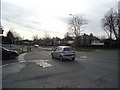
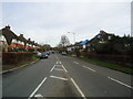
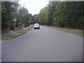
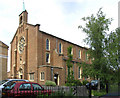
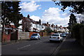
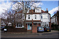
Photos of Raynes Park Ward

Area Information
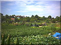
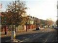
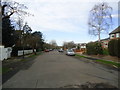
Raynes Park Ward sits on the southern edge of the London Borough of Merton, covering a compact 1.9 square kilometres of adaptable living space. You will find residential streets and a railway station serving a local centre that stands between West Barnes and New Malden. The ward includes distinct neighbourhoods such as Shannon Corner and Grand Drive, forming a unified electoral division for the London Borough Council. Historical records indicate the name originates from the Rayne family, previous landowners, while the London & South Western Railway arrived in 1838 to catalyse development. A planned garden suburb emerged south of the railway under landowner Richard Garth before major growth occurred in the 1930s. WWII bombing damage, including V-1 attacks in 1944, Left its mark, yet the 2015 high street recognised the locality by becoming a finalist in the Great British High Street competition. Today, the area remains a suburban residential hub known for leafy streets and green spaces. It forms a functional part of South West London, situated 7.8 miles southwest of Charing Cross. You live in a setting that balances historic charm with modern connectivity, far from the centre but well integrated into it. The population density is manageable, creating a sense of place that feels distinct from other parts of London.
- Area Type
- District Borough Unitary Ward
- Area Size
- 1.9 km²
- Population
- Not available
- Population Density
- Not available
Demographics
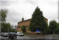
The community within Raynes Park Ward is defined by an older population profile with a median age of 70 years. The 2011 population census recorded 19,619 residents across the combined Raynes Park and West Barnes wards. This age distribution suggests an area where you might find retirement communities or current retirees enjoying down-sized homes. Although specific data for the single ward is not fully detailed in the provided records, the broader ward statistics indicate a significant proportion of older adults compared to other London boroughs. Home ownership stands at a robust 58%, indicating that the majority of residents have built equity or purchased their property outright. The household composition data remains general in the current records, preventing a precise breakdown of single-person versus family households. You can expect a settled neighbourhood where long-term residents dominate the landscape. The area reflects a mature demographic rather than a young professional hub. This skew influences local commerce and social activities, focusing on services suitable for an older population. The presence of Grade II listed All Saints Church and established housing further reinforces this historical settlement pattern. Living here means engaging with a community that has evolved over centuries since the parish of Merton was historically south of Coombe Lane.
Household Size
Accommodation Type
Tenure
Ethnic Group
Religion
Household Composition
Age
Household Deprivation
NS-SEC
Explore more demographic insights in this area
Go to Demographics tabPlanning
Planning Constraints
- Flood RiskPremium
- Ramsar Wetland SitesPremium
- Area of Outstanding Natural BeautyPremium
- Protected Nature ReservePremium
- Protected WoodlandPremium
- Crime RiskPremium