Area Overview for Portsoken Ward
Photos of Portsoken Ward

Area Information
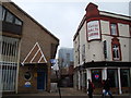
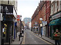
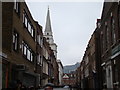
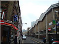
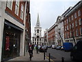
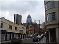
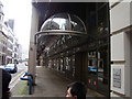
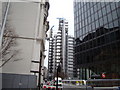
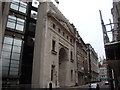
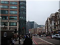
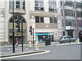
Portsoken Ward stands as the easternmost of the 26 wards that make up the City of London. This district, covering exactly 6.2 hectares, holds the distinction of being an area where the land lies east of the historic London Wall. Although it falls entirely within the parish of St Botolph Aldgate, its location often places it in the perception of London's East End. The ward's boundaries underwent significant adjustments in 1994 and 2013, which expanded its territory to include specific zones such as the Middlesex Street Estate from Tower Hamlets. These shifts also incorporated areas like the site of John Cass's Foundation Primary School, now known as The Aldgate School, from the neighbouring Aldgate Ward. Currently, the ward sits near coordinates 51.51425128475878, -0.07538874351670143, placing it in immediate proximity to Aldgate. This alignment creates a distinct boundary between the ancient City walls and the expanding modern metropolis. Residents seeking homes in Portsoken Ward enter a historic corridor that connects deep-rooted heritage with contemporary urban development. The physical size of the ward imposes a compact, intense living environment that defines daily movement and street life for everyone calling this small borough unitary ward home.
- Area Type
- District Borough Unitary Ward
- Area Size
- 6.2 hectares
- Population
- Not available
- Population Density
- Not available
Demographics
The community profile within Portsoken Ward reflects a specific demographic structure defined by precise figures. While exact age breakdowns or household type percentages are not included in the current records, the area's historical status as an extra-mural district shapes who lives there today. The ward covers 6.2 hectares, a small footprint that concentrates the local population into a dense urban setting. Historically, the land served as the "soke" east of Aldgate before being granted to the Cnichtengild guild of knights. This lineage influences the current social fabric, even as the demographic composition shifts with modern development. The area remains coterminous with the broader history of St Botolph without Aldgate, though it has lost southern territories around the year 1200 due to the Tower of London expansion. These historical losses shaped the boundary constraints that persist today. When evaluating where to live or invest, prospective buyers must consider the specific identity of this ward. The population density within these 6.2 hectares creates a unique environment where community interaction occurs in historic streets. Any analysis of the local household types or ownership levels requires close scrutiny of the specific plots within this easternmost ward of the City.
Household Size
Accommodation Type
Tenure
Ethnic Group
Religion
Household Composition
Age
Household Deprivation
NS-SEC
Explore more demographic insights in this area
Go to Demographics tabPlanning
Planning Constraints
- Flood RiskPremium
- Ramsar Wetland SitesPremium
- Area of Outstanding Natural BeautyPremium
- Protected Nature ReservePremium
- Protected WoodlandPremium
- Crime RiskPremium