Area Overview for Plumstead Common Ward
Photos of Plumstead Common Ward

Area Information
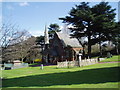
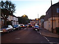
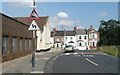
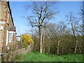
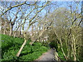
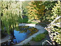
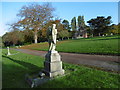
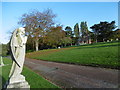
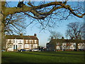
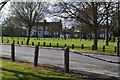
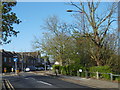
Living in Plumstead Common Ward means residing within a historic district in southeast London that balances urban convenience with significant green space. This ward, which sits in the Royal Borough of Greenwich, covers a specific area of 2.5 km² and is defined by its proximity to Plumstead Common. This 100-acre urban park is the primary landmark of the location, offering a protected open space for recreation that has been managed since the 19th century. The ward's identity is rooted in its history, dating back to Saxon times, with the area around the Common serving as a favourable setting for residents seeking access to nature without leaving the London borough. Current living conditions are shaped by the local population structure, where approximately 1,551 people reside across this compact footprint. The area is characterised by its established community feel, anchored by local institutions such as St Margaret's, a school built in 1856, and historic pubs like The Ship where Arsenal FC originated in 1886. You will find a neighbourhood that respects its agricultural past, specifically the historic rights for grazing, while functioning as a modern residential ward. The layout ensures that daily life for those buying homes in Plumstead Common Ward involves easy access to amenities and the expansive common ground that gives the district its name.
- Area Type
- District Borough Unitary Ward
- Area Size
- 2.5 km²
- Population
- 1551
- Population Density
- 632 people/km²
Demographics
The community profile of Plumstead Common Ward is distinct, centred on an older demographic where the median age stands at 70 years. This indicates that the area predominantly houses retirees and those in the later stages of life rather than young families or single professionals. With a total population of 1,551 people spread across 2.5 km², the resulting population density reaches 632 people per square kilometre, suggesting a moderate level of crowding despite the presence of the large common. Home stability is relatively high, as 50% of households in this ward own their property outright or with a mortgage, while the remaining half typically rents. The ward accommodates a mix of household types, though specific breakdowns for single-person or family units are not detailed in current records. Residents likely benefit from a quiet environment typical of neighbourhoods with such an older age profile. The presence of significant green space, including the protected Plumstead Common, contributes to the quality of life for inhabitants in this ward. Those looking for homes in Plumstead Common Ward should expect an environment suited to those who value established green areas and lower-impact neighbourhoods over high-energy urban hubs.
Household Size
Accommodation Type
Tenure
Ethnic Group
Religion
Household Composition
Age
Household Deprivation
NS-SEC
Explore more demographic insights in this area
Go to Demographics tabPlanning
Planning Constraints
- Flood RiskPremium
- Ramsar Wetland SitesPremium
- Area of Outstanding Natural BeautyPremium
- Protected Nature ReservePremium
- Protected WoodlandPremium
- Crime RiskPremium