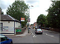
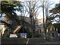
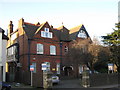
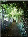
Area Overview for Plaistow Ward
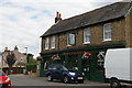
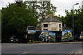
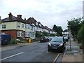
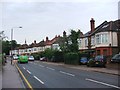
Photos of Plaistow Ward
Area Information
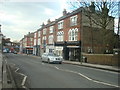
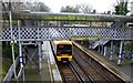
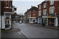
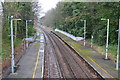
Living in Plaistow Ward offers residents a defined slice of the London Borough of Newham, covering an area of just 2.3 square kilometres. This ward is largely residential, situated in East London with deep historical roots tracing back to the 12th century when Hugh de Balun first became associated with the locality. The area was once the richest village in West Ham parish before evolving into its own ecclesiastical parish in 1844. You will find a neighbourhood that balances its historic character as a former chapelry with the modern reality of a diverse urban community within the district borough unitary ward. Although the postcode BR1 4SY technically points towards Bromley, reliable local context confirms Plaistow in Newham as the primary match for this specific ward identity. Your daily life here is shaped by a community that has grown from the manor grants of Sir Richard de Playz to the industrial transport links established by the London, Tilbury and Southend Railway. The ward stands distinct for being split from All Saints, West Ham, yet maintaining its own identity as a well-defined administrative unit. You are entering an environment where history matters, from the smallpox hospital opened in 1871 to the later establishment of a hospital for women and children in 1893. This background provides a stable context for those considering homes in Plaistow Ward, offering a neighbourhood defined by clear boundaries and a recognised place in the broader Newham estate. The area represents a settled community where the past informs the present residential landscape.
- Area Type
- District Borough Unitary Ward
- Area Size
- 2.3 km²
- Population
- Not available
- Population Density
- Not available
Demographics
The community in Plaistow Ward reflects a settled population with a median age of 70. This indicates that the ward is dominated by older residents, suggesting a strong cohort of retirees or long-term locals who have lived in the area for decades. You will not find a neighbourhood filled primarily with young families or students, but rather a demographic where stability and length of residency appear to be key characteristics. House ownership stands at 63%, meaning nearly two out of every three households live in their own properties. This high rate of owner occupation usually correlates with community cohesion and investment in local infrastructure. Accommodation types and household composition are recorded as totals, confirming the broad nature of the living arrangements within this 2.3 square kilometre stretch of London. While specific data on predominant ethnic groups and religious affiliations is not detailed in the current statistics, the historical notes reveal the area as a diverse urban area. The high home ownership figure suggests that many residents have deep ties to Plaistow Ward, having moved in previously and stayed. This demographic profile creates a distinct atmosphere from the rapidly changing populations often seen in other parts of East London. You are looking at a neighbourhood defined by its mature residents and a high rate of private home ownership rather than temporary renting arrangements. The age profile of 70 years old points towards a quiet, established community where daily rhythm is determined by an older generation.
Household Size
Accommodation Type
Tenure
Ethnic Group
Religion
Household Composition
Age
Household Deprivation
NS-SEC
Explore more demographic insights in this area
Go to Demographics tabPlanning
Planning Constraints
- Flood RiskPremium
- Ramsar Wetland SitesPremium
- Area of Outstanding Natural BeautyPremium
- Protected Nature ReservePremium
- Protected WoodlandPremium
- Crime RiskPremium