Area Overview for Pimlico North Ward
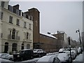
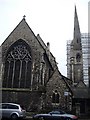
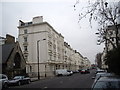
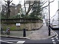
Photos of Pimlico North Ward


Area Information
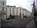
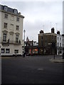
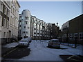
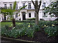
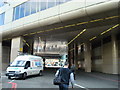
Living in Pimlico North Ward offers city centre convenience with a distinct village atmosphere. This electoral ward sits between Buckingham Palace Road, Vauxhall Bridge Road, Lupus Street and Winchester Street in the City of Westminster. It encompasses Victoria Station and Pimlico Underground station, alongside shopping areas on Warwick Way, Wilton Road and Churton Street. The area forms a southern extension to Belgravia, characterised by stucco terraces and garden squares. Thomas Cubitt designed much of this architecture starting in 1825. The ward covers 59.7 hectares and holds a population of 1362 according to current records. You will find a mix of 19th-century stucco-fronted terraces, garden squares, and post-war estates like the Grade II*-listed Lillington and Longmoore Gardens. Abbott's Manor Estate also defines the residential character. The Pimlico Conservation Area protects over 350 Grade II-listed buildings here. Dolphin Square, Churchill Gardens estate and Tate Britain stand as nearby landmarks. Daily life revolves around the active community feel, with residents accessing major transport hubs and local shops within easy reach. The diversity of the ward offers a blend of historic grandeur and functional urban living.
- Area Type
- District Borough Unitary Ward
- Area Size
- 59.7 hectares
- Population
- 1362
- Population Density
- 2282 people/km²
Demographics
The community profile in Pimlico North Ward shows a clear shift toward an older demographic. The median age here is 70 years old. This age range is the most common cohort across the total population. You will find a settlement that caters significantly to retirees or older residents living in longevity. Home ownership stands at 29%, meaning the majority of households currently rent rather than own their homes. This figure indicates a strong letting market within the ward. There are no specific statistics provided for household composition breakdowns beyond the total category in the available data. Similar gaps exist for predominant ethnic group details and religious affiliation based on the total population data. Despite the lack of granular data on specific demographics, the area maintains a strong community feel. The ward committee emphasises teamwork, suggesting an engaged local governance structure. Residents navigate a landscape defined by historic estates and modern conservation zones. Living here means accessing a population where senior citizens form the backbone of social interactions.
Household Size
Accommodation Type
Tenure
Ethnic Group
Religion
Household Composition
Age
Household Deprivation
NS-SEC
Explore more demographic insights in this area
Go to Demographics tabPlanning
Planning Constraints
- Flood RiskPremium
- Ramsar Wetland SitesPremium
- Area of Outstanding Natural BeautyPremium
- Protected Nature ReservePremium
- Protected WoodlandPremium