Area Overview for Penge & Cator Ward
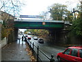
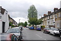
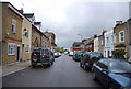
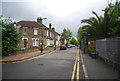
Photos of Penge & Cator Ward
Area Information
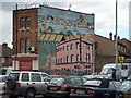
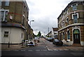
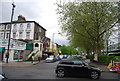
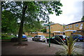
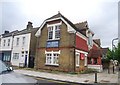
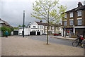
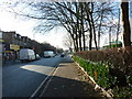
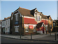
Penge & Cator Ward sits as a distinct electoral ward within the London Borough of Bromley, covering 3.1 square kilometres of South East London. You will find approximately 6,475 residents distributed across this small district, creating a neighbourhood with a density of 2,120 people per square kilometre. This area encompasses the historic suburb of Penge and territories linked to the former Cator estates. The ward lies roughly 3.5 miles west of Bromley, though it remains close to Bromley town centre to the south east. Living in Penge & Cator Ward connects you to a location with deep historical roots. The area was once a hamlet attached to Battersea before becoming an independent urban district in 1900. You may walk past landmarks like the Crooked Billet, a public house dating back at least to 1601. Other notable sites include Victorian almshouses such as the Free Watermen and Lightermen's Almshouses on Beckenham Road, which were built between 1840 and 1841. The ward's transportation history spans over a century, marked by the London and Croydon Railway opening in 1839 and the closure of tram services at various points. This mix of historic charm and suburban utility defines daily life here.
- Area Type
- District Borough Unitary Ward
- Area Size
- 3.1 km²
- Population
- 6475
- Population Density
- 2120 people/km²
Demographics
The community in Penge & Cator Ward reflects a specific life stage rather than a broad family demographic. Data shows a median age of 70, indicating that the population skews significantly towards older residents. You are likely to encounter fewer young children or young professionals compared to other London suburbs, as the most common age bracket corresponds to the total population rather than any specific youth segment. This age profile suggests the ward attracts retirees or older couples seeking a quieter life. Homeownership stands at 49%, meaning the remaining just under half of households operate as rentals. Households in the area are composed of adults, with the data not specifying a dominance of single-person or multi-generation living arrangements. While the primary ethnic and religious breakdowns are listed as "total" in the source files, the area has historical ties to the Victorian expansion era that shaped its early demographics. Deprivation is not explicitly quantified in the provided dataset, but the high median age often correlates with specific socioeconomic patterns typical of retirement zones. Understanding these figures helps you assess whether the community fits your lifestyle needs. The stability of an older population often brings calmer streets but may limit local services targeted at younger families.
Household Size
Accommodation Type
Tenure
Ethnic Group
Religion
Household Composition
Age
Household Deprivation
NS-SEC
Explore more demographic insights in this area
Go to Demographics tabPlanning
Planning Constraints
- Flood RiskPremium
- Ramsar Wetland SitesPremium
- Area of Outstanding Natural BeautyPremium
- Protected Nature ReservePremium
- Protected WoodlandPremium
- Crime RiskPremium