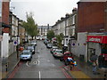
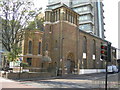
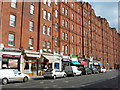
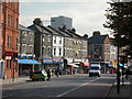
Area Overview for Oval Ward
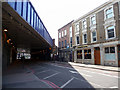
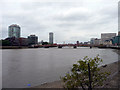
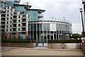
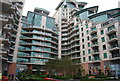
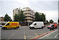
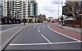
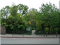
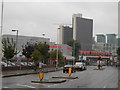
Photos of Oval Ward
Area Information
Oval Ward represents a densely populated district within the borough structure of England. The area covers a total size of just 79.1 hectares, which supports a current population of 2517 residents. This compact footprint results in a population density of 3183 people per square kilometre, indicating a tight-knit community where proximity is high. Living in Oval Ward means navigating an environment where space is limited by design, creating a neighbourhood that is manageable for daily movement but lacks the sprawling green expanses found elsewhere. The district functions as a distinct borough unitary ward, integrating seamlessly into the wider regional framework without acting as an isolated pocket. Daily life for residents is defined by this high concentration of people in a relatively small geographical area. You will find yourself surrounded by neighbours quickly, with walkable distances replacing car journeys. The small physical area means that amenities, schools, and transport links are concentrated nearby rather than scattered far away. Consequently, the everyday rhythm of life in Oval Ward revolves around efficiency and community closeness. Potential buyers must consider whether this intense density suits their lifestyle preferences. The area offers a clear, defined neighbourhood identity where the boundaries are sharply drawn within the local administrative structure.
- Area Type
- District Borough Unitary Ward
- Area Size
- 79.1 hectares
- Population
- 2517
- Population Density
- 3183 people/km²
Demographics
The community profile in Oval Ward reflects a distinct demographic shift towards an older population. The median age stands at 70 years, indicating that more than half the residents are of retirement age or older. While the specific breakdown of age ranges is not detailed beyond this total, the concentration in the higher age bracket suggests a settlement established for long-term residents rather than young professionals or families with school-age children. Home ownership levels in Oval Ward sit at 25 per cent, meaning three out of four households are tenants in some form. This high rental occupancy rate points towards an area where ownership transitions are increasingly difficult or where renting remains the norm. Household composition, accommodation types, and predominant ethnic groups are recorded within the total census data, though specific percentages are not broken out here. The age profile strongly influences how locals utilise public services and social infrastructure. You should anticipate a quieter social dynamic with an older demographic dominating the streets. A quarter of the area being owner-occupied implies the purchase market may differ from the rental market in terms of availability. When planning for retirement living in Oval Ward, the sheer number of residents in this age bracket confirms that the services and housing stock are oriented towards this specific life stage.
Household Size
Accommodation Type
Tenure
Ethnic Group
Religion
Household Composition
Age
Household Deprivation
NS-SEC
Explore more demographic insights in this area
Go to Demographics tabPlanning
Planning Constraints
- Flood RiskPremium
- Ramsar Wetland SitesPremium
- Area of Outstanding Natural BeautyPremium
- Protected Nature ReservePremium
- Protected WoodlandPremium
- Crime RiskPremium