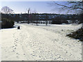
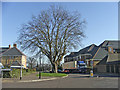
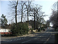
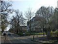
Area Overview for Oakwood Ward
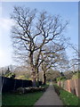
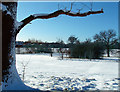
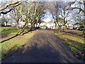
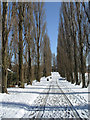
Photos of Oakwood Ward

Area Information
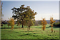
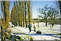
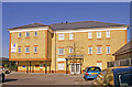
Living in Oakwood Ward offers a defined residential experience within a compact district. This ward covers a small footprint of just 1.9 square kilometres, creating a relatively enclosed neighbourhood where daily familiarity is likely a hallmark of daily life. The physical scale suggests a community where destinations may be close together, yet the specific configuration of the housing estate remains a localized detail you would discover on a personal visit. Because the ward functions as a unitary authority area, it operates under a distinct local governance structure that manages its own affairs. The prevailing demographic shift towards an older population suggests a mature community settling into a retirement phase rather than a dynamic hub for young families seeking rapid growth. You are looking at a space where the built environment is fixed and the population trend is clearly established. The absence of major planning constraints within this small area means that the existing character of Oakwood Ward is unlikely to face significant transformation from new large-scale developments or protected natural sites. Your daily routine here will be shaped by the current residential fabric rather than future speculative projects.
- Area Type
- District Borough Unitary Ward
- Area Size
- 1.9 km²
- Population
- Not available
- Population Density
- Not available
Demographics
The community profile of Oakwood Ward is distinctly oriented towards older residents. Census data indicates a median age of 70 years, placing this area among the oldest wards in the country. This figure reflects a neighbourhood where the majority of households likely consist of retirees or those living out their later years. With 74 per cent of residents owning their homes outright, the demographic data points strongly to a settled, owner-occupied population rather than a transient rental sector. This high rate of home ownership aligns with the age profile, suggesting stability within the neighbourhood. While specific details on household composition and predominant ethnic groups are not detailed in the current statistics, the overarching age concentration is the primary defining feature of this community. You should anticipate a quieter atmosphere where services and social interactions cater to an elderly demographic. The local estate is characterised by long-term residents who have settled into their property base. There is a clear lack of young professionals moving into this space based on the median age data available. Your day-to-day life here involves neighbours who share a similar life stage and likely similar priorities regarding safety and leisure.
Household Size
Accommodation Type
Tenure
Ethnic Group
Religion
Household Composition
Age
Household Deprivation
NS-SEC
Explore more demographic insights in this area
Go to Demographics tabPlanning
Planning Constraints
- Flood RiskPremium
- Ramsar Wetland SitesPremium
- Area of Outstanding Natural BeautyPremium
- Protected Nature ReservePremium
- Protected WoodlandPremium
- Crime RiskPremium