Area Overview for NW9 9PW
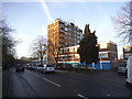
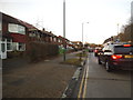
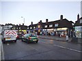
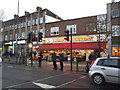
Photos of NW9 9PW
Area Information
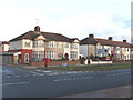
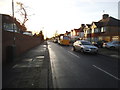
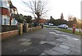
NW9 9PW represents a specific postcode area covering a small residential cluster in England. This compact neighbourhood forms part of the larger Queensbury and Kingsbury regions, situated within the London Borough of Barnet. The area contains a total population of 1623 residents, creating a relatively concentrated community compared to surrounding districts. Living in NW9 9PW means residing in a tightly knit environment where neighbours are likely known. The postcode serves as a distinct identifier for this specific pocket of housing within the wider neighbourhood. Daily life here focuses on local access rather than sprawling urban exploration. The small scale of the area allows for quicker travel between nearby stations and shops. You will find this postcode primarily supports residential living with minimal industrial intrusion. The location offers a clear boundary between private homes and the transport infrastructure that services the region. Prospective buyers should view NW9 9PW as a defined segment of the larger Kingsbury area. This distinction matters for understanding local council services and community facilities. The geography supports a quiet existence while maintaining convenient links to central London and other outer boroughs. You can access basic needs without navigating congested high streets far from your doorstep.
- Area Type
- Postcode
- Area Size
- Not available
- Population
- 1623
- Population Density
- 7075 people/km²
The property market in NW9 9PW is characterised by a strong preference for owner-occupied homes. With 67% of residents owning their accommodation, this area functions primarily as a settled residential zone rather than a rental hub. Houses dominate the accommodation type landscape, meaning you will find limited stock of flats or maisonettes within this specific cluster. This housing stock typically appeals to families or couples seeking garden space and privacy. The high level of ownership indicates that property values here have likely reflected stable, long-term growth. Buyers looking for homes in NW9 9PW should prepare competitively as most homes change hands through existing owners. The local market may show less volatility than areas with high transient populations. Houses in this postcode generally require modification to suit modern buyer tastes if they are older. The dominance of houses over other property types creates a consistent neighbourhood feel. You will not find the mixed-density feel of borough centres where flats and terraced homes clash. Instead, the aesthetic remains uniform with pitched roofs and driveways. This consistency often drives demand from those prioritising space and lifestyle over urban density. The small population of 1623 ensures the market remains niche rather than sprawling. Economic factors influencing this sector likely centre on interest rates and local employment shifts. The high ownership rate also means fewer distressed sales might appear during financial downturns.
House Prices in NW9 9PW
No properties found in this postcode.
Energy Efficiency in NW9 9PW
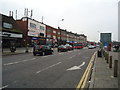
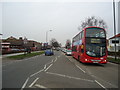
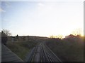
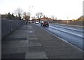
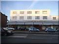
Lifestyle in NW9 9PW revolves around convenient access to major transport nodes and retail chains. Kingsbury Station, Queensbury Station, and Preston Road Station all fall within practical reach for daily commutes. South Kenton Station, Hendon Station, and North Wembley Station further expand your rail network options. This density of stations facilitates easy travel to central London without excessive journey times. Retail options include Aldi Kingsbury, Tesco Kingsbury, and Iceland Kingsbury, ensuring you can purchase groceries nearby. You can stock your kitchen or grab essentials without driving to distant supermarkets. The presence of multiple retail outlets indicates a well-serviced local economy. Little Venice Waterbus Stop and London Zoo Waterbus Stop provide unique water-based leisure opportunities close by. These stops offer a different perspective on commuting and weekend activities. Living in NW9 9PW gives you immediate pathways to both conventional rail travel and scenic water bus routes. The variety of transport modes reduces reliance on any single network for getting around. Shops and stations are clustered enough to allow for walking or short carriage journeys. Daily errands become quick tasks rather than hour-long expeditions. This accessibility defines the rhythm of life for homeowners in this postcode.
Amenities
Schools
| Rank | School | Type | Entry gender | Ages |
|---|
Explore more schools in this area
Go to Schools tabDemographics
The community in NW9 9PW reflects a mature demographic profile with significant stability. Adults aged between 30 and 64 years represent the most common age range, while the median age reaches 47. This indicates a predominance of families with established careers or retired couples seeking a settled environment. The workforce in NW9 9PW is likely experienced rather than entry-level given the average age. Home ownership stands at 67%, meaning more than two-thirds of residents own their properties outright or with a mortgage. This high rate suggests long-term settlement and financial investment in the area. Houses form the primary accommodation type throughout the postcode, offering detached or semi-detached living rather than flats. The predominant ethnic group in NW9 9PW is Asian, contributing to the cultural character of the streets. You will encounter a diverse population that has chosen this specific locale for its quiet nature. The aging population statistic of 47 years often correlates with lower demand for student accommodation. Instead, the housing stock meets the needs of established households. High owner occupancy often leads to stronger community bonds and better-maintained properties. Safety concerns may vary among different age groups within this predominantly older working demographic. The mix of families suggests schools remain a relevant factor for current and future residents.
Household Size
Accommodation Type
Tenure
Ethnic Group
Religion
Household Composition
Age
Household Deprivation
NS-SEC
Explore more demographic insights in this area
Go to Demographics tabPlanning
Planning Constraints
- Flood RiskPremium
- Ramsar Wetland SitesPremium
- Area of Outstanding Natural BeautyPremium
- Protected Nature ReservePremium
- Protected WoodlandPremium
- Crime RiskPremium