Area Overview for NW9 9NT
Photos of NW9 9NT
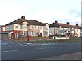
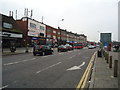
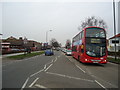
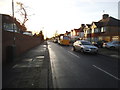
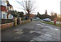
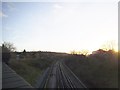
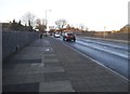
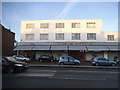
100 photos from this area
Area Information
Key information about the NW9 9NT including its size, population, and administrative classification.
- Area Type
- Postcode
- Area Size
- 26.6 hectares
- Population
- 2013
- Population Density
- 2747 people/km²
House Prices in NW9 9NT
38
Properties
£508,461
Average Sold Price
£128,000
Lowest Price
£850,000
Highest Price
Showing 38 properties
| Address | Type | Beds | Baths | Last Sale Price | Last Sale Date | |
|---|---|---|---|---|---|---|
| 111A Valley Drive, London, NW9 9NT | Detached | 4 | 1 | £800,000 | Mar 2025 | |
| 133 Valley Drive, London, NW9 9NT | Semi-detached | 3 | 1 | £750,000 | Jun 2024 | |
| 169 Valley Drive, London, NW9 9NT | house | - | - | £730,000 | Apr 2023 | |
| 111 Valley Drive, London, NW9 9NT | Semi-detached | 4 | 3 | £850,000 | Nov 2022 | |
| 115 Valley Drive, London, NW9 9NT | house | - | - | £685,000 | Jan 2021 | |
| 135 Valley Drive, London, NW9 9NT | Semi-detached | 3 | 1 | £670,000 | Nov 2020 | |
| 167 Valley Drive, London, NW9 9NT | Semi-detached | 4 | 1 | £725,000 | Aug 2018 | |
| 107 Valley Drive, London, NW9 9NT | house | - | - | £749,950 | Aug 2017 | |
| 159 Valley Drive, London, NW9 9NT | house | - | - | £690,000 | Sep 2016 | |
| 161 Valley Drive, London, NW9 9NT | house | 2 | 1 | £550,000 | Jul 2015 |
Page 1 of 4
Energy Efficiency in NW9 9NT
Amenities
Schools
| Rank | School | Type | Entry gender | Ages |
|---|
Explore more schools in this area
Go to Schools tabDemographics
Household Size
Family (3-5 people)
most common
Accommodation Type
Houses
most common
Tenure
45
majority
Ethnic Group
White
most common
Religion
N/A
most common
Household Composition
N/A
most common
Age
47
median
Adults (30-64 years)
most common
Household Deprivation
N/A
with no deprivation
NS-SEC
21
in Lower managerial occupations
Explore more demographic insights in this area
Go to Demographics tabPlanning
Planning Constraints
- Flood RiskPremium
- Ramsar Wetland SitesPremium
- Area of Outstanding Natural BeautyPremium
- Protected Nature ReservePremium
- Protected WoodlandPremium