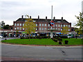
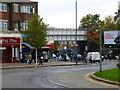
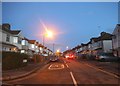
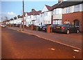
Area Overview for NW9 9BQ
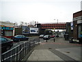
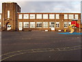
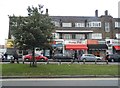
Photos of NW9 9BQ
Area Information
Living in NW9 9BQ means residing within a tightly defined residential cluster that spans exactly 3600 square metres. This specific postcode area in England serves a population of 2551 people, creating a neighbourhood where residents interact frequently due to the compact footprint. The density here stands at 708,685 people per square kilometre, which reflects a high degree of occupancy within this small footprint. You are looking at a community where space is efficient and daily movements between homes, local shops, and transport links are quite short. This area functions as a concentrated residential zone rather than a sprawling suburb, offering convenience over spread. The primary draw of NW9 9BQ is its integration into the broader Queensbury and Kingsbury wards without losing its distinct identity as a specific postal code. You will find that daily life revolves around accessibility to nearby tube stations and railway hubs, making the commute manageable despite the local density. The area attracts a demographic skewed towards adults aged 30 to 64, suggesting a community of established residents rather than transient market renters. Home ownership stands at a significant 61%, indicating stability in the area. While the density is high, the layout ensures that those seeking homes in this specific post code receive a lived-in, established environment close to major transport arteries.
- Area Type
- Postcode
- Area Size
- 3600 m²
- Population
- 2551
- Population Density
- 8766 people/km²
The property market in NW9 9BQ is characterised by a strong lean towards owner-occupancy, with 61% of residents holding the keys to their own homes. This statistic fundamentally shapes the character of the neighbourhood, as most properties have been lived in for a considerable period. You are looking at a stock that consists primarily of Houses, which are the dominant accommodation type in this specific postcode area. This contrasts with markets dominated by rentals or purpose-built blocks, indicating a desire for traditional domestic living spaces. For buyers considering homes in NW9 9BQ, the high ownership rate implies a settled community rather than a transient rental hub. When you view properties here, you are likely inspecting detached, semi-detached, or terraced houses that suit families or individuals seeking permanence. The small size of the area, covering just 3600 square metres, means variation in property style may be slight, resulting in a relatively uniform streetscape. If you are renting, you will find fewer opportunities here compared to nearby wards, so the focus is clearly on purchase. The lack of mentions regarding flats or high-rise units further cements this as an area built for ground-level house living.
House Prices in NW9 9BQ
Showing 35 properties
| Address | Type | Beds | Baths | Last Sale Price | Last Sale Date | |
|---|---|---|---|---|---|---|
| 24, Palm Court, Alpine Road, London, NW9 9BQ | Flat | 2 | 2 | - | - | |
| 19, Palm Court, Alpine Road, London, NW9 9BQ | Flat | 3 | 3 | - | - | |
| 25, Palm Court, Alpine Road, London, NW9 9BQ | Flat | 2 | 2 | - | - | |
| 1, Palm Court, Alpine Road, London, NW9 9BQ | Flat | 3 | 3 | - | - | |
| 28, Palm Court, Alpine Road, London, NW9 9BQ | Flat | 2 | 2 | - | - | |
| 13, Palm Court, Alpine Road, London, NW9 9BQ | Flat | 2 | 2 | - | - | |
| 11, Palm Court, Alpine Road, London, NW9 9BQ | Flat | - | - | - | - | |
| 2, Palm Court, Alpine Road, London, NW9 9BQ | Flat | - | - | - | - | |
| 26, Palm Court, Alpine Road, London, NW9 9BQ | Flat | - | - | - | - | |
| 33, Palm Court, Alpine Road, London, NW9 9BQ | Flat | 2 | 2 | - | - |
Energy Efficiency in NW9 9BQ
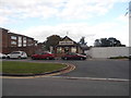
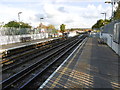
Your daily life in NW9 9BQ is supported by a cluster of amenities located within a short travel radius. Retail options are immediate and convenient, with five major supermarkets standing amongst your nearest facilities. You can shop at Morrisons Queensbury, Iceland Kingsbury, or Tesco Kingsbury for your weekly groceries and household essentials without needing a long drive. These venues form the commercial heart of the area for those living nearby. Transport infrastructure further enhances your lifestyle, with five metro stations and five railway stations accessible to you. Queensboro, Kingsbury Station, and Burnt Oak Station offer direct links via the Northern Line, while South Kenton Station, Hendon Station, and Mill Hill Broadway provide broader rail connections. This density of public transport means you rarely need a car for short trips. You can walk to the shops or hop on a train for work, enjoying a balance of suburban convenience and urban access. The presence of these specific venues and stations defines the practical rhythm of living in NW9 9BQ.
Amenities
Schools
| Rank | School | Type | Entry gender | Ages |
|---|
Explore more schools in this area
Go to Schools tabDemographics
The community within NW9 9BQ is defined by a mature population profile where the median age is exactly 47 years. The most common age range consists of adults between 30 and 64 years, meaning the majority of your neighbours are likely in their working or semi-retirement years. You are not moving into an area dominated by young families or students, but rather a stable cohort of long-term residents. This age distribution suggests a quiet atmosphere during the day, with social activities perhaps peaking during evening hours. Significant proportions of this population identify as Asian, making ethnic diversity a central feature of daily life in NW9 9BQ. Such diversity often manifests in the cultural food options and community groups you might encounter locally. Regarding housing tenure, 61% of properties in this area are owned outright or through a mortgage. This high ownership rate points to a stable community where families have put down roots and are unlikely to move frequently. The accommodation type is predominantly houses, which aligns with the ownership figures and suggests a residential focus over high-density apartment living. You can expect a neighbourhood built around private gardens and domestic spaces rather than blocks of flats.
Household Size
Accommodation Type
Tenure
Ethnic Group
Religion
Household Composition
Age
Household Deprivation
NS-SEC
Explore more demographic insights in this area
Go to Demographics tabPlanning
Planning Constraints
- Flood RiskPremium
- Ramsar Wetland SitesPremium
- Area of Outstanding Natural BeautyPremium
- Protected Nature ReservePremium
- Protected WoodlandPremium