Area Overview for NW9 9AG
Photos of NW9 9AG
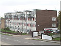
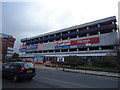
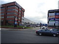
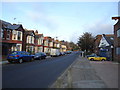
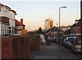

82 photos from this area
Area Information
Key information about the NW9 9AG including its size, population, and administrative classification.
- Area Type
- Postcode
- Area Size
- 1.4 hectares
- Population
- 1936
- Population Density
- 7254 people/km²
House Prices in NW9 9AG
35
Properties
£378,800
Average Sold Price
£127,500
Lowest Price
£565,500
Highest Price
Showing 35 properties
| Address | Type | Beds | Baths | Last Sale Price | Last Sale Date | |
|---|---|---|---|---|---|---|
| 334 Stag Lane, London, NW9 9AG | Semi-detached | 3 | 2 | £515,000 | Dec 2024 | |
| 326 Stag Lane, London, NW9 9AG | Terraced | 3 | 1 | £565,000 | Jun 2022 | |
| 350 Stag Lane, London, NW9 9AG | Semi-detached | 3 | 3 | £550,000 | Jun 2022 | |
| 336 Stag Lane, London, NW9 9AG | house | - | - | £565,500 | Sep 2021 | |
| 358 Stag Lane, London, NW9 9AG | house | - | - | £550,000 | Jan 2021 | |
| 356 Stag Lane, London, NW9 9AG | Semi-detached | 3 | 1 | £485,000 | Apr 2018 | |
| 324 Stag Lane, London, NW9 9AG | Terraced | 3 | 1 | £475,000 | Jul 2017 | |
| 364 Stag Lane, London, NW9 9AG | house | - | - | £514,000 | May 2017 | |
| 332 Stag Lane, London, NW9 9AG | Terraced | 3 | - | £400,000 | Jan 2014 | |
| 320 Stag Lane, London, NW9 9AG | Terraced | 3 | - | £320,000 | Jan 2014 |
Page 1 of 4
Energy Efficiency in NW9 9AG
Amenities
Schools
| Rank | School | Type | Entry gender | Ages |
|---|
Explore more schools in this area
Go to Schools tabDemographics
Household Size
Family (3-5 people)
most common
Accommodation Type
Houses
most common
Tenure
68
majority
Ethnic Group
White
most common
Religion
N/A
most common
Household Composition
N/A
most common
Age
47
median
Adults (30-64 years)
most common
Household Deprivation
N/A
with no deprivation
NS-SEC
30
in Lower managerial occupations
Explore more demographic insights in this area
Go to Demographics tabPlanning
Planning Constraints
- Flood RiskPremium
- Ramsar Wetland SitesPremium
- Area of Outstanding Natural BeautyPremium
- Protected Nature ReservePremium
- Protected WoodlandPremium