Area Overview for NW9 9AA
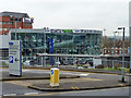
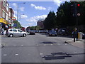
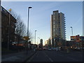
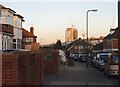
Photos of NW9 9AA


Area Information
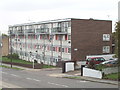
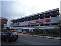
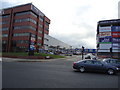
The postcode NW9 9AA encompasses a specific residential cluster within Greater London, covering a mere 7093 square metres. Despite its small footprint, the area supports a population of 1677 people, creating a dense living environment typical of central London neighbourhoods. With a population density of 236,444 people per square kilometre, this postcode offers a compact community layout where daily amenities are within immediate reach. Living in NW9 9AA means sharing a vibrant urban space where proximity defines the experience. The area operates on a public transit network that connects residents rapidly to the wider capital, ensuring short commute times to central business districts. You will find yourself in a setting where the space between homes is minimal, fostering a close-knit atmosphere. This high density reflects the efficient use of London land, prioritising accessibility over open land. The character of NW9 9AA is defined by its concentration of households and its integration into the broader transport infrastructure situated along the northern edge of London. Every moment in this postcode is marked by the awareness of surrounding urban life.
- Area Type
- Postcode
- Area Size
- 7093 m²
- Population
- 1677
- Population Density
- 6910 people/km²
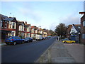
The property market in NW9 9AA is distinctly characterised by high-density living. Flats represent the predominant accommodation type, aligning with the area's small size and urban location. You will find that the housing stock is primarily designed for efficient use of space rather than sprawling suburban properties. With home ownership levels recorded at 48%, this postcode sits almost exactly on the border between owner-occupied and rental communities. This split means that while many residents own their flats, a substantial portion of the market operates under tenancy agreements. For buyers considering homes in NW9 9AA, the focus is inevitably on vertical living within a residential cluster. The small area size of 7093 square metres limits the variety of building footprints available, reinforcing the flat-centric model of the local real estate scene. This configuration appeals to those who prioritise location and transport links over garden space. The market here is driven by the convenience of the immediate surroundings and the connectivity provided by nearby rail and metro stations. Understanding this mix of ownership and property type is essential for anyone looking to invest in or move into this specific London postcode.
House Prices in NW9 9AA
Showing 1 properties
| Address | Type | Beds | Baths | Last Sale Price | Last Sale Date | |
|---|---|---|---|---|---|---|
| Roe Green Farm, 366 Stag Lane, London, NW9 9AA | Terraced | 3 | 2 | - | - |
Energy Efficiency in NW9 9AA
Residents of NW9 9AA enjoy convenient access to a wide array of retail and leisure options within practical reach. The local retail environment is well-served by major supermarkets including Morrisons Colindale, Asda Colindale, and Aldi Colindale. These five retail locations ensure that weekly grocery shopping and bulk buying are easily accessible to anyone living in this postcode. Transport links are equally extensive, with direct access to five metro stations, including Kingsbury Station, Colindale Station, and Queensbury. The area also benefits from five nearby rail stations such as Hendon Station, Mill Hill Broadway, and South Kenton Station. For those preferring waterways, three ferry stops are available, including London Zoo Waterbus Stop, Little Venice Waterbus Stop, and Camden Lock Water bus. This density of transport nodes means you can travel by tube, train, or even boat with minimal planning. The mix of large supermarkets and diverse transport modes creates a lifestyle where essentials are bought and journeys are made with ease. Living in NW9 9AA grants you entry to a sophisticated network of mobility and commerce.
Amenities
Schools
Families living in NW9 9AA have access to a mix of educational facilities, though the specific offerings in the immediate vicinity are limited. The area is near Brent River College, which is listed as a nearby school. This institution is classified as an 'other' type of school, distinguishing it from standard primary or secondary institutions. While Brent River College provides educational pathways, the data provided does not include details on primary or secondary schools operating directly within the postcode itself. Consequently, many households in NW9 9AA likely rely on schools across the wider NW9 or adjacent areas for their children's primary and secondary education. The presence of Brent River College suggests an option for further education or vocational training nearby. However, access to comprehensive primary and secondary schools requires travelling slightly beyond this specific 7093 square metre cluster. Parents should research schools slightly further afield to find the standard state-funded primary and secondary education available across London's Kilburn and Friern Barnet postcodes.
| Rank | School | Type | Entry gender | Ages |
|---|
Explore more schools in this area
Go to Schools tabDemographics
The community within NW9 9AA features a mature and established population. The median age for residents is 47 years, indicating that adults between 30 and 64 years constitute the most common age range. This demographic profile suggests a neighbourhood populated by individuals who have typically stabilized in their careers and family lives. Home ownership stands at 48% for this postcode, meaning nearly half of the residents own their properties outright or with a mortgage. This ownership rate reflects a significant stake in the local area among long-term inhabitants. The primary form of accommodation in NW9 9AA consists of flats, a housing style suited to the compact urban layout and high-density nature of the site. The predominant ethnic group in this area is White, forming the backbone of the local resident base. These statistics paint a picture of a stable, middle-aged community that values stability and established routines. The specific figures regarding age and ownership underscore the serious and settled nature of those who call NW9 9AA their home.
Household Size
Accommodation Type
Tenure
Ethnic Group
Religion
Household Composition
Age
Household Deprivation
NS-SEC
Explore more demographic insights in this area
Go to Demographics tabPlanning
Planning Constraints
- Flood RiskPremium
- Ramsar Wetland SitesPremium
- Area of Outstanding Natural BeautyPremium
- Protected Nature ReservePremium
- Protected WoodlandPremium