Area Overview for NW9 8EU
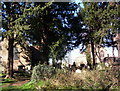
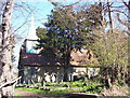
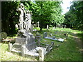
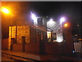
Photos of NW9 8EU
Area Information
Living in NW9 8EU means residing within a tightly defined residential cluster in north west London. This postcode serves exactly 1,672 people, creating a concentrated neighbourhood where daily interactions are frequent. The area is characterised by flats, which dominate the local housing stock. Residents here enjoy a mature community atmosphere centred around established transport links. You are neighbours to key travel hubs, meaning your commute relies on the wider NW9 network rather than a single isolated station. The small population size fosters a distinct sense of locality, yet your everyday needs are met by extensive nearby options. Travel to central London is quick via the nearest metro and rail connections. You have immediate access to major retail parks, including Blackbird and Kingsbury hubs, without needing a lengthy drive. Digital infrastructure supports remote working seamlessly. This compact area offers a specific type of urban living where convenience is prioritised over expansive gardens or detached homes. The environment is practical and efficient, designed for those who value proximity to transport and shopping. Safety levels remain high, making it a secure choice for families and professionals alike. The postcode acts as a precise entry point to a functional residential zone.
- Area Type
- Postcode
- Area Size
- Not available
- Population
- 1672
- Population Density
- 6248 people/km²
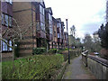
Homes in NW9 8EU are defined by a strong concentration of flats. With 48 percent home ownership, the market splits between private owners and rental occupants. This balance prevents the area from becoming solely a luxury buy-to-let zone or a transient student village. The prevalence of flats means limited space for detached properties or large family gardens. You will find mostly multi-unit residential buildings rather than single-family homes. This structural reality influences both price corridors and eligibility for buyers seeking standard terraced houses. The small population of 1,672 keeps the local market niche and specific. Demand here often follows London-wide trends but remains distinct due to the flat-dominant stock. Prospective buyers should expect competition for available units given the high concentration of flats. The 0 percent flood risk and lack of planning constraints like protected woodlands or Ramsar sites simplify acquisition. There are no hidden planning battles affecting immediate development potential. Prices reflect the practicality of the flat design in a prime transport location. Commuters value this stock for its ease of access and low maintenance requirements.
House Prices in NW9 8EU
No properties found in this postcode.
Energy Efficiency in NW9 8EU
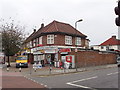
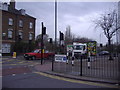
Residents of NW9 8UI enjoy immediate access to diverse retail and leisure outlets. Five retail amenities lie within practical reach, including M&S Blackbird BP, Lidl Blackbird Hill, and Co-op Kingsbury. These shops cover grocery needs, clothing, and daily essentials without requiring a car. You can shop for essentials at Lidl or grab groceries at the Co-op with ease. Transport options reinforce this lifestyle convenience. Five metro stations, five rail points, and four waterbus stops cluster nearby. Wembley Park Station connects you to the Jubilee line. Neasden and Kingsbury stations offer Metropolitan line access. The waterbus network provides scenic routes near Little Venice. Four ferry stops allow leisure trips along the Regent's Canal. This mix of retail and transport creates a self-contained daily routine. You do not need to leave the postcode area for basic needs. Dining options and leisure activities are a short walk or tube ride away. The area balances urban convenience with local quietness.
Amenities
Schools
Families considering NW9 8EU will find two notable independent institutions nearby. Gower House School operates as an independent provider within walking or short drive distance. St Nicholas School also offers independent education close to the postcode boundary. These schools cater to private sector requirements rather than the state sector. You must budget for independent school fees rather than relying on council tax-funding mechanisms. The presence of two independent options suggests a demographic capable of affording premium education. No state-maintained schools are listed in the immediate vicinity of this small cluster. This forces families living in NW9 8EU to evaluate catchment areas further afield for comprehensive schools. The proximity of Gower House and St Nicholas offers selective choice for parents wishing to avoid state school zones. Traffic pollution from school runs might be less intense than in areas with multiple state primaries. Distance matters significantly here since only these two names appear in the verified data.
| Rank | School | Type | Entry gender | Ages |
|---|
Explore more schools in this area
Go to Schools tabDemographics
The community in NW9 8EU reflects an mature population with a median age of 47 years. Most residents fall into the 30 to 64 year age range, indicating a stable workforce and long-term dwellers. Home ownership stands at 48 percent, meaning roughly half of the households own their property outright or with a mortgage. The other half are likely tenants, contributing to a mixed occupancy pattern common in flat-heavy districts. Flats are the predominant accommodation type, shaping the social fabric of this cluster. The area is predominantly white, following the broader national trend for this demographic profile. Age distribution suggests fewer young children compared to communal children's zones, yet enough young adults to maintain local energy. This demographic profile supports steady property values rather than speculative growth. The high proportion of middle-aged adults implies residents have researched their choice and intend to stay long term. Safety scores reflect this settled community nature. With a crime risk level passing at a score of 82 out of 100, the neighbourhood remains secure. The lifestyle here suits established professionals rather than starters of a rural regeneration project.
Household Size
Accommodation Type
Tenure
Ethnic Group
Religion
Household Composition
Age
Household Deprivation
NS-SEC
Explore more demographic insights in this area
Go to Demographics tabPlanning
Planning Constraints
- Flood RiskPremium
- Ramsar Wetland SitesPremium
- Area of Outstanding Natural BeautyPremium
- Protected Nature ReservePremium
- Protected WoodlandPremium