Area Overview for NW9 6BL
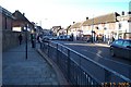
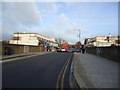
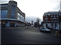
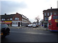
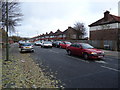
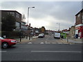
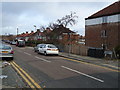
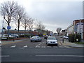
Photos of NW9 6BL

Area Information
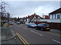
Living in NW9 6BL offers a defined residential experience within a small cluster of homes. This postcode covers a specific population of 2,049 residents, creating a distinct community feel separate from the wider sprawl of London. You will find yourself in a neighbourhood that balances convenience with a tight-knit atmosphere. The area functions primarily as a residential zone, yet it maintains strong links to major transport hubs. Burnt Oak Station and Colindale Station serve as primary gateways, while Mill Hill Broadway and Hendon Station provide additional rail connectivity. Retail options are immediate and practical, with Tesco Watling, Sainsburys Colindale, and Co-op Colindale all within easy reach. Even outdoor enthusiasts have a unique option available, as the London Zoo Waterbus Stop provides a direct water route nearby. You do not have to travel far for everyday needs, yet the location retains a sense of locality. The area passes critical planning checks, avoiding flood risks, protected wetlands, and areas of outstanding natural beauty constraints. This allows for stable development without the uncertainty of environmental restrictions. Your daily life here is shaped by reliable infrastructure and a clear residential focus.
- Area Type
- Postcode
- Area Size
- Not available
- Population
- 2049
- Population Density
- 8302 people/km²
The property market in NW9 6BL is characterised by a housing stock dominated by houses. This architectural style supports the residential clusters found within this specific postcode area. With 49% of residents owning their homes, the area displays a strong preference for ownership over private renting. You will find more households looking to consolidate existing equity rather than seeking short-term tenancy agreements. The lack of flats or apartment blocks ensures that the built environment feels more traditional and spacious. This ownership rate suggests that buyers entering the market are often those who can access mortgages or inherit properties locally. The surrounding area shares similar housing trends, maintaining consistency in property values and maintenance standards. Families seeking single-family homes will find this postcode aligns with their requirements. The small geographic size of the cluster means property transactions can happen with quick communication between buyer, seller, and local agents. There is no noise of commercial construction dominating the residential streets, preserving the value of the homes in NW9 6BL.
House Prices in NW9 6BL
No properties found in this postcode.
Energy Efficiency in NW9 6BL
Your lifestyle in NW9 6BL revolves around the practical amenities that lie within practical reach. You do not need to commute far for groceries, as Tesco Watling, Sainsburys Colindale, and Co-op Colindale are all nearby. These supermarkets handle your weekly shopping and daily essentials with ease. Transport enthusiasts or those who dislike driving will appreciate the rail options, including Mill Hill Broadway, Hendon Station, and Brent Cross West Station. Burnt Oak Station and Colindale Station serve as major hubs closer to postcode boundaries. For leisure, the London Zoo Waterbus Stop offers a unique mode of transport to the zoo. You can enjoy a scenic water route that combines travel with sightseeing. Five distinct metro points are available nearby, giving you choices depending on your destination. This variety of transport modes means you can switch between trains, buses, and water buses as needed. The concentration of five retail outlets ensures you have consistent options for purchasing goods.
Amenities
Schools
Families living in NW9 6BL have access to a specific selection of educational institutions nearby. The only primary school listed with an Ofsted rating is Barnfield Primary School, which holds a good rating. This designation confirms that the school meets the required standards for education and safeguarding in the Hertsmere borough. For alternative education needs, The Park PRU is located close to the area, serving students who require further provision outside the standard curriculum. While more secondary schools may exist further away, your immediate choices are defined by these two named entities. You will need to plan transport arrangements if your children require education beyond these two specific locations. The presence of a Primary school with a good rating suggests that the immediate vicinity supports the early education stage of school-going children. If you are looking at homes near NW9 6BL, you will know exactly which primary institution serves the local catchment area. The mix of education types means families must make specific choices based on their children's needs.
| Rank | School | Type | Entry gender | Ages |
|---|
Explore more schools in this area
Go to Schools tabDemographics
The community in NW9 6BL reflects an established demographic with a median age of 47 years. Most residents fall into the adult category, specifically those between 30 and 64 years of age. This age profile indicates a settled neighbourhood where families and professionals have roots in the area. Home ownership stands at 49%, a figure that suggests a balanced mix of leaseholders and landlords. The accommodation type is predominantly houses, which aligns with the quieter, suburban nature of the postcode. The predominant ethnic group is White, contributing to a culturally consistent visual landscape for new arrivals. With nearly half of the houses owned by their occupants, you will likely experience long-term stability rather than high tenant turnover. The population density is low, supporting a peaceful environment without the chaos of high-rise living. These facts paint a picture of a mature community where residents value privacy and stability. The age distribution means you will encounter neighbours who are likely to be invested in the local school system or managing older family members.
Household Size
Accommodation Type
Tenure
Ethnic Group
Religion
Household Composition
Age
Household Deprivation
NS-SEC
Explore more demographic insights in this area
Go to Demographics tabPlanning
Planning Constraints
- Flood RiskPremium
- Ramsar Wetland SitesPremium
- Area of Outstanding Natural BeautyPremium
- Protected Nature ReservePremium
- Protected WoodlandPremium