Area Overview for NW9 6AD
Photos of NW9 6AD
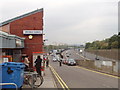
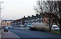
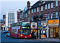
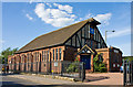
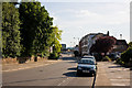
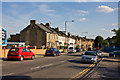
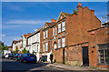

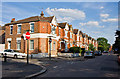
100 photos from this area
Area Information
Key information about the NW9 6AD including its size, population, and administrative classification.
- Area Type
- Postcode
- Area Size
- 2130 m²
- Population
- 1901
- Population Density
- 8712 people/km²
House Prices in NW9 6AD
20
Properties
£227,571
Average Sold Price
£62,000
Lowest Price
£515,000
Highest Price
Showing 20 properties
| Address | Type | Beds | Baths | Last Sale Price | Last Sale Date | |
|---|---|---|---|---|---|---|
| 16 Herbert Road, Colindale, London, NW9 6AD | house | 6 | 2 | £445,000 | Jul 2025 | |
| 8 Herbert Road, Colindale, London, NW9 6AD | house | - | - | £515,000 | Dec 2021 | |
| 10 Herbert Road, Colindale, London, NW9 6AD | Terraced | - | - | £222,000 | Oct 2002 | |
| 6 Herbert Road, Colindale, London, NW9 6AD | Terraced | 6 | 2 | £168,000 | Oct 2001 | |
| 22 Herbert Road, Colindale, London, NW9 6AD | Semi-detached | 4 | - | £95,000 | Dec 1997 | |
| 24 Herbert Road, Colindale, London, NW9 6AD | Semi-detached | - | - | £86,000 | Mar 1996 | |
| 14 Herbert Road, Colindale, London, NW9 6AD | Terraced | 6 | 2 | £62,000 | May 1995 | |
| 18A Herbert Road, Colindale, London, NW9 6AD | Terraced | 3 | 2 | - | - | |
| Room 2, 12 Herbert Road, Colindale, London, NW9 6AD | Flat | 1 | 1 | - | - | |
| Room 4, 12 Herbert Road, Colindale, London, NW9 6AD | Unknown | - | - | - | - |
Page 1 of 2
Energy Efficiency in NW9 6AD
Amenities
Schools
| Rank | School | Type | Entry gender | Ages |
|---|
Explore more schools in this area
Go to Schools tabDemographics
Household Size
Family (3-5 people)
most common
Accommodation Type
Flats
most common
Tenure
35
majority
Ethnic Group
White
most common
Religion
N/A
most common
Household Composition
N/A
most common
Age
47
median
Adults (30-64 years)
most common
Household Deprivation
N/A
with no deprivation
NS-SEC
29
in Lower managerial occupations
Explore more demographic insights in this area
Go to Demographics tabPlanning
Planning Constraints
- Flood RiskPremium
- Ramsar Wetland SitesPremium
- Area of Outstanding Natural BeautyPremium
- Protected Nature ReservePremium
- Protected WoodlandPremium