Area Overview for NW9 5WP
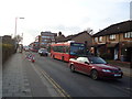
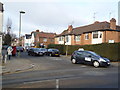
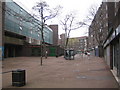
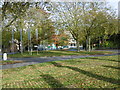
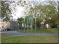
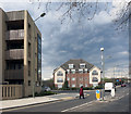
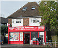
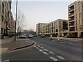
Photos of NW9 5WP


Area Information
The postcode NW9 5WP covers a very specific residential cluster measuring just 1.5 hectares. You are looking at a small, densely populated pocket of north-west London where 2,274 people call it home. This compact footprint creates a tight-knit environment, with a population density that exceeds 147,774 people per square kilometre. Living in NW9 5WP means navigating a high-rise residential cluster where individual households are in close proximity to one another. The area is situated within the broader Colindale and Hendon zone, benefitting from its location within the 11 postcode district while maintaining the distinct identity of this smaller postcode sector. Your daily life here revolves around immediate access to major transport hubs and local amenities that are deliberately placed within walking distance. You will find that routine errands require little travel, as essential services cluster around this specific location. The high density suggests the area caters to those who value proximity over spacious plots of land. While the scale is small, the infrastructure supporting 2,274 residents is significant. This postcode acts as a microcosm of the wider area's connectivity and convenience, offering a residential experience defined by efficiency and accessibility rather than open space.
- Area Type
- Postcode
- Area Size
- 1.5 hectares
- Population
- 2274
- Population Density
- 14081 people/km²
The property market in NW9 5WP is heavily skewed towards renting, with home ownership standing at just 31 per cent. This low percentage indicates a vibrant rental sector rather than an area dominated by owner-occupiers. You can expect to find mostly flats as the predominant accommodation type, reflecting the limited land area that sits at only 1.5 hectares. This housing style suits older residents and professionals who prefer not to maintain a detached house. Buying a property here is statistically less common than renting, though the second-hand and new flats market is likely active. The high density of 147,774 people per square kilometre suggests that floor plans in NW9 5WP are designed for efficiency rather than large gardens. Land values in this specific postcode are likely influenced heavily by its location within the wider Colindale and Hendon corridor. Potential buyers looking for detached homes will struggle to find matches within these boundaries. Instead, the market focuses on vertical living solutions. The low ownership rate means leasehold agreements may be more common than freehold titles. Investors often target this segment of the market given the strong rental demand from the large percentage of non-owners.
House Prices in NW9 5WP
Showing 66 properties
| Address | Type | Beds | Baths | Last Sale Price | Last Sale Date | |
|---|---|---|---|---|---|---|
| 50 Kenley Avenue, Colindale, London, NW9 5WP | Flat | 2 | 1 | £270,000 | Jun 2022 | |
| 51 Kenley Avenue, Colindale, London, NW9 5WP | Flat | - | - | £275,000 | Jan 2019 | |
| 48 Kenley Avenue, Colindale, London, NW9 5WP | Flat | 2 | 1 | £332,000 | May 2016 | |
| 46 Kenley Avenue, Colindale, London, NW9 5WP | Flat | 2 | 1 | - | - | |
| 29A Kenley Avenue, Colindale, London, NW9 5WP | Flat | - | - | - | - | |
| 29D Kenley Avenue, Colindale, London, NW9 5WP | Flat | - | - | - | - | |
| 29B Kenley Avenue, Colindale, London, NW9 5WP | Flat | - | - | - | - | |
| 29C Kenley Avenue, Colindale, London, NW9 5WP | Flat | - | - | - | - | |
| 52 Kenley Avenue, Colindale, London, NW9 5WP | Flat | - | - | - | - | |
| 49 Kenley Avenue, Colindale, London, NW9 5WP | Flat | - | - | - | - |
Energy Efficiency in NW9 5WP
Your lifestyle in NW9 5WP benefits from immediate access to five retail outlets, including Sainsburys Colindale, Sainsburys Colindale, and Co-op Colindale. These supermarkets are located within practical reach, ensuring you can complete weekly groceries without a long car journey. Five metro stations serve the immediate vicinity, providing frequent service to London and the north-west. Colindale Station and Burnt Oak Station act as major interchange points for your daily travel. You also have access to three ferry stops, including the London Zoo Waterbus Stop and the Camden Lock Waterbus Stop. These water-based routes connect you to future leisure spots in Camden and beyond. Dining options are plentiful in the surrounding high street and local hubs. Residents can choose from numerous restaurants across nearby Colindale, Burnt Oak, and Highgate. The presence of five rail stations nearby means you can access Hendon and Mill Hill Broadway quickly for day trips or meetings. This transport network supports a flexible lifestyle where you can work locally or access global opportunities with ease. Shops, dining, and parks are just a short walk away from your doorstep in this convenient location.
Amenities
Schools
| Rank | School | Type | Entry gender | Ages |
|---|
Explore more schools in this area
Go to Schools tabDemographics
The community in NW9 5WP has a distinct age profile, with a median age of 47 years. You will find that adults between the ages of 30 and 64 form the most common age range within this cluster. This demographic skew indicates an area populated by established residents rather than young families or students moving in for university. Home ownership makes up only 31 per cent of the total housing stock, meaning the majority of residents are likely tenants. Most accommodations in NW9 5WP are flats, confirming the high-density nature of the living arrangement. The predominant ethnic group in this postcode sector is White. The limited home ownership rate is consistent with the flat-heavy architecture found in many parts of north-west London. A quarter of the population attends the local primary school, though the specific name of the nearest school is not explicitly detailed in the available records for this micro-area. The age structure suggests a stable environment where long-term renting is the norm. Families with children may find the housing stock more challenging to purchase compared to the rental market. The demographic data paints a picture of a mature, urban residential zone where few people buy their own homes.
Household Size
Accommodation Type
Tenure
Ethnic Group
Religion
Household Composition
Age
Household Deprivation
NS-SEC
Explore more demographic insights in this area
Go to Demographics tabPlanning
Planning Constraints
- Flood RiskPremium
- Ramsar Wetland SitesPremium
- Area of Outstanding Natural BeautyPremium
- Protected Nature ReservePremium
- Protected WoodlandPremium