Area Overview for NW9 5QB
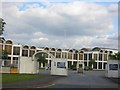
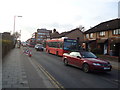
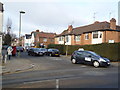
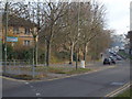
Photos of NW9 5QB

Area Information
Living in NW9 5QB means residing within a distinct residential cluster situated in north London. This specific postcode covers an area of 1584 square metres and houses a population of 1721 people. The density here is exceptionally high, with 1,086,487 people per square kilometre according to the recorded figures. Despite these extreme density metrics, the location offers a defined urban living experience common to this sector of the capital. You will find yourself in a borough characterised by mixed residential estates and close proximity to major public transport hubs. Daily life is shaped by the immediate availability of commuter rail links and local shopping venues. The area sits near the M25 orbital motorway, though data does not specify exact distances from this motorway. For those seeking homes in NW9 5QB, the environment presents a high-density urban setting rather than a sprawling suburban landscape. Expect a neighbourhood where infrastructure serves a large population within a compact footprint. The location benefits from being part of the NW9 postcode area, known for its connection to the wider Edgware and Hendon districts. While specific historical context is not detailed in the records, the functional layout of the area prioritises connectivity. You should anticipate a lifestyle defined by efficiency and access to city-centre amenities. The compact size of this residential zone means services are rarely far away.
- Area Type
- Postcode
- Area Size
- 1584 m²
- Population
- 1721
- Population Density
- 12103 people/km²
The housing stock in NW9 5QB is heavily skewed towards a rental economy. Data indicates that only 10% of homes are owner-occupied, leaving the vast majority available to tenants. This low ownership rate typically points to an area dominated by leasehold flats or houses on long leases, consistent with the description of flats as the primary accommodation type. Buyers looking for homes in NW9 5QB may find fewer opportunities for outright purchase compared to larger, owner-led estates. The prevalence of flats aligns with the high population density recorded for this postcode. This market structure often results in higher demand for rental properties and competitive yields for landlords. If you are considering this area, expect property transactions to focus heavily on the leasehold sector. The small area size of 1584 square metres further supports a high-velocity market typical of central London fringe locations.
House Prices in NW9 5QB
Showing 6 properties
| Address | Type | Beds | Baths | Last Sale Price | Last Sale Date | |
|---|---|---|---|---|---|---|
| 6, Hammersley, Broadhead Strand, Colindale, London, NW9 5QB | Flat | 3 | 2 | - | - | |
| 5, Hammersley, Broadhead Strand, Colindale, London, NW9 5QB | Terraced | - | - | - | - | |
| 1, Hammersley, Broadhead Strand, Colindale, London, NW9 5QB | Terraced | - | - | - | - | |
| 4, Hammersley, Broadhead Strand, Colindale, London, NW9 5QB | house | - | - | - | - | |
| 3, Hammersley, Broadhead Strand, Colindale, London, NW9 5QB | house | - | - | - | - | |
| 2, Hammersley, Broadhead Strand, Colindale, London, NW9 5QB | house | - | - | - | - |
Energy Efficiency in NW9 5QB
Residents enjoying a lifestyle in NW9 5QB benefit from a wide array of amenities within practical reach. The retail offering includes five key stores such as Sainsburys Colindale, Tesco Hendon, and M&S Watford Way BP. These supermarkets provide all necessary groceries and household essentials without requiring long journeys. Transport options are diverse, with five metro and five rail stations accessible from the postcode. Notable stops include Colindale Station, Burnt Oak Station, Hendon Central Station, Mill Hill Broadway, Hendon Station, and Brent Cross West Station. For leisure travel, three ferry stops are nearby, specifically the London Zoo Waterbus Stop, Camden Lock Waterbus, and Little Venice Waterbus Stop. This combination of shopping, railway access, and water transport creates a convenient daily routine. You can walk to a supermarket or board a train for the commute easily. The density of services ensures that practical needs are met quickly.
Amenities
Schools
Families residing in NW9 5QB have access to reputable educational institutions nearby. Blessed Dominic Catholic Primary School operates as a primary school with an outstanding Ofsted rating. St James' Catholic High School also serves the area as a primary school and holds a good Ofsted rating. These two schools represent the specific educational options listed for this immediate vicinity. The presence of an outstanding-rated primary school provides a strong foundation for early years education. A good-ranked secondary option completes the dual-school mix available to local residents. While the data does not list multiple secondary schools, the combination of these institutions offers a recognised educational pathway. Schools near NW9 5QB cater specifically to the needs of the local community's school-age children. Prospective parents can rely on the stated ratings rather than speculation when choosing a home.
| Rank | School | Type | Entry gender | Ages |
|---|
Explore more schools in this area
Go to Schools tabDemographics
The community within NW9 5QB reflects a mature demographic profile. Residents are primarily adults aged between 30 and 64 years, which defines the most common age range for the population. The median age for people living here is 47, indicating a settled population rather than a transient one. Only 10% of households in this postcode report owning their homes outright, which suggests a market heavily weighted towards tenants or those with mortgage liabilities. The dominant form of accommodation consists of flats, making the neighbourhood a strong choice for urban living arrangements. White ethnicity remains the predominant group within this specific cluster. With a household ownership level of just 10%, the area functions largely as a rental market where leasehold properties are prevalent. This demographic concentration creates a community stable enough for families while accommodating young professionals. The high median age of 47 suggests residents are likely in their peak earning years or approaching retirement. Such an age profile often correlates with a demand for convenient transport links and quality schooling nearby. Living in NW9 5QB provides access to a neighbourhood where life stages align with long-term residential stability.
Household Size
Accommodation Type
Tenure
Ethnic Group
Religion
Household Composition
Age
Household Deprivation
NS-SEC
Explore more demographic insights in this area
Go to Demographics tabPlanning
Planning Constraints
- Flood RiskPremium
- Ramsar Wetland SitesPremium
- Area of Outstanding Natural BeautyPremium
- Protected Nature ReservePremium
- Protected WoodlandPremium