Area Overview for NW9 5PS
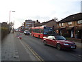
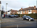
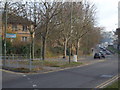
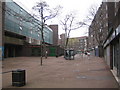
Photos of NW9 5PS

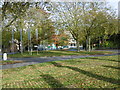
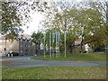

Area Information
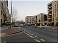
Living in NW9 5PS means residing in a compact postcode cluster covering just 2,299 square metres in England. This tiny residential patch contains a population of 1,721 people, creating an intensely dense living environment with a density figure of 748,454 people per square kilometre. Such high density dictates that daily life revolves around close-quarters interaction and immediate access to shared spaces rather than sprawling gardens or isolated streets. The location sits within the broader NW9 zone of North London, situating residents in a neighbourhood where residential clusters dominate the local landscape. You are dealing with a specific postcode area where thousands of individuals occupy a very small footprint, which inherently shapes the pace and noise levels of daily routines. The area functions as a tight-knit residential unit where neighbours are invariably close by, both physically and socially. When you consider moving here, you must accept that space is a premium commodity and the community operates with a certain intensity. This concentration of residents defines the character of the locality, making it distinct from wider suburban districts. The sheer volume of people within such a limited area suggests a vibrant, sometimes crowded atmosphere where urban convenience meets high-rise living.
- Area Type
- Postcode
- Area Size
- 2299 m²
- Population
- 1721
- Population Density
- 12103 people/km²
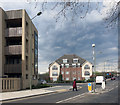
The property market in NW9 5PS is characterised almost entirely by rental living, as owner-occupied homes account for a mere 10% of the total housing stock. This low ownership rate indicates that buyers looking to purchase here will find very few options, forcing many to seek housing elsewhere in the wider North London region. Flats represent the predominant accommodation type, meaning you will encounter a landscape of apartments rather than traditional semi-detached houses or bungalows. This housing mix supports a high-density residential environment where vertical living is the norm rather than horizontal sprawl. For investors or landlords considering this area, the low ownership percentage suggests a potentially buoyant rental demand driven by the lack of affordable purchase options for local families. Prospective buyers must navigate a market that is likely skewed towards studio or one-bedroom units designed to suit the specific demographics found in the postcode. The concentration of flats combined with the 10% ownership figure creates a distinct economic environment where renting is the primary mode of residence.
House Prices in NW9 5PS
Showing 12 properties
| Address | Type | Beds | Baths | Last Sale Price | Last Sale Date | |
|---|---|---|---|---|---|---|
| 4, Grebe, Broadhead Strand, Colindale, London, NW9 5PS | Terraced | 3 | 1 | £450,000 | Feb 2023 | |
| 1, Grebe, Broadhead Strand, Colindale, London, NW9 5PS | house | 3 | 1 | £415,000 | Sep 2017 | |
| 5, Grebe, Broadhead Strand, Colindale, London, NW9 5PS | house | - | - | £400,000 | Jul 2017 | |
| 8, Grebe, Broadhead Strand, Colindale, London, NW9 5PS | house | - | - | £235,000 | Dec 2009 | |
| 9, Grebe, Broadhead Strand, Colindale, London, NW9 5PS | Terraced | - | - | £196,000 | Sep 2004 | |
| 6, Grebe, Broadhead Strand, Colindale, London, NW9 5PS | Terraced | - | - | £185,000 | Jun 2003 | |
| 3, Grebe, Broadhead Strand, Colindale, London, NW9 5PS | house | - | - | £122,000 | May 2001 | |
| 10, Grebe, Broadhead Strand, Colindale, London, NW9 5PS | Terraced | - | - | £112,000 | Nov 2000 | |
| 2, Grebe, Broadhead Strand, Colindale, London, NW9 5PS | house | 3 | 1 | £58,000 | Mar 1996 | |
| 12, Grebe, Broadhead Strand, Colindale, London, NW9 5PS | house | - | - | £53,000 | Jan 1995 |
Energy Efficiency in NW9 5PS
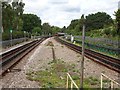
Your lifestyle in NW9 5PS is anchored by a network of practical amenities within practical reach of every resident. Five retail outlets serve the immediate shopping needs, including Sainsburys Colindale, Tesco Hendon, and the M&S Watford Way BP station, ensuring you can stock supplies without travelling far. Transport connectivity is robust, with five metro stations nearby, including Colindale Station, Burnt Oak Station, and Hendon Central Station, offering swift access to central London and surrounding boroughs. Five rail links are available at Mill Hill Broadway, Hendon Station, and Brent Cross West Station, providing flexibility during transport strikes or peak hour congestion. Cultural and leisure options extend to the water network, with three waterbus stops at London Zoo Waterbus Stop, Camden Lock Waterbus, and Little Venice Waterbus Stop. This diverse mix of shops, trains, and water taxis creates a multifaceted living experience where daily essentials and leisure activities are condensed into a short commute.
Amenities
Schools
Families living in NW9 5PS have access to two specific educational institutions, both offering education within the Catholic tradition. Blessed Dominic Catholic Primary School holds an outstanding Ofsted rating, marking it as a top-tier environment for younger children in the immediate vicinity. St James' Catholic High School maintains a good Ofsted rating, providing secondary education options close to the postcode boundary. The presence of these two schools, one rated outstanding and the other good, demonstrates a strong commitment to educational quality within the catchment area. You will find a mix of primary and high school facilities nearby, which reduces travel time for students and simplifies logistics for parents. However, the limited number of schools listed suggests that competition for places may be keen, given the high density of the population. The schools serve the local community directly, offering a settled educational foundation for children growing up in this dense yet convenient neighbourhood.
| Rank | School | Type | Entry gender | Ages |
|---|
Explore more schools in this area
Go to Schools tabDemographics
The community profile of NW9 5PS is defined by a strong dominance of adults, specifically those aged between 30 and 64 years, who form the most common age range in the area. The median age stands at 47 years, indicating a mature demographic rather than a youthful family hive or a retirement enclave. With adults comprising the bulk of the population, the local energy likely reflects established lifestyles and professional careers. Home ownership remains exceptionally low, with only 10% of residents owning their properties outright. This statistic confirms that the vast majority of people in this postcode are landlords or tenants rather than owner-occupiers. Flats constitute the primary accommodation type, aligning with the high-density nature of the location and the low rate of private ownership. The predominant ethnic group is White, which forms the core of the local diversity breakdown. You can expect a community composed largely of working-age adults living in rented accommodation, suggesting a transient or investment-driven market dynamic. The lack of home ownership also implies fewer long-term plotted residents, which may influence neighbourly stability.
Household Size
Accommodation Type
Tenure
Ethnic Group
Religion
Household Composition
Age
Household Deprivation
NS-SEC
Explore more demographic insights in this area
Go to Demographics tabPlanning
Planning Constraints
- Flood RiskPremium
- Ramsar Wetland SitesPremium
- Area of Outstanding Natural BeautyPremium
- Protected Nature ReservePremium
- Protected WoodlandPremium