Area Overview for NW9 0QB
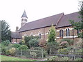
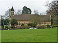
Photos of NW9 0QB

Area Information
Living in NW9 0QB means residing within a compact residential cluster defined by a precise postcode. This specific area covers a small footprint of 2099 square metres, creating an intimate neighbourhood grid for a population of 1677 people. The density here is exceptionally high, with approximately 798,855 people per square kilometre according to the recorded metrics for this postcode. Life in this location centres around close proximity to established transport links and retail hubs, yet the physical area itself remains small. Residents enjoy easy access to major railway stations and supermarkets without traversing large urban expanses. The environment is characterised by efficient use of space rather than sprawling development. You will find a community where daily routines revolve around access to Colindale and Kingsbury, both of which lie within practical reach. The area combines urban convenience with a contained living arrangement. Despite the high population density figure, the immediate streets offer a focused residential experience. Homebuyers entering this postcode are purchasing into a specific slice of the Greater London market where services are concentrated near the bedroom community. The area serves as a functional base for commuters and workers accessing the wider capital region.
- Area Type
- Postcode
- Area Size
- 2099 m²
- Population
- 1677
- Population Density
- 6910 people/km²
The property market in NW9 0QB is distinct due to the dominance of flats as the primary accommodation type. With 48 per cent of the population owning their homes, the area presents a viable opportunity for both buyer owners and investors in the residential sector. This statistic indicates a healthy level of domestic stability within the small postcode cluster. The high concentration of flats suggests that buyers should expect to find terraced properties or blocks of flats rather than large detached houses. This housing stock is typical for high-density urban clusters where space is at a premium. For potential homeowners, the balance between ownership and renting implies a competitive but stable market. Those looking to purchase homes in NW9 0QB will find the local stock aligns with neighbours who have already secured tenure. The presence of flats can appeal to professionals seeking low-maintenance living or families requiring vertical space in a constrained postcode. Understanding that flats predominate is essential when viewing properties advertised near this specific location. The relatively low freehold percentage compared to the total housing stock suggests a mix of leasehold apartments within the area. Buyers must remain aware of the specific tenure options available for flats in this cluster.
House Prices in NW9 0QB
Showing 6 properties
| Address | Type | Beds | Baths | Last Sale Price | Last Sale Date | |
|---|---|---|---|---|---|---|
| 1 The Retreat, London, NW9 0QB | Bungalow | - | - | £503,000 | Mar 2021 | |
| 3 The Retreat, London, NW9 0QB | Semi-detached | 2 | 2 | £495,000 | Sep 2017 | |
| 5 The Retreat, London, NW9 0QB | Semi-detached | 2 | - | £432,500 | Apr 2017 | |
| 4 The Retreat, London, NW9 0QB | Semi-detached | 2 | - | £450,000 | Dec 2015 | |
| 6 The Retreat, London, NW9 0QB | Semi-detached | 4 | 2 | £235,000 | Jan 2007 | |
| 2 The Retreat, London, NW9 0QB | Semi-detached | 3 | 1 | - | - |
Energy Efficiency in NW9 0QB
Daily life in NW9 0QB benefits from immediate access to a wide range of retail, leisure, and transport amenities. You are within practical reach of five major retail locations, including Morrisons Colindale, Asda Colindale, and Aldi Colindale. These supermarkets ensure that grocery shopping and household essentials are available without the need for long journeys. Beyond retail, residents have access to five metro stations and five rail stations, providing seamless connections to central London and surrounding commuter belts. The nearby ferry network includes the London Zoo Waterbus Stop, Little Venice Waterbus Stop, and Camden Lock Waterbus, adding a unique leisure option for weekend trips to North London. This mix of practical shops and cultural transport hubs creates a versatile lifestyle environment. You can complete weekly chores at Colindale or Burnt Oak while planning cultural outings via the waterbus to Camden. The density of amenities supports a self-sufficient lifestyle where major needs are met locally or via short public transport links. Shopping, commuting, and leisure activities converge around the immediate vicinity of the postcode. This integration of large supermarkets and international transport nodes defines the character of living in NW9 0QB.
Amenities
Schools
Families considering live in NW9 0QB will find Brent River College as the significant educational institution in the immediate vicinity. The data identifies this facility as a school classified under the 'other' category, indicating it may not follow the standard primary or secondary age bands in the traditional sense. This specific naming and classification provide clear context for the educational landscape around the postcode. While detailed Ofsted ratings are not listed in the current data, the presence of Brent River College suggests access to further education or specialist training facilities for residents. The mix of school types within the postcode area is limited based on the available information, focusing primarily on this single named entity. Prospective parents should investigate the specific curriculum and intake age ranges for this college to determine suitability for their children's needs. The concentration of educational options near NW9 0QB supports the requirement for reliable schooling nearby. Living in this area ensures proximity to at least one major educational establishment. Families should verify catchment areas and admission criteria directly with the institution to ensure alignment with their expectations for their children's education path.
| Rank | School | Type | Entry gender | Ages |
|---|
Explore more schools in this area
Go to Schools tabDemographics
The community in NW9 0QB reflects a mature demographic profile with a median age of 47 years. The most common population group consists of adults aged between 30 and 64 years, indicating a neighbourhood populated by established individuals and families rather than young professionals or retirees. Regarding home stability, 48 per cent of residents own their homes, suggesting a balanced market with significant owner-occupancy alongside private renting. The primary form of accommodation in this postcode is flats, which aligns with the high-density nature of the location. Census data identifies White as the predominant ethnic group within the population. These socioeconomic factors paint a picture of a settled residential area where long-term residents form the bulk of the community. The age distribution suggests schools catering to children might serve the younger end of this adult spectrum, while local services likely cater to working families. The high average age could imply a quieter atmosphere compared to areas dominated by students or young workers. This demographic stability provides a predictable environment for anyone considering purchasing homes in NW9 0QB.
Household Size
Accommodation Type
Tenure
Ethnic Group
Religion
Household Composition
Age
Household Deprivation
NS-SEC
Explore more demographic insights in this area
Go to Demographics tabPlanning
Planning Constraints
- Flood RiskPremium
- Ramsar Wetland SitesPremium
- Area of Outstanding Natural BeautyPremium
- Protected Nature ReservePremium
- Protected WoodlandPremium