Area Overview for NW8 9TJ
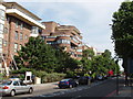
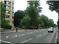
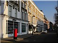
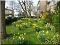
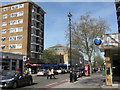
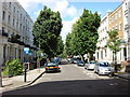
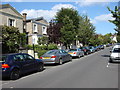
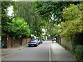
Photos of NW8 9TJ


Area Information
Living in NW8 9TJ places you within a specific residential cluster in north-west Inner London. This postcode covers a total area of 1,265 square metres, creating a tightly knit environment for its residents. The neighbourhood encompasses a population of 1,688 people, fostering a close community atmosphere typical of smaller London enclaves. Located near the historic grounds of Regent's Park, the area benefits from a setting that dates back to King Henry VIII and the 1810s redesign by John Nash. The proximity to the Royal Park offers a distinct character compared to other parts of the city. While the area is defined by its compact footprint, it connects to major historic sites including Queen Mary's Gardens and the London Zoo. The location serves as a practical residential hub adjacent to one of London's most significant green spaces. Regent's University London occupies the site of South Villa within the nearby park, adding an academic element to the local landscape. The specific geography of NW8 9TJ means you are part of a functional neighbourhood where daily life revolves around convenient access to key metropolitan landmarks. This area represents a balance between private living and the shared history of the surrounding parklands. The density and size of the postcode indicate a mature, established living space that has evolved over centuries. Understanding the layout and limits of this 1,265 m² zone helps prospective buyers appreciate the scale of life here.
- Area Type
- Postcode
- Area Size
- 1265 m²
- Population
- 1688
- Population Density
- 9095 people/km²
The property market in NW8 9TJ is defined by specific characteristics visible in the housing stock. Ownership levels stand at 39%, which indicates a relatively high proportion of tenants compared to owner-occupiers. This figure suggests the area appeals strongly to renters who may value the flexibility of a lease or seek proximity to Regent's Park. The predominant accommodation type is flats, confirming that the physical infrastructure of this 1,265 m² postcode is designed around multi-unit dwellings. Living in this postcode often means navigating a rental-heavy environment where demand for quality flats outstrips supply. The high density of flats created by the 1688 residents living in such a small area constrains the number of large detached or semi-detached homes available. Prospective buyers should consider whether they wish to buy in a market dominated by leasehold properties. The mix of 39% ownership implies that many immediate neighbours may be landlords or foreign nationals investing in London property. This market dynamic can affect the sense of community stability and the length of tenancies. For those seeking a traditional buysellmove cycle, this area requires careful consideration of lease terms and service charges common in flat developments. The data points to an urban market where rental income often drives property values as much as primary residence needs.
House Prices in NW8 9TJ
No properties found in this postcode.
Energy Efficiency in NW8 9TJ
Your lifestyle in NW8 9TJ revolves around immediate access to a wide range of amenities within practical reach. Five retail locations serve the local community, including Tesco St John's, Tesco Maida, and Tesco Maida Vale, ensuring your daily shopping needs are met without travelling far. The area offers five nearby metro stations, such as St John's Wood and Swiss Cottage Station, making it easy to reach workplaces or leisure destinations across the city. For those who prefer water-based travel, five ferry options are available, including the London Zoo Waterbus Stop and Camden Lock Waterbus. Public transport diversity extends to rail and coach services as well. You can access South Hampstead Station and Kilburn High Road Station for broader rail networks, while London Victoria Coach Station remains a key arrival point for long-distance travel. These five coach stations provide connectivity to destinations beyond London. The presence of these diverse transport modes, combined with nearby supermarkets, creates a convenient routine. Your daily life involves short trips to a local Tesco or a quick commute from a nearby subway entrance. This infrastructure supports a balanced existence where work, shopping, and travel occupy minimal time. Living here means you rarely need to plan complex journeys for simple daily activities.
Amenities
Schools
| Rank | School | Type | Entry gender | Ages |
|---|
Explore more schools in this area
Go to Schools tabDemographics
The community in NW8 9TJ presents a clear demographic profile centred on adult life stages. The median age for residents is 47 years, reflecting a mature population where Adults aged between 30 and 64 years form the most common age range. This distribution suggests the area attracts individuals and families established in their careers or approaching retirement. Home ownership stands at 39%, meaning that a significant portion of the population rents their accommodation. The predominant form of housing is flats, which aligns with the urban nature of this Inner London postcode. Ethnic diversity in the area shows a predominance of White residents, according to current census data. The higher proportion of renters compared to owners may indicate a mix of professionals, international students, or those seeking flexibility in a prime London location. The concentration of flats supports a lifestyle where residents share building amenities while maintaining individual privacy. With a population density that defines a compact living space, social interaction occurs frequently within the immediate neighbourhood and surrounding streets. The age structure and housing types contribute to a stable environment where long-term residents often coexist with those seeking a specific urban experience. These statistics paint a picture of a mature, predominantly non-majority-owner neighbourhood with a clear focus on adult living.
Household Size
Accommodation Type
Tenure
Ethnic Group
Religion
Household Composition
Age
Household Deprivation
NS-SEC
Explore more demographic insights in this area
Go to Demographics tabPlanning
Planning Constraints
- Flood RiskPremium
- Ramsar Wetland SitesPremium
- Area of Outstanding Natural BeautyPremium
- Protected Nature ReservePremium
- Protected WoodlandPremium
- Crime RiskPremium