Area Overview for NW8 8SY
Photos of NW8 8SY


Area Information
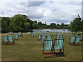
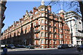
Living in NW8 8SY offers proximity to the bustling heart of London while maintaining a defined residential character. This postcode covers a specific residential cluster with a total area size of 3,059 square metres. Approximately 1,981 individuals reside within these boundaries, creating a tight-knit community environment. The location is situated in England, benefiting from a distinct positioning that balances urban convenience with neighbourhood intimacy. The population density stands at 647,619 people per square kilometre, reflecting the intensive nature of living in central London districts. Residents enjoy immediate access to major transport hubs, including Edgware Road Station and Baker Street Station, which serve both metro and rail networks. Nearby ferry options like the London Zoo Waterbus Stop provide alternative river crossings. Your daily commute is streamlined by highly rated digital connectivity, with a broadband score of 89 and a mobile coverage score of 85 out of 100. Such infrastructure supports remote working and seamless digital life. Safety assessments confirm this area passes rigorous checks regarding flood risk and environmental constraints, with a low crime risk score of 78 out of 100. The combination of high-rise flats and excellent transport links defines the practicalities of daily life here. You secure a home close to retail giants like Tesco Lisson and major stations without the typical commute burdens associated with the wider city.
- Area Type
- Postcode
- Area Size
- 3059 m²
- Population
- 1981
- Population Density
- 36415 people/km²
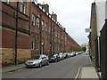
The property market in NW8 8SY is defined by a high proportion of rental accommodation. Only 16% of households own their homes, leaving an 84% rental segment. This statistic clearly indicates that the area functions primarily as a rental location rather than an owner-occupied zone. The predominant accommodation type listed for this postcode is flats. This housing stock perfectly suits the high density of 647,619 people per square kilometre found within the 3,059 square metre area. Buyers looking to invest should focus on the rental demand generated by the large tenant population. The availability of flats suggests new developments or conversions likely meet the needs of young professionals and small families. Home buyers should expect competition for purchases given the low owner-ship rate and the inherent desirability of the location. You will not find many detached houses or owner-occupied families in this specific cluster. Instead, the market revolves around leasehold properties and serviced residential units. This configuration supports the transient yet high-demand nature of the local population. When evaluating homes in NW8 8SY, prioritize properties with strong rental potential or those suited for long-term tenancy agreements. The area's proximity to major transport hubs like Paddington and Bond Street further sustains rental values. You must understand that purchasing here means entering a market where sellers are fewer, and buyers are strategic.
House Prices in NW8 8SY
No properties found in this postcode.
Energy Efficiency in NW8 8SY
Your daily lifestyle in NW8 8SY revolves around convenience and immediate access to major retail and transport hubs. Five notable retail outlets including Tesco Lisson, M&S Marylebone Rail SF, and Co-op Park sit within practical reach. These venues provide all essential shopping needs without requiring a vehicle. Residents can easily reach Edgware Road Station, Baker Street Station, and St John's Wood Station by foot or short bus ride. Five rail stations including Paddington Station and Bond Street Station offer direct connections to the rest of the country. Three bus routes link you to London Victoria Coach Station Arrivals and the Green Line Coach Station. You also have access to five ferry points like the London Zoo Waterbus Stop and Camden Lock Water, though their specific utility depends on your travel preferences. The neighbourhood balances urban density with household comfort. Living in NW8 8SY means you can run errands at Tesco or dine near Bond Street without significant travel time. The presence of these amenities supports a self-sufficient daily routine. Whether commuting to work via South Hampstead Station or grabbing supplies from M&S, the infrastructure keeps you active. This connectivity reduces the need for car ownership and enhances your freedom of movement. You enjoy the benefits of city centre living with the ability to reach specific destinations efficiently.
Amenities
Schools
Families residing in NW8 8SY have access to a specific set of educational institutions within practical reach. The Portman Early Childhood Centre operates as a nursery nearby. This facility provides early years education for the youngest residents in the postcode area. While there are no primary or secondary schools listed in the immediate vicinity of this specific cluster, the presence of a nursery indicates support for child development from an early stage. Parents of young children in homes in NW8 8SY will need to look slightly further afield for primary and secondary education options, as the local data only confirms the nursery. The existence of the Portman Early Childhood Centre complements the wider school catchment areas serving the surrounding Marylebone and St John's Wood neighbourhoods. Prospective buyers should verify the catchment boundaries for secondary schools if they plan to keep children in the area long-term. For early childhood needs, the local nursery offers a convenient option right next door. The school type is specifically a nursery, catering to children aged two to five. Although the data does not list further academic institutions, the infrastructure supports the young element of the 30 to 64 age group living here. When considering schools near NW8 8SY, you must evaluate the distance to nearby primary colleges not explicitly listed but inherent to the location.
| Rank | School | Type | Entry gender | Ages |
|---|---|---|---|---|
| 1 | Portman Early Childhood Centre | nursery | N/A | N/A |
Explore more schools in this area
Go to Schools tabDemographics
The community in NW8 8SY reflects a mature and stable population structure. The median age for residents is 47 years, indicating a neighbourhood predominantly settled by adults. Data shows that the most common age range spans from 30 to 64 years. This demographic profile suggests the area attracts professionals and established families who seek stability. Home ownership stands at 16%, meaning the vast majority of residents rent their homes. This low figure highlights a significant rental market dynamic within the cluster. The predominant accommodation type consists of flats, aligning with the high population density and the nature of the local urban fabric. While specific breakdowns by ethnicity are not detailed beyond the general category of Asian total for the predominant group, the area maintains a diverse population typical of central London postcodes. The high population density of 647,619 people per square kilometre ensures services are walking distance away. You will find that the demographic makeup supports a mature social environment with established routines. The concentration of adults in their working and retirement years creates a settled atmosphere. This age distribution influences local demand for amenities such as convenience stores and healthcare services rather than play areas for young children, although the Portman Early Childhood Centre provides early education support. Living here means joining a community accustomed to city pace and shared urban values.
Household Size
Accommodation Type
Tenure
Ethnic Group
Religion
Household Composition
Age
Household Deprivation
NS-SEC
Explore more demographic insights in this area
Go to Demographics tabPlanning
Planning Constraints
- Flood RiskPremium
- Ramsar Wetland SitesPremium
- Area of Outstanding Natural BeautyPremium
- Protected Nature ReservePremium
- Protected WoodlandPremium
- Crime RiskPremium