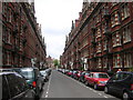
Area Overview for NW8 8DS
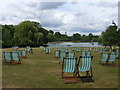
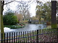
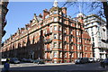
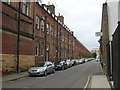
Photos of NW8 8DS


Area Information
Living in NW8 8DS means residing within a specific postcode cluster in England that covers just 1,271 square metres. This small residential area holds a population of 1,266 people, creating a dense neighbourhood where daily interactions are frequent and local streets are well populated. The area functions as a tightly knit residential pocket rather than a sprawling district, which influences the pace of daily life for everyone here. Residents navigate a compact environment where proximity defines community life, and the sheer size of the postcode area suggests a focus on efficient use of space rather than expansive grounds. For those considering homes in this location, the setup offers immediate immersion into a crowded urban setting. The high population density of 99,623,400 people per square kilometre reflects a built-up urban zone typical of central London postcodes. You will find that lifestyle here is dictated by proximity to nearby hubs, as the physical footprint of the area limits private outdoor space. Daily routines revolve around navigating narrow streets and accessing shared local infrastructure quickly. The character of NW8 8DS is defined by its density and its position as a contained residential unit within a larger metropolitan context.
- Area Type
- Postcode
- Area Size
- 1271 m²
- Population
- 1266
- Population Density
- 25422 people/km²
The property market in NW8 8DS is dominated by rental accommodation rather than owner-occupied stock. Specifically, just 20% of households own their homes, meaning 80% of residents live in rented properties. This imbalance defines the local housing economy and influences investment strategies for those looking to buy in this postcode. The predominant accommodation type is flats, which is consistent with a dense urban environment where space is at a premium. This focus on flats means you will mostly encounter multi-bedroom apartments rather than terraced houses or semi-detached homes. Prospective buyers should advance with the understanding that entry into this market likely involves purchasing a flat participating in a higher proportion of the rental sector. The small geographical size of the area, covering only 1,271 square metres, limits the availability of detached or semi-detached properties. Consequently, the housing inventory revolves around urban living solutions designed for larger households or professionals who prioritise location over land. If you are searching for homes in NW8 8DS, your options will centre on flats suitable for city living. The market dynamics suggest strong demand for rental units, which may also impact the valuation and flow of properties into the open market for future sale.
House Prices in NW8 8DS
Showing 26 properties
Energy Efficiency in NW8 8DS
Lifestyle in NW8 8DS is driven by immediate access to a wide range of retail, transport, and leisure options. You are within practical reach of five retail outlets including Tesco Lisson, M&S Marylebone Rail SF, and Tesco Paddington, providing everything from daily groceries to clothing. For commuters, the area is well-served by five metro stations, notably Edgware Road Station, Baker Street Station, and Warwick Avenue, facilitating quick journeys across London. Rail connections are equally strong, with access to Paddington Station, Bond Street Station, and South Hampstead Station for long-distance travel. Travel by ferry is also possible, with nearby Little Venice Waterbus Stop, London Zoo Waterbus Stop, and Camden Lock Water offering scenic river travel. Three bus services, though limited in count, include connections to London Victoria Coach Station Arrivals and Green Line services. Residents living in NW8 8DS benefit from a transport-rich environment that reduces reliance on private vehicles. This mix of metro, rail, and ferry options ensures you can reach work or leisure destinations effortlessly. Convenience is a central pillar of daily life here, supported by the sheer number of available transit lines.
Amenities
Schools
Education provision for families in NW8 8DS centres on Christ Church Bentinck CofE Primary School. This primary institution holds an outstanding Ofsted rating, placing it among the highest-performing schools in the borough. As a Church of England school, it caters to the educational needs of younger children attending the area's primary age bracket. You will find no secondary schools or sixth forms listed within the immediate data for this postcode, indicating that older children typically travel longer distances for their education. Christ Church Bentinck CofE Primary School serves as the key educational anchor for families residing in this specific cluster. The fact that this single outstanding-rated primary school is the only local entry highlights a gap in local secondary provision within the immediate vicinity. If you are considering schools near NW8 8DS for younger children, this institution offers a secure and highly regarded option. Parents living here will likely transport their children to this specific school before attending institutions further away for secondary education. The presence of just one named primary school suggests a concentrated educational catchment area rather than a wide variety of local choices.
| Rank | School | Type | Entry gender | Ages |
|---|
Explore more schools in this area
Go to Schools tabDemographics
The community in NW8 8DS is defined by a mature demographic profile with a median age of 47 years. Most residents fall into the 30 to 64-year-old age range, suggesting a population drawn from working families, established workers, or those transitioning into retirement. Only 20% of households own their homes outright, indicating that the vast majority of residents operate within the private rental market. This low ownership rate contrasts with typical suburban areas and points to a transient population or a high volume of long-term renters. The primary accommodation type consists of flats, which aligns with the high population density and the urban nature of the postcode area. While the predominant ethnic group is White, the data focuses heavily on age and tenure rather than diverse cultural mixing. For buyers looking at demographics, this area appeals to those seeking proximity to amenities rather than established family neighbourhoods with high owner-occupier rates. The flat-based housing stock supports the concentration of adults who likely favour urban living over detached houses. These figures show a clear preference for rental living among the 1,052 households that do not own their properties. Understanding this tenant-heavy composition helps you gauge the stability and type of community you will join if you choose to live here.
Household Size
Accommodation Type
Tenure
Ethnic Group
Religion
Household Composition
Age
Household Deprivation
NS-SEC
Explore more demographic insights in this area
Go to Demographics tabPlanning
Planning Constraints
- Flood RiskPremium
- Ramsar Wetland SitesPremium
- Area of Outstanding Natural BeautyPremium
- Protected Nature ReservePremium
- Protected WoodlandPremium