Area Overview for NW8 6LQ
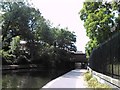
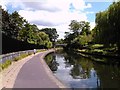
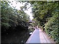
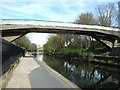
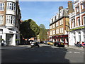
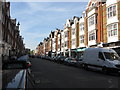
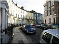
Photos of NW8 6LQ


Area Information
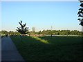
Living in NW8 6LQ offers a residential experience defined by its specific postcode cluster within a larger historical context. The area covers a small residential space with a total population of 1,392 people. This density creates an intimate neighbourhood where daily life revolves around immediate localities rather than sprawling estates. The location sits near Regent's Park, one of London's most significant royal parks. While the lot borders Regent's Park Ward, the immediate neighbourhood functions as a distinct residential entity. The housing stock is dominated by flats, shaping the architectural character and social interactions of the street. Residents enjoy a specific slice of north-west Inner London that balances urban convenience with proximity to green space. The history of the broader park area, originally a hunting ground for King Henry VIII and later redesigned by architect John Nash in the 1810s, adds a layer of heritage to the surroundings. You are steps away from notable features within the park, including Queen Mary's Gardens and the Avenue Gardens. The presence of Regent's University London just inside the park boundary also influences the local demographic and atmosphere. This is a place where you live in a tight-knit community with access to major leisure and transport hubs without the congestion of the city centre.
- Area Type
- Postcode
- Area Size
- Not available
- Population
- 1392
- Population Density
- 7131 people/km²
The property market in NW8 6LQ is characterised by a predominance of flats as the primary accommodation type. Only 35% of the housing stock is owned by its occupants, which indicates a substantial rental sector alongside the smaller number of owner-occupied properties. This balance means you will encounter a mix of investors, landlords, and long-term owners within this small residential cluster. The prevalence of flats offers a specific type of urban living, often with shared facilities or communal corridors, distinct from detached houses. For a area of just 1,392 residents, the housing density is efficient but lacks the traditional suburban sprawl found further out. The 35% ownership figure suggests that finding an owner-occupied property here requires looking carefully within the limited cluster. Many residents may be tenants, which can affect property management choices and potential security considerations. The market dynamics in this small postcode reflect the broader trends of London's inner areas where space is at a premium. You are entering a market where flats are the standard, offering variety in unit sizes and configurations within a compact neighbourhood.
House Prices in NW8 6LQ
No properties found in this postcode.
Energy Efficiency in NW8 6LQ
Your lifestyle in NW8 6LQ benefits from immediate access to diverse amenities within practical reach. You have five retail options nearby, including Tesco St John's and Tesco Hampstead, guaranteeing essential shopping is never far away. Manchester Supermarket operates in Swiss Cottage, completing the core retail offerings. Transport links are extensive, with five metro stations close by, allowing quick access to central London and beyond. Rail services from South Hampstead and Kilburn High Road provide suburban connectivity without the need for a car. The area features five waterbus stops, including the London Zoo Waterbus and Camden Lock Waterbus, offering scenic travel routes along the waterways. Three bus stations are also nearby, covering Victoria Coach Station arrivals and London's main intercity terminals. Regent's Park dominates the local scenery, providing 410 acres of green space for walking and relaxation. The park contains Queen Mary's Gardens and the Avenue Gardens, areas completed in the 1930s and 1864 respectively. London Zoo, established between 1826 and 1828, is an integrated part of the park's attractions. You live in a neighbourhood where culture, nature, and commerce intersect seamlessly.
Amenities
Schools
You have access to one specific primary school in your immediate vicinity: Robinsfield Infant School. This institution holds a 'good' Ofsted rating, which confirms its standard of education meets regulatory expectations. While you have a primary option nearby, there are no secondary schools or specialist academies listed for this precise postcode in the available data. Families must look to surrounding neighbourhoods for older children's education, as the local educational provision is limited to infant years. The presence of a single school suggests that parents often travel to neighbouring postcodes for their children's full educational journey. The 'good' rating provides reassurance regarding the quality of instruction and care for younger residents living in NW8 6LQ. It is important to research transport links to other schools if you have children beyond the infant stage. The local education mix is simple, focusing on early years development within the community. Consider the walking distance to Robinsfield Infant School when evaluating homes for primary-aged children.
| Rank | School | Type | Entry gender | Ages |
|---|
Explore more schools in this area
Go to Schools tabDemographics
The community in NW8 6LQ reflects a mature demographic profile with a median age of 47 years. The predominant age group consists of adults between 30 and 64 years old, indicating a family or established professional population. White residents form the most common ethnic group within this postcode cluster. Home ownership stands at 35%, meaning the majority of homes are either rented or shared ownership. The accommodation type is categorised as flats, which aligns with the high-rise or urban residential nature of this part of Hampstead. This mix suggests a lively environment where long-term residents share the space with those seeking rental accommodation. The age distribution implies that schools and health services relevant to older children and young adults are essential local needs. With over half the population in the 30-64 bracket, there is a strong core of working-age residents. The home ownership rate of 35% suggests significant investment in private property by those who already live here. You will find a neighbourhood where life experiences are shared among people who are generally settled and have established roots in London for many years.
Household Size
Accommodation Type
Tenure
Ethnic Group
Religion
Household Composition
Age
Household Deprivation
NS-SEC
Explore more demographic insights in this area
Go to Demographics tabPlanning
Planning Constraints
- Flood RiskPremium
- Ramsar Wetland SitesPremium
- Area of Outstanding Natural BeautyPremium
- Protected Nature ReservePremium
- Protected WoodlandPremium