Area Overview for NW8 6HS
Photos of NW8 6HS


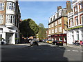
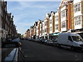
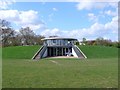
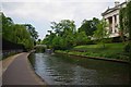
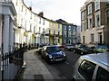
100 photos from this area
Area Information
Key information about the NW8 6HS including its size, population, and administrative classification.
- Area Type
- Postcode
- Area Size
- 1.4 hectares
- Population
- 1539
- Population Density
- 4136 people/km²
House Prices in NW8 6HS
9
Properties
£17,862,857
Average Sold Price
£240,000
Lowest Price
£38,500,000
Highest Price
Showing 9 properties
| Address | Type | Beds | Baths | Last Sale Price | Last Sale Date | |
|---|---|---|---|---|---|---|
| 36 Avenue Road, London, NW8 6HS | Detached | 9 | 8 | £25,880,000 | Jan 2025 | |
| 52 AVENUE ROAD, London, NW8 6HS | Detached | - | - | £29,500,000 | Aug 2021 | |
| 38 Avenue Road, London, NW8 6HS | house | - | - | £38,500,000 | Mar 2019 | |
| 44 Avenue Road, London, NW8 6HS | Detached | - | - | £8,000,000 | Jul 2018 | |
| 42 Avenue Road, London, NW8 6HS | house | 6 | - | £22,500,000 | Jun 2015 | |
| 50 Avenue Road, London, NW8 6HS | house | - | - | £420,000 | Sep 2001 | |
| 46 AVENUE ROAD, London, NW8 6HS | Flat | 7 | 8 | £240,000 | Nov 1997 | |
| 40 Avenue Road, London, NW8 6HS | Detached | 10 | 8 | - | - | |
| 48 Avenue Road, London, NW8 6HS | Semi-detached | 7 | - | - | - |
Energy Efficiency in NW8 6HS
Amenities
Schools
| Rank | School | Type | Entry gender | Ages |
|---|
Explore more schools in this area
Go to Schools tabDemographics
Household Size
Family (3-5 people)
most common
Accommodation Type
Flats
most common
Tenure
43
majority
Ethnic Group
White
most common
Religion
N/A
most common
Household Composition
N/A
most common
Age
47
median
Adults (30-64 years)
most common
Household Deprivation
N/A
with no deprivation
NS-SEC
53
in Lower managerial occupations
Explore more demographic insights in this area
Go to Demographics tabPlanning
Planning Constraints
- Flood RiskPremium
- Ramsar Wetland SitesPremium
- Area of Outstanding Natural BeautyPremium
- Protected Nature ReservePremium
- Protected WoodlandPremium