Area Overview for NW8 0ST
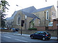
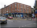
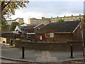
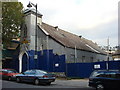
Photos of NW8 0ST


Area Information
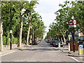
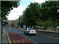
Living in NW8 0ST offers a distinct experience within a specific residential cluster. This postcode covers a small residential area with a total population of 1915 people. The setting is characterised by a density that supports community interaction while maintaining a residential focus. Daily life here revolves around the practicalities of urban living, where proximity to major transport hubs shapes the rhythm of the week. Residents enjoy immediate access to Kilburn High Road Station, South Hampstead Station, and West Hampstead Railway Station, ensuring connectivity across the greater London area. The area also benefits from three waterbus stops, including the London Zoo Waterbus Stop and Camden Lock Waterbus, providing unique river route access. You will find Sainsburys Camden, Tesco High, and M&S Kilburn SF within practical reach for your weekly shopping needs. This location sits in a zone where you can expect consistent service levels due to the high volume of transport options. The environment reflects a settled neighbourhood where residents rely on established routes and nearby facilities for their daily requirements. It is a place defined by its utility and its position within the wider transport network of North West London.
- Area Type
- Postcode
- Area Size
- Not available
- Population
- 1915
- Population Density
- 19601 people/km²
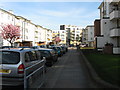
The property market in NW8 0ST is heavily inclined towards renting rather than ownership. Only 20% of households own their homes, meaning the market is driven significantly by tenants and investment portfolios. Flats dominate the accommodation type, which defines the physical character of the dwellings available for purchase or rent. You are unlikely to find large suburban detached houses in this specific postcode cluster; instead, expect smaller, high-density units typical of urban flats. This concentration of flats often appeals to professionals who prioritise location over space. The low ownership rate suggests a transient or professional demographic where renting offers flexibility. Buyers looking for freehold properties should be prepared for a competitive landscape where flats command the market share. The area functions as a rental hot spot within London, where demand for flat living exceeds local supply of owned properties. Your investment strategies must account for this high reliance on the private rental sector. Understanding this dynamic is crucial for anyone considering entering the property market in this specific postcode.
House Prices in NW8 0ST
No properties found in this postcode.
Energy Efficiency in NW8 0ST
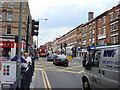
Your lifestyle in NW8 0ST is supported by a dense network of amenities within practical reach. You have five retail options including Sainsburys Camden, Tesco High, and M&S Kilburn SF for all your grocery and shopping needs. Transport choices are abundant with five rail stations nearby, notably Kilburn High Road Station and South Hampstead Station, plus five metro stations such as Kilburn Park Station and St John's Wood Station. Three waterbus stops add variety, including the London Zoo Waterbus Stop and Camden Lock Waterbus for river travel. Five bus services connect you to major hubs like London Victoria Coach Station Arrivals and Green Line Coach Station. This variety means you have over 20 daily transport options at your disposal. Dining and leisure facilities surround these transport nodes, making evenings easy to plan around walking or cycling distances. The presence of multiple superstore branches ensures you never need to travel far for daily essentials. You will find that convenience is built directly into the layout of the neighbourhood.
Amenities
Schools
| Rank | School | Type | Entry gender | Ages |
|---|
Explore more schools in this area
Go to Schools tabDemographics
The community in NW8 0ST is predominantly populated by adults aged between 30 and 64 years. Your demographic neighbours are part of this core adult age range, which forms the most common age bracket for residents here. The median age across the area stands at 47 years, indicating a mature population with established routines and life stages. Home ownership remains relatively low compared to other regions, with only 20% of households owning their property outright. This suggests a significant portion of the community lives in rented accommodation or shared ownership schemes. Flats constitute the primary form of accommodation, shaping the street layouts and building structures you will encounter. The predominant ethnic group in this cluster is White, reflecting the historical and social composition of the neighbourhood. These figures paint a picture of a stable demographic where adults seek stability in flat-based living. The age distribution implies a quiet evenings atmosphere after work hours. Understanding these statistics helps you gauge the social habits and community dynamics likely to exist around you.
Household Size
Accommodation Type
Tenure
Ethnic Group
Religion
Household Composition
Age
Household Deprivation
NS-SEC
Explore more demographic insights in this area
Go to Demographics tabPlanning
Planning Constraints
- Flood RiskPremium
- Ramsar Wetland SitesPremium
- Area of Outstanding Natural BeautyPremium
- Protected Nature ReservePremium
- Protected WoodlandPremium