Area Overview for NW7 3EB
Photos of NW7 3EB

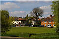
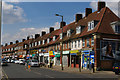
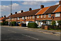
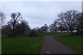

56 photos from this area
Area Information
Key information about the NW7 3EB including its size, population, and administrative classification.
- Area Type
- Postcode
- Area Size
- 7879 m²
- Population
- 1938
- Population Density
- 7322 people/km²
House Prices in NW7 3EB
22
Properties
£625,313
Average Sold Price
£265,000
Lowest Price
£920,000
Highest Price
Showing 22 properties
| Address | Type | Beds | Baths | Last Sale Price | Last Sale Date | |
|---|---|---|---|---|---|---|
| 28 Delamere Gardens, Mill Hill, London, NW7 3EB | Semi-detached | 4 | 2 | £880,000 | Mar 2024 | |
| 14 Delamere Gardens, Mill Hill, London, NW7 3EB | Semi-detached | 3 | 2 | £792,500 | Apr 2018 | |
| 8 Delamere Gardens, Mill Hill, London, NW7 3EB | house | 3 | - | £920,000 | Feb 2017 | |
| 12 Delamere Gardens, Mill Hill, London, NW7 3EB | Semi-detached | 3 | - | £625,000 | Nov 2015 | |
| 32 Delamere Gardens, Mill Hill, London, NW7 3EB | Semi-detached | 3 | - | £640,000 | Sep 2015 | |
| 30 Delamere Gardens, Mill Hill, London, NW7 3EB | Semi-detached | 3 | - | £565,000 | Jan 2015 | |
| 18 Delamere Gardens, Mill Hill, London, NW7 3EB | house | - | - | £315,000 | Sep 2009 | |
| 10 Delamere Gardens, Mill Hill, London, NW7 3EB | house | - | - | £265,000 | Mar 2002 | |
| Upper Flat, 26 Delamere Gardens, Mill Hill, London, NW7 3EB | Flat | 2 | - | - | - | |
| Upper Flat, 16 Delamere Gardens, Mill Hill, London, NW7 3EB | Flat | 2 | 1 | - | - |
Page 1 of 3
Energy Efficiency in NW7 3EB
Amenities
Schools
| Rank | School | Type | Entry gender | Ages |
|---|
Explore more schools in this area
Go to Schools tabDemographics
Household Size
Family (3-5 people)
most common
Accommodation Type
Houses
most common
Tenure
72
majority
Ethnic Group
White
most common
Religion
N/A
most common
Household Composition
N/A
most common
Age
47
median
Adults (30-64 years)
most common
Household Deprivation
N/A
with no deprivation
NS-SEC
42
in Lower managerial occupations
Explore more demographic insights in this area
Go to Demographics tabPlanning
Planning Constraints
- Flood RiskPremium
- Ramsar Wetland SitesPremium
- Area of Outstanding Natural BeautyPremium
- Protected Nature ReservePremium
- Protected WoodlandPremium