Area Overview for NW7 2NX
Photos of NW7 2NX
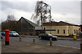
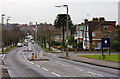
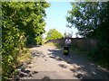
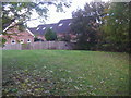
81 photos from this area
Area Information
Key information about the NW7 2NX including its size, population, and administrative classification.
- Area Type
- Postcode
- Area Size
- 5159 m²
- Population
- 1700
- Population Density
- 1592 people/km²
House Prices in NW7 2NX
16
Properties
£427,917
Average Sold Price
£295,000
Lowest Price
£770,000
Highest Price
Showing 16 properties
| Address | Type | Beds | Baths | Last Sale Price | Last Sale Date | |
|---|---|---|---|---|---|---|
| 49 Salcombe Gardens, Mill Hill, London, NW7 2NX | Semi-detached | 4 | 3 | £770,000 | Jun 2023 | |
| 57 Salcombe Gardens, Mill Hill, London, NW7 2NX | Terraced | 3 | 1 | £520,000 | Nov 2018 | |
| 53 Salcombe Gardens, Mill Hill, London, NW7 2NX | Semi-detached | 3 | - | £330,000 | Jun 2013 | |
| 79 Salcombe Gardens, Mill Hill, London, NW7 2NX | house | 2 | - | £307,500 | Dec 2011 | |
| 71 Salcombe Gardens, Mill Hill, London, NW7 2NX | house | 3 | - | £345,000 | Jun 2011 | |
| 63 Salcombe Gardens, Mill Hill, London, NW7 2NX | Terraced | - | - | £295,000 | Dec 2005 | |
| 59 Salcombe Gardens, Mill Hill, London, NW7 2NX | house | - | - | - | - | |
| 61 Salcombe Gardens, Mill Hill, London, NW7 2NX | house | - | - | - | - | |
| 65 Salcombe Gardens, Mill Hill, London, NW7 2NX | house | - | - | - | - | |
| 51 Salcombe Gardens, Mill Hill, London, NW7 2NX | house | - | - | - | - |
Page 1 of 2
Energy Efficiency in NW7 2NX
Amenities
Schools
| Rank | School | Type | Entry gender | Ages |
|---|
Explore more schools in this area
Go to Schools tabDemographics
Household Size
Family (3-5 people)
most common
Accommodation Type
Houses
most common
Tenure
63
majority
Ethnic Group
White
most common
Religion
N/A
most common
Household Composition
N/A
most common
Age
47
median
Adults (30-64 years)
most common
Household Deprivation
N/A
with no deprivation
NS-SEC
37
in Lower managerial occupations
Explore more demographic insights in this area
Go to Demographics tabPlanning
Planning Constraints
- Flood RiskPremium
- Ramsar Wetland SitesPremium
- Area of Outstanding Natural BeautyPremium
- Protected Nature ReservePremium
- Protected WoodlandPremium