Area Overview for NW7 1LU
Photos of NW7 1LU
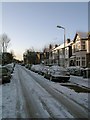


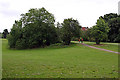

100 photos from this area
Area Information
Key information about the NW7 1LU including its size, population, and administrative classification.
- Area Type
- Postcode
- Area Size
- 1.5 hectares
- Population
- 1701
- Population Density
- 5374 people/km²
House Prices in NW7 1LU
28
Properties
£556,808
Average Sold Price
£127,000
Lowest Price
£1,150,000
Highest Price
Showing 28 properties
| Address | Type | Beds | Baths | Last Sale Price | Last Sale Date | |
|---|---|---|---|---|---|---|
| 166 Holders Hill Road, Church End, London, NW7 1LU | Semi-detached | 4 | 3 | £1,115,000 | May 2025 | |
| 162 Holders Hill Road, Church End, London, NW7 1LU | Semi-detached | 3 | 1 | £950,000 | Sep 2022 | |
| 182 Holders Hill Road, Church End, London, NW7 1LU | Semi-detached | 4 | - | £1,150,000 | Sep 2021 | |
| 172 Holders Hill Road, Church End, London, NW7 1LU | Detached | 4 | 3 | £1,085,000 | Aug 2019 | |
| 170 HOLDERS HILL ROAD, Church End, London, NW7 1LU | Detached | 3 | 1 | £725,000 | Mar 2018 | |
| 168 Holders Hill Road, Church End, London, NW7 1LU | Semi-detached | - | - | £455,000 | Mar 2013 | |
| 184 Holders Hill Road, Church End, London, NW7 1LU | Semi-detached | - | - | £410,000 | Jul 2005 | |
| 178 Holders Hill Road, Church End, London, NW7 1LU | Semi-detached | - | - | £500,000 | Mar 2003 | |
| 164 Holders Hill Road, Church End, London, NW7 1LU | Semi-detached | - | - | £185,000 | Sep 1999 | |
| 158 Holders Hill Road, Church End, London, NW7 1LU | Detached | 4 | 2 | £166,500 | Apr 1999 |
Page 1 of 3
Energy Efficiency in NW7 1LU
Amenities
Schools
| Rank | School | Type | Entry gender | Ages |
|---|
Explore more schools in this area
Go to Schools tabDemographics
Household Size
Family (3-5 people)
most common
Accommodation Type
Flats
most common
Tenure
64
majority
Ethnic Group
White
most common
Religion
N/A
most common
Household Composition
N/A
most common
Age
47
median
Adults (30-64 years)
most common
Household Deprivation
N/A
with no deprivation
NS-SEC
52
in Lower managerial occupations
Explore more demographic insights in this area
Go to Demographics tabPlanning
Planning Constraints
- Flood RiskPremium
- Ramsar Wetland SitesPremium
- Area of Outstanding Natural BeautyPremium
- Protected Nature ReservePremium
- Protected WoodlandPremium