Area Overview for NW7 1BQ
Photos of NW7 1BQ

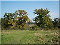
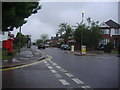
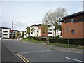
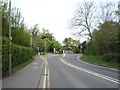
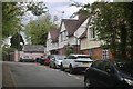
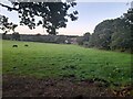
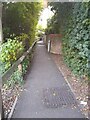
36 photos from this area
Area Information
Key information about the NW7 1BQ including its size, population, and administrative classification.
- Area Type
- Postcode
- Area Size
- 1.3 hectares
- Population
- 1703
- Population Density
- 7939 people/km²
House Prices in NW7 1BQ
68
Properties
£623,267
Average Sold Price
£520,000
Lowest Price
£885,000
Highest Price
Showing 68 properties
| Address | Type | Beds | Baths | Last Sale Price | Last Sale Date | |
|---|---|---|---|---|---|---|
| 22 Thirleby Road, Mill Hill, London, NW7 1BQ | Semi-detached | 4 | 2 | £885,000 | Sep 2023 | |
| 20 Thirleby Road, Mill Hill, London, NW7 1BQ | Semi-detached | 4 | 2 | £845,000 | Jun 2022 | |
| 64 Thirleby Road, Mill Hill, London, NW7 1BQ | Terraced | 4 | 3 | £870,000 | Jun 2021 | |
| 32 Thirleby Road, Mill Hill, London, NW7 1BQ | Detached | - | - | £600,000 | Aug 2019 | |
| 30 Thirleby Road, Mill Hill, London, NW7 1BQ | Detached | - | - | £600,000 | Aug 2019 | |
| 8 Thirleby Road, Mill Hill, London, NW7 1BQ | Semi-detached | 2 | 2 | £720,000 | Jul 2019 | |
| 40 Thirleby Road, Mill Hill, London, NW7 1BQ | Semi-detached | 4 | - | £750,000 | Oct 2015 | |
| 6 Thirleby Road, Mill Hill, London, NW7 1BQ | Detached | 4 | 2 | £650,000 | Aug 2015 | |
| 16 Thirleby Road, Mill Hill, London, NW7 1BQ | Semi-detached | 4 | 2 | £725,000 | Jan 2015 | |
| 14 Thirleby Road, Mill Hill, London, NW7 1BQ | Semi-detached | 4 | 2 | £665,000 | Nov 2013 |
Page 1 of 7
Energy Efficiency in NW7 1BQ
Amenities
Schools
| Rank | School | Type | Entry gender | Ages |
|---|
Explore more schools in this area
Go to Schools tabDemographics
Household Size
Family (3-5 people)
most common
Accommodation Type
Houses
most common
Tenure
63
majority
Ethnic Group
White
most common
Religion
N/A
most common
Household Composition
N/A
most common
Age
47
median
Adults (30-64 years)
most common
Household Deprivation
N/A
with no deprivation
NS-SEC
53
in Lower managerial occupations
Explore more demographic insights in this area
Go to Demographics tabPlanning
Planning Constraints
- Flood RiskPremium
- Ramsar Wetland SitesPremium
- Area of Outstanding Natural BeautyPremium
- Protected Nature ReservePremium
- Protected WoodlandPremium