Area Overview for NW6 7YT
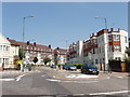
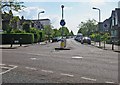
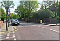
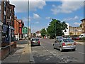
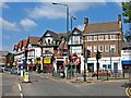
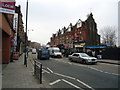
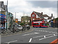
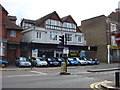
Photos of NW6 7YT


Area Information
The postcode district of NW6 7YT represents a compact residential cluster covering just over two square kilometres. You are looking at a defined area with a population of 1,761 people living in close proximity to one another. The physical footprint is small, which often creates a tight-knit atmosphere where neighbours know each other. This is not a sprawling suburban development but a concentrated zone where daily life revolves around local routines and shared transit options. Residents benefit from being situated within a specific, measurable community boundary. The area size suggests that streets are likely close together, making it easy to walk to nearby stations or shops. Living here means you are part of a well-defined sector rather than the edge of a larger town. The density of the population per square kilometre indicates a bustling urban environment despite the modest total area. You will find that the sense of place is reinforced by the sheer concentration of homes in such a limited space. This postcode serves as a practical snapshot of a significant part of the wider neighbourhood. When you consider buying here, you are purchasing a slice of a larger, active community. The specific boundaries of NW6 7YT offer a clear geographic identity that distinguishes it from surrounding zones.
- Area Type
- Postcode
- Area Size
- 2321 m²
- Population
- 1761
- Population Density
- 8034 people/km²
Homes in NW6 7YT are defined by a specific housing stock characterised prominently by flats. The question of who owns property here splits almost evenly, with 36% of people owning their homes outright. This statistic indicates that the area is not exclusively a rental market, nor is it fully owner-occupied like some suburban districts. You will encounter a blend of leaseholders and freeholders alongside private tenants seeking accommodation. The prevalence of flats suggests that garden space is rare and floor area is maximised vertically. This type of housing stock appeals to those prioritising location over detached living. Prospective buyers should note that the 36% ownership rate reflects a district where landlords and property investors play a substantial role. The nature of the dwellings means you are likely looking at units within managed blocks or conversions. When you search for properties in this postcode, expect modern apartments mixed with converted shared Flats. This market structure offers flexibility for renters while providing steady yields for investors. You must consider that the high proportion of rental stock can sometimes lead to shorter tenancies or higher competition. The property landscape of NW6 7YT is practical, urban, and shaped by the constraints of a dense city location.
House Prices in NW6 7YT
Showing 25 properties
Energy Efficiency in NW6 7YT
Daily life in NW6 7YT benefits from immediate access to a wide range of retail and transport amenities. You can walk to Sainsburys Willesden and Co-op Willesden for your weekly groceries and household essentials. These stores are located within practical reach, reducing the need for long car journeys to Tesco or Asda. Nearby rail options include Brondesbury Park Station, Brondesbury Station, and Kensal Rise Station. These three stations offer direct links to central London and surrounding commuter towns. If you prefer the Underground, Kilburn Station, Dollis Hill Station, and Kilburn Park Station provide frequent metro services. Small waterbus services also operate at Little Venice Waterbus Stop, London Zoo Waterbus Stop, and Camden Lock Waterbus. These options mean you have multiple arteries for commuting or weekend trips. The bus network connects you to London Victoria Coach Station Arrivals, Victoria Coach Station, and Green Line Coach Station. Dining and leisure are accessible via short walks from these transit hubs. Living in NW6 7YT means you do not need a car for most weekly trips. The concentration of shops and stations creates a convenient environment where essentials are always close by. You can combine a morning trip to the baker with an afternoon train ride to the city.
Amenities
Schools
| Rank | School | Type | Entry gender | Ages |
|---|
Explore more schools in this area
Go to Schools tabDemographics
The community in NW6 7YT has a distinct age profile centred on adults between 30 and 64 years old. The median age sits at 47, confirming that this is an area dominated by working-age families and established professionals. You will find that the population is mature compared to student enclaves or retirement villages. The recent figures show that 36% of households are owner-occupied, leaving a significant portion of residents as private tenants. This mix of ownership types often means a dynamic market with both investors and long-term stewards of the property. The predominant ethnic group is White, which sets the demographic tone for the immediate surroundings. Accommodation data identifies flats as the primary form of housing in this postcode. This structural detail influences how people live, with many likely residing in apartment blocks rather than detached houses. Understanding these numbers helps you picture your daily interactions with neighbours who are generally settled rather than transient. The age range suggests that families and couples without dependent children make up the bulk of the demographic. You can expect a environment that balances suburban convenience with urban amenities. The data clearly outlines a stable, middle-aged population that has settled in this specific part of London.
Household Size
Accommodation Type
Tenure
Ethnic Group
Religion
Household Composition
Age
Household Deprivation
NS-SEC
Explore more demographic insights in this area
Go to Demographics tabPlanning
Planning Constraints
- Flood RiskPremium
- Ramsar Wetland SitesPremium
- Area of Outstanding Natural BeautyPremium
- Protected Nature ReservePremium
- Protected WoodlandPremium