Area Overview for NW6 7XG
Photos of NW6 7XG
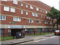
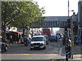
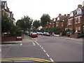
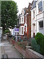


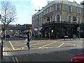


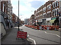
100 photos from this area
Area Information
Key information about the NW6 7XG including its size, population, and administrative classification.
- Area Type
- Postcode
- Area Size
- 1.8 hectares
- Population
- 1921
- Population Density
- 16575 people/km²
House Prices in NW6 7XG
69
Properties
£705,250
Average Sold Price
£320,000
Lowest Price
£1,242,500
Highest Price
Showing 69 properties
| Address | Type | Beds | Baths | Last Sale Price | Last Sale Date | |
|---|---|---|---|---|---|---|
| 49 Dyne Road, London, NW6 7XG | Terraced | 4 | 3 | £1,070,000 | Dec 2024 | |
| 21 Dyne Road, London, NW6 7XG | Unknown | - | - | £400,000 | Sep 2024 | |
| 23 Dyne Road, London, NW6 7XG | Flat | 2 | 1 | £450,000 | Nov 2022 | |
| 25 Dyne Road, London, NW6 7XG | Land | - | - | £465,000 | Feb 2022 | |
| 3 Dyne Road, London, NW6 7XG | Terraced | 4 | 3 | £1,175,000 | Mar 2016 | |
| 1 Dyne Road, London, NW6 7XG | Detached | 4 | 3 | £1,242,500 | Dec 2014 | |
| 31 Dyne Road, London, NW6 7XG | Flat | 1 | 3 | £320,000 | Nov 2013 | |
| 13 Dyne Road, London, NW6 7XG | Terraced | 4 | 3 | £720,000 | Nov 2012 | |
| 45 Dyne Road, London, NW6 7XG | Terraced | 5 | 3 | £660,000 | Jun 2006 | |
| 37 Dyne Road, London, NW6 7XG | Semi-detached | - | - | £550,000 | Aug 2001 |
Page 1 of 7
Energy Efficiency in NW6 7XG
Amenities
Schools
| Rank | School | Type | Entry gender | Ages |
|---|
Explore more schools in this area
Go to Schools tabDemographics
Household Size
One person
most common
Accommodation Type
Flats
most common
Tenure
24
majority
Ethnic Group
White
most common
Religion
N/A
most common
Household Composition
N/A
most common
Age
47
median
Adults (30-64 years)
most common
Household Deprivation
N/A
with no deprivation
NS-SEC
41
in Lower managerial occupations
Explore more demographic insights in this area
Go to Demographics tabPlanning
Planning Constraints
- Flood RiskPremium
- Ramsar Wetland SitesPremium
- Area of Outstanding Natural BeautyPremium
- Protected Nature ReservePremium
- Protected WoodlandPremium