Area Overview for NW6 7UU
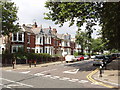
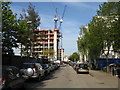
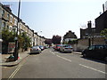
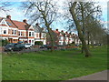
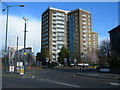
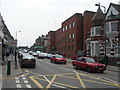
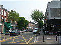
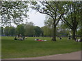
Photos of NW6 7UU


Area Information
Living in NW6 7UU means residing in a compact residential cluster of just 5065 square metres within England. This small postcode serves 1656 people, creating a densely populated environment where neighbours are inevitably close by. The area functions as a specific pocket within a larger neighbourhood, offering a high degree of urban concentration. Its tiny footprint dictates a specific style of living characterised by proximity and immediacy rather than expansive suburban space. You find yourself in an environment where daily necessities are physically near, fostering a community reliant on local resources and shared public spaces. The sheer density of 326922 people per square kilometre defines the rhythm of daily life here. Residents navigate a landscape where every street corner holds potential activity. This postcode area is not a sprawling district but a concentrated hub of habitation. Understanding the scale of NW6 7UU requires accepting that it is a microcosm of wider London living. The area packs its population efficiently, meaning transport links and amenities are never far away.
- Area Type
- Postcode
- Area Size
- 5065 m²
- Population
- 1656
- Population Density
- 21847 people/km²
The housing stock in NW6 7UU is dominated by flats, which aligns with the area's small physical size and high density. Only 44% of residents own their homes, a figure that indicates a market where tenancy is the norm. This low ownership rate suggests that many homes in NW6 7UU are available for rent rather than purchase. Buyers looking at this postcode must navigate a landscape where possession is less common than in traditional suburban districts. The accommodation type data confirms that flats are the primary dwelling style, limiting options for those seeking detached or semi-detached houses. You will find a market driven by rental demand and investment properties rather than family home buyers seeking permanence. The concentration of flats within such a small 5065 square metre area creates a specific character for the local property market. This setup often appeals to professionals or smaller households who prioritise location over space. When searching for properties, expect to encounter leasehold structures typical of flat developments. The 56% tenant population means that tenancy agreements are a more common reality than long-term ownership deeds in this specific cluster.
House Prices in NW6 7UU
Showing 63 properties
| Address | Type | Beds | Baths | Last Sale Price | Last Sale Date | |
|---|---|---|---|---|---|---|
| 118 Priory Park Road, London, NW6 7UU | Terraced | 5 | 2 | £1,380,000 | Apr 2024 | |
| 124 Priory Park Road, London, NW6 7UU | house | - | - | £1,325,000 | Oct 2022 | |
| 138 Priory Park Road, London, NW6 7UU | Terraced | 4 | 2 | £1,100,000 | Jun 2022 | |
| 148 Priory Park Road, London, NW6 7UU | house | 3 | 1 | £1,130,000 | Jun 2022 | |
| 134 Priory Park Road, London, NW6 7UU | Terraced | 3 | 1 | £1,200,000 | Mar 2021 | |
| 152 Priory Park Road, London, NW6 7UU | Terraced | 4 | 2 | £1,250,000 | May 2020 | |
| Former, 98 Priory Park Road, London, NW6 7UU | Terraced | 8 | 8 | £900,000 | Feb 2020 | |
| 114 Priory Park Road, London, NW6 7UU | Terraced | 4 | 2 | £1,175,000 | Jul 2018 | |
| 144 Priory Park Road, London, NW6 7UU | Terraced | - | - | £651,000 | May 2007 | |
| 112 Priory Park Road, London, NW6 7UU | Maisonette | 1 | - | £90,000 | Jun 1995 |
Energy Efficiency in NW6 7UU
Residents of NW6 7UU enjoy immediate access to a wide array of amenities, retail options, and transport hubs. You can walk to five notable rail stations including Brondesbury Park Station, Queens Park Station, and Brondesbury Station for rapid city access. The nearby metro network includes Kilburn Park Station, Kilburn Station, and Maida Vale Station for local travel. Five ferry stops lie within practical reach, including Little Venice Waterbus Stop, London Zoo Waterbus Stop, and Camden Lock Waterbus. Retail options abound with five nearby shops such as Tesco Willesden, Planet Organic Queens, and Sainsburys Queens meeting all grocery and daily shopping needs. Three bus stops provide further connectivity to London Victoria Coach Station Arrivals, Victoria Coach Station, and Green Line Coach Station. Living in NW6 7UU means constant access to diverse entertainment and transport without lengthy commutes. This density of locations ensures that leisure, work, and errands intersect efficiently.
Amenities
Schools
| Rank | School | Type | Entry gender | Ages |
|---|
Explore more schools in this area
Go to Schools tabDemographics
The community in NW6 7UU has a clearly defined age profile with a median age of 47 years. Adults aged between 30 and 64 years represent the most common age range within this population. This demographic skew suggests an area populated by established residents and families rather than young professionals or retirees. Home ownership stands at 44%, indicating that the majority of households are tenants. This high rental proportion shapes the local market dynamics and community turnover. Flats constitute the predominant accommodation type, reflecting the compact nature of the postcode and its density constraints. While the predominant ethnic group recorded is White, the area remains a standard urban residential zone. There are no recorded statistics on deprivation levels in the available data, so specific quality of life metrics regarding income or housing conditions remain unquantified. You should approach the social composition with the understanding that it is dominated by middle-aged adults in rented flats. The mix implies a temporary stability for some renters while others remain long-term residents. The environment supports a population that has settled into a high-density urban fabric.
Household Size
Accommodation Type
Tenure
Ethnic Group
Religion
Household Composition
Age
Household Deprivation
NS-SEC
Explore more demographic insights in this area
Go to Demographics tabPlanning
Planning Constraints
- Flood RiskPremium
- Ramsar Wetland SitesPremium
- Area of Outstanding Natural BeautyPremium
- Protected Nature ReservePremium
- Protected WoodlandPremium