Area Overview for NW6 7SN
Photos of NW6 7SN
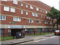
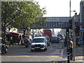
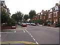
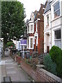


100 photos from this area
Area Information
Key information about the NW6 7SN including its size, population, and administrative classification.
- Area Type
- Postcode
- Area Size
- 6527 m²
- Population
- 2086
- Population Density
- 4683 people/km²
House Prices in NW6 7SN
30
Properties
£291,500
Average Sold Price
£58,000
Lowest Price
£485,000
Highest Price
Showing 30 properties
| Address | Type | Beds | Baths | Last Sale Price | Last Sale Date | |
|---|---|---|---|---|---|---|
| 13, Athelstan Gardens, Kimberley Road, London, NW6 7SN | Terraced | 2 | 1 | £372,000 | Mar 2024 | |
| 28, Athelstan Gardens, Kimberley Road, London, NW6 7SN | Maisonette | - | - | £485,000 | Dec 2020 | |
| 4, Athelstan Gardens, Kimberley Road, London, NW6 7SN | Maisonette | - | - | £425,000 | Sep 2020 | |
| 21, Athelstan Gardens, Kimberley Road, London, NW6 7SN | Maisonette | - | - | £455,000 | Sep 2016 | |
| 23, Athelstan Gardens, Kimberley Road, London, NW6 7SN | Maisonette | 3 | 1 | £391,000 | Dec 2015 | |
| 22, Athelstan Gardens, Kimberley Road, London, NW6 7SN | Maisonette | 4 | - | £450,000 | Apr 2015 | |
| 10, Athelstan Gardens, Kimberley Road, London, NW6 7SN | Maisonette | 3 | 1 | £315,000 | May 2013 | |
| 24, Athelstan Gardens, Kimberley Road, London, NW6 7SN | Flat | - | - | £282,000 | Sep 2012 | |
| 20, Athelstan Gardens, Kimberley Road, London, NW6 7SN | Flat | - | - | £219,000 | Aug 2006 | |
| 3, Athelstan Gardens, Kimberley Road, London, NW6 7SN | Maisonette | 3 | 1 | £215,000 | Oct 2005 |
Page 1 of 3
Energy Efficiency in NW6 7SN
Amenities
Schools
| Rank | School | Type | Entry gender | Ages |
|---|
Explore more schools in this area
Go to Schools tabDemographics
Household Size
Family (3-5 people)
most common
Accommodation Type
Flats
most common
Tenure
46
majority
Ethnic Group
White
most common
Religion
N/A
most common
Household Composition
N/A
most common
Age
47
median
Adults (30-64 years)
most common
Household Deprivation
N/A
with no deprivation
NS-SEC
52
in Lower managerial occupations
Explore more demographic insights in this area
Go to Demographics tabPlanning
Planning Constraints
- Flood RiskPremium
- Ramsar Wetland SitesPremium
- Area of Outstanding Natural BeautyPremium
- Protected Nature ReservePremium
- Protected WoodlandPremium