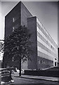
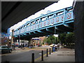
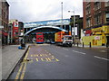
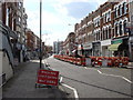
Area Overview for NW6 7PP
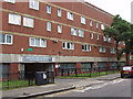
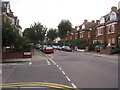
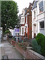
Photos of NW6 7PP
Area Information
Living in NW6 7PP means residing in a tightly knit residential cluster covering exactly 8,773 square metres. With a population of 1,591, this postcode represents a specific and concentrated slice of North West London. The area functions as a small, defined community rather than a sprawling neighbourhood, which often fosters a sense of locality among its residents. Daily life here is characterised by proximity, where the built environment supports a population density of 181,353 people per square kilometre. This density suggests a bustling environment where residents rely heavily on local infrastructure for their needs. You will find a setting that combines urban intensity with a manageable scale, offering a distinct residential experience close to major London transport arteries. The area serves as a practical base for those seeking housing within reach of Kilburn and Kensal Rise, blending convenience with a focused living space. Understanding the physical boundaries and population figures helps you visualise exactly what it is like to call this small region home.
- Area Type
- Postcode
- Area Size
- 8773 m²
- Population
- 1591
- Population Density
- 9255 people/km²
The property market in NW6 7PP is dominated by rental activity rather than owner-occupation. The data confirms that just 27 per cent of residents own their homes, meaning the vast majority live in rented accommodations. This tenure structure points to a housing stock where landlords and investors play a central role in providing homes. In a small area of this size, the lack of owner-occupiers often means properties move frequently or are leased on rolling contracts. You should expect a market defined by tenancy agreements rather than long-term family homesteading. The accommodation type is primarily flats, which aligns with the high-density urban nature of the postcode. For a buyer looking at this area, the opportunity to purchase a freehold home may be scarce compared to the volume of rental units available. The market dynamics here favour flexibility and mobility for those seeking a foothold in North West London.
House Prices in NW6 7PP
Showing 7 properties
| Address | Type | Beds | Baths | Last Sale Price | Last Sale Date | |
|---|---|---|---|---|---|---|
| 182 Willesden Lane, Kilburn, London, NW6 7PP | Detached | 7 | 3 | £1,800,000 | Jul 2013 | |
| 184A Willesden Lane, Kilburn, London, NW6 7PP | Flat | - | - | - | - | |
| 184B Willesden Lane, Kilburn, London, NW6 7PP | Flat | 3 | 2 | - | - | |
| 184D Willesden Lane, Kilburn, London, NW6 7PP | Flat | - | - | - | - | |
| 184C Willesden Lane, Kilburn, London, NW6 7PP | Flat | - | - | - | - | |
| Caretakers House, North West London Jewish Day School, Willesden Lane, Kilburn, London, NW6 7PP | Detached | - | - | - | - | |
| School Kitchen, North West London Jewish Day School, Willesden Lane, Kilburn, London, NW6 7PP | commercial | - | - | - | - |
Energy Efficiency in NW6 7PP
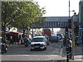
Life in NW6 7PP offers convenient access to a variety of retail and leisure amenities within practical reach. Residents can visit Tesco Kilburn and Sainsburys Kilburn for local grocery shopping, or head to Tesco Willesden for broader retail needs. Dining and lifestyle options extend to water-based activities via the Little Venice Waterbus Stop, London Zoo Waterbus Stop, and Camden Lock Waterbus. If you prefer traditional shopping hubs, London Victoria Coach Station Arrivals and the Green Line Coach Station serve as significant retail and transport nodes nearby. While bus services are present, the count is lower at three, with specific stops like London Victoria Coach Station Arrivals serving broader transit needs rather than local customer service. This mix of historic transport hubs and modern supermarkets ensures basic and leisure needs are met without needing to travel far. You will find a lifestyle that balances modern convenience with the unique character of the nearby waterbus routes.
Amenities
Schools
Families looking at NW6 7PP have access to named educational institutions nearby, specifically the North West London Jewish Day School. This establishment operates as both a primary school and an academy holding good Ofsted ratings. The presence of a single-sited institution serving both primary and secondary phases offers a consolidated educational route for local children. You do not have access to data on other curriculum types or private schools within this immediate radius, so your options are focused on this well-rated academy. The fact that the school has a good rating provides a baseline of quality for primary education in the vicinity. This mix means families navigating the area have a reliable state-funded option close by. You must rely on available transport links to reach the school, as the data does not indicate they are directly on the doorstep of every property in the postcode.
| Rank | School | Type | Entry gender | Ages |
|---|
Explore more schools in this area
Go to Schools tabDemographics
The community in NW6 7PP features a distinct age profile with a median age of 47 years. Adults aged between 30 and 64 years constitute the most common age range, indicating a population dominated by families and established residents rather than young singles or retirees. This demographic skew often results in a quieter domestic atmosphere compared to student-heavy zones. Regarding housing tenure, only 27 per cent of residents are homeowners, implying that the majority of the population rents their accommodation. This较高比例 of renting suggests a dynamic tenant turnover and a market heavily influenced by landlords or housing associations. The predominant ethnic group is White, which reflects the specific cultural makeup of this immediate postcode. These statistics paint a picture of a stable, middle-aged population predominantly composed of renters, all situated within a small geographical footprint. Understanding who lives here helps you anticipate the neighbourhood's character and the type of neighbours you might meet on the street.
Household Size
Accommodation Type
Tenure
Ethnic Group
Religion
Household Composition
Age
Household Deprivation
NS-SEC
Explore more demographic insights in this area
Go to Demographics tabPlanning
Planning Constraints
- Flood RiskPremium
- Ramsar Wetland SitesPremium
- Area of Outstanding Natural BeautyPremium
- Protected Nature ReservePremium
- Protected WoodlandPremium