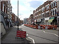
Area Overview for NW6 7LH
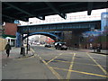
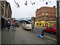
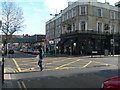
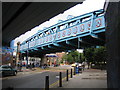
Photos of NW6 7LH


Area Information
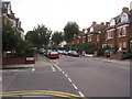
The postcode NW6 7LH covers a defined residential cluster within Greater London, spanning an area of 1,228 square metres. This specific location supports a population of 1,640 people, creating a tightly knit community environment. Residents here navigate a neighbourhood character defined by high residential density rather than expansive green spaces or rural setting. Life in NW6 7LH involves proximity to major London thoroughfares and immediate access to extensive public transport networks, distinguishing it from quieter suburban fringes. The area functions as a practical base for those working in central London or the West London corridor, benefiting from transport links that reduce daily commute times to significant hubs like London Victoria. Daily life revolves around the immediate convenience of local services, with supermarkets, train stations, and waterbus stops all within practical reach. The compact nature of this postcode means amenities are less than a walk away for many dwellings. You will find yourself surrounded by a mix of urban housing stock that prioritises accessibility over isolation. This specific cluster offers a slice of urban living where the famous Kilburn and Brondesbury areas intersect. While the physical footprint is small, the connectivity ensures it remains central to the wider city network. Living here means accepting a high-level of noise and movement in exchange for unparalleled access to London's infrastructure and services without the need for a private vehicle.
- Area Type
- Postcode
- Area Size
- 1228 m²
- Population
- 1640
- Population Density
- 17263 people/km²
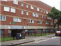
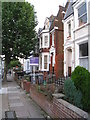
The housing market in NW6 7LH is defined by a specific accommodation type that dominates the local stock. Flats constitute the primary form of housing, meaning free-standing houses or detached homes are rare within this specific postcode boundary. This structural reality dictates the nature of available properties, catering heavily to investors and tenants who prefer low-maintenance urban living. The fact that only 34% of residents own their homes confirms that this is largely a rental area with fewer owner-occupied properties available for purchase. Buying a home in NW6 7LH requires a focus on apartment-style living, as the traditional detached house market is effectively absent from these coordinates. The low ownership rate suggests that successful investment strategies here often target buy-to-let portfolios or the private rental sector. For buyers entering the market, the competition will focus heavily on the quality of the flat, its floor height, and proximity to transport nodes like Brondesbury Station or Kilburn High Road. This property type concentration means you will not find the family houses typical of outer London suburbs. Instead, the market responds to demand for proximity to Tube lines and rail connections. The 1,228 square metre area size limits land availability, reinforcing the flats-over-houses dynamic. When searching for homes in this specific sector, prioritise units with reliable natural light and internal storage, as exterior communal spaces are limited by the density of the cluster. The market here rewards those who understand the value of connectivity in a city setting.
House Prices in NW6 7LH
Showing 16 properties
| Address | Type | Beds | Baths | Last Sale Price | Last Sale Date | |
|---|---|---|---|---|---|---|
| 10C Streatley Road, London, NW6 7LH | Flat | 2 | 1 | - | - | |
| Flat 2, 6 Streatley Road, London, NW6 7LH | Flat | 2 | 1 | - | - | |
| 4B Streatley Road, London, NW6 7LH | Flat | 2 | 1 | - | - | |
| Former, 2 Streatley Road, London, NW6 7LH | Detached | - | - | - | - | |
| Flat 3, 6 Streatley Road, London, NW6 7LH | Flat | 1 | - | - | - | |
| 8B Streatley Road, London, NW6 7LH | Flat | - | - | - | - | |
| 10D Streatley Road, London, NW6 7LH | Flat | - | - | - | - | |
| 8A Streatley Road, London, NW6 7LH | Flat | - | - | - | - | |
| Flat 1, 6 Streatley Road, London, NW6 7LH | Flat | - | - | - | - | |
| 4C Streatley Road, London, NW6 7LH | Flat | - | - | - | - |
Energy Efficiency in NW6 7LH
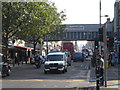
Living in NW6 7LH places you steps away from a dense array of shopping and leisure options. Tesco Willesden, Aldi Kilburn, and Sainsburys Kilburn form the core of your retail landscape, ensuring groceries and household essentials are always accessible. These five major supermarkets cut out the need for grocery shopping as a weekend excursion, supporting a daily-living rhythm where errands are swift and convenient. Your transport choices are exceptionally varied compared to other parts of the London grid. Five rail stations, five metro stations, and five ferry stops within practical reach provide unparalleled flexibility. You can choose between the Piccadilly Line at Kilburn Station, the Bakerloo Line at Finchley Road, or the Overground at Brondesbury. For those who prefer scenic travel, the Little Venice Waterbus Stop and London Zoo Waterbus Stop offer a leisurely alternative to the tube, connecting you to the city centre or Regent's Park. Beyond commerce and transit, the area offers six bus routes, including direct links to London Victoria Coach Station. This infrastructure benefits social attendees and reduces reliance on private car usage. The proximity of Kilburn High Road, a major shopping artery, means dining and entertainment venues are immediately adjacent. Life here balances urban convenience with the ability to reach London's cultural hubs without significant transit delays.
Amenities
Schools
Families considering this area have access to specific educational institutions within the immediate vicinity. Christ Church CofE Primary School is located nearby and holds a Good rating from Ofsted. This state-supported primary school serves as the main local option for younger children living in the neighbourhood. The designation of a Church of England school provides a specific ethos to the education available, which some parents may find appealing regarding moral foundation and community integration. Currently, the data highlights only one primary school in the immediate list, meaning secondary education would likely require travel to specific zones outside the narrow NW6 7LH boundary. The presence of a single well-rated primary institution offers a clear starting point for your research into family planning. You can expect robust primary education support for those with young children in this specific postcode. For residents without school-going children, the local school mix reflects the area's other demographic realities, such as the concentration of adults aged 30-64 and the flat-based housing stock. While nursery provision often supplements primary school catchment areas, the primary option remains central to the local cluster. The Good rating of Christ Church CofE Primary School provides a reassurance of educational standards, ensuring that families moving here do not face the prospect of long travel times for early years education. This local resource remains a stabilising factor for the community, despite the small geographical spread.
| Rank | School | Type | Entry gender | Ages |
|---|
Explore more schools in this area
Go to Schools tabDemographics
The community in NW6 7LH displays distinct demographic markers that reflect its position within the London housing market. The median age of residents is 47 years, indicating a population with significant life experience and stability. Most households consist of adults aged between 30 and 64 years, suggesting a permanent resident base rather than a student or young professional enclave. This age distribution often correlates with established families or empty nesters who have settled long-term in the area. It is crucial to understand that the majority of housing stock consists of flats, aligned with the London-wide trend for urban living. Consequently, only 34% of residents own their homes outright. This relatively low ownership figure suggests a market where long-term renting remains a significant pathway to living in this sector. The demographic landscape is predominantly White, mirroring the wider historical settlement patterns of this part of west London. You should note that crime risk assessments for this area return a medium rating. This reality does not negate the area's appeal but requires standard security precautions similar to many urban centres. The concentration of adults in the 30-64 bracket implies a need for services catering to working-age families and retirees alike. The combination of predominantly flat living and high tenancy rates means the social fabric is likely fluid, with frequent resident turnover balanced against the stability provided by the core adult demographic.
Household Size
Accommodation Type
Tenure
Ethnic Group
Religion
Household Composition
Age
Household Deprivation
NS-SEC
Explore more demographic insights in this area
Go to Demographics tabPlanning
Planning Constraints
- Flood RiskPremium
- Ramsar Wetland SitesPremium
- Area of Outstanding Natural BeautyPremium
- Protected Nature ReservePremium
- Protected WoodlandPremium