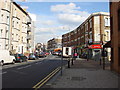
Area Overview for NW6 6JP
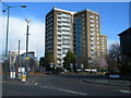
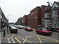
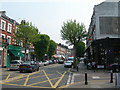
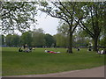
Photos of NW6 6JP


Area Information
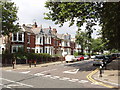
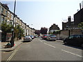
Living in NW6 6JP means residing within a specific postcode covering a small residential cluster of 2,049 households. This compact population creates a neighbourhood where daily life moves at a steadier pace than some of the more sprawling districts nearby. You are part of a community centred on Queens Park, where the proximity to transport hubs and local shops structures your routine. The area functions as a practical base for those who value direct access to London's north-west while maintaining a contained living environment. Your immediate surroundings are defined by established streets and a clear layout typical of this postcode area. Residents here enjoy a setting where the boundary between home and local amenities is short, allowing for quick trips to transport links or supermarkets without extensive travel. The character of NW6 6JP is one of established convenience, supported by a fixed population size that fosters community recognition. When you consider what life is like, you are stepping into an area where the built environment supports a settled way of living. The small footprint ensures that distance is often measured in minutes rather than miles, making this postcode a straightforward choice for those seeking a residential focus near key London arteries.
- Area Type
- Postcode
- Area Size
- Not available
- Population
- 2049
- Population Density
- 10497 people/km²
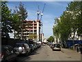
The property market in NW6 6JP is shaped by a housing stock where flats are the predominant accommodation type. You will encounter a mix of leases and freeholds within this small residential cluster, though data on specific leasehold details is not included in the general overview. With a home ownership rate of 43%, the area functions as a blend of owner-occupier and rental environments. This balance means you might see properties being marketed to first-time buyers looking for flats or investors seeking yield from well-maintained units. The concentration of flats suggests that vertical living is the standard here, offering convenience close to the ground floor or via elevator access. Buyers looking at this postcode should expect a market driven by practicality and location. The fact that 43% of residents own their homes indicates that there is a solid base of long-term owners who have chosen to make this their permanent address. Whether you are eyeing a flat for personal residence or investment, the stock is defined by this urban cluster layout. Your search will involve inspecting specific properties within the 2,049-unit cluster to find a home that suits your needs, as the market is not a uniform landscape but a collection of individual residential units.
House Prices in NW6 6JP
No properties found in this postcode.
Energy Efficiency in NW6 6JP
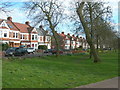
Your lifestyle in NW6 6JP centres on immediate access to shops and leisure venues. Retail convenience is high, with Co-op Queens, Sainsburys Queens, and Planet Organic Queen's located within practical reach. You can purchase groceries or organic produce without needing a long drive. For those who enjoy active travel, the transport network includes Queen's Park Station, Brondesbury Park Station, and Kilburn High Road Station for rail access. Metro services at Kilburn Park Station, Kilburn Station, and Maida Vale Station bring cultural and business districts close to your door. If you prefer water-based travel, Little Venice Waterbus Stop, London Zoo Waterbus Stop, and Camden Lock Waterbus offer a scenic route through the park. Bus links to London Victoria Coach Station and the Green Line Coach Station provide further regional connectivity. This density of amenities means your daily errands are resolved locally. You do not need to travel far for fresh food or to catch a train. The area supports a mix of shoppers who need supermarkets and those who seek the convenience of local organic outlets. All these facilities are situated near the residential cluster, ensuring that your day-to-day life is managed efficiently.
Amenities
Schools
| Rank | School | Type | Entry gender | Ages |
|---|
Explore more schools in this area
Go to Schools tabDemographics
The community in NW6 6JP centres on a mature demographic, with a median age of 47 years. The most common age range involves Adults between 30 and 64 years, indicating a neighbourhood dominated by working families and long-term residents. You are more likely to find established households here than newly arrived buyers. Home ownership stands at 43%, meaning slightly more than half of the residents own their properties outright or with a mortgage while the remainder live in rental accommodation. This split suggests a stable yet open market. Flats form the predominant accommodation type, reflecting the urban density of the small residential cluster that defines this postcode. The area is ethnically diverse, with White being the predominant ethnic group. There is no specific data on deprivation levels provided for this area, so you will find that quality of life varies based on individual property conditions rather than a generalised index for the whole cluster. You are looking for a section of London where the population is steady and the housing stock is varied. The age profile suggests a village-like atmosphere within the city, with many residents having been in their homes for a significant period.
Household Size
Accommodation Type
Tenure
Ethnic Group
Religion
Household Composition
Age
Household Deprivation
NS-SEC
Explore more demographic insights in this area
Go to Demographics tabPlanning
Planning Constraints
- Flood RiskPremium
- Ramsar Wetland SitesPremium
- Area of Outstanding Natural BeautyPremium
- Protected Nature ReservePremium
- Protected WoodlandPremium
- Crime RiskPremium