Area Overview for NW6 6DJ
Photos of NW6 6DJ
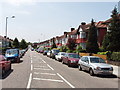
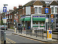
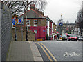
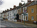
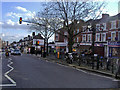
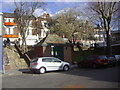
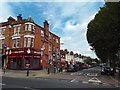
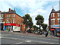
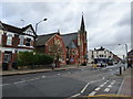
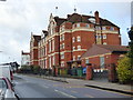


100 photos from this area
Area Information
Key information about the NW6 6DJ including its size, population, and administrative classification.
- Area Type
- Postcode
- Area Size
- 5168 m²
- Population
- 1851
- Population Density
- 9566 people/km²
House Prices in NW6 6DJ
22
Properties
£1,497,286
Average Sold Price
£314,000
Lowest Price
£2,700,000
Highest Price
Showing 22 properties
| Address | Type | Beds | Baths | Last Sale Price | Last Sale Date | |
|---|---|---|---|---|---|---|
| 5 Keslake Road, London, NW6 6DJ | Terraced | 5 | 2 | £2,100,000 | Jun 2024 | |
| 31 Keslake Road, London, NW6 6DJ | house | 3 | 1 | £1,760,000 | Oct 2022 | |
| 33 Keslake Road, London, NW6 6DJ | house | 3 | - | £2,700,000 | Jun 2022 | |
| 3 Keslake Road, London, NW6 6DJ | Terraced | 4 | 3 | £2,021,500 | May 2019 | |
| 15 Keslake Road, London, NW6 6DJ | Terraced | 5 | 2 | £1,700,000 | Feb 2018 | |
| 1 Keslake Road, London, NW6 6DJ | house | - | - | £2,015,000 | Jun 2017 | |
| 21 Keslake Road, London, NW6 6DJ | house | - | - | £2,120,000 | Jul 2016 | |
| 11 Keslake Road, London, NW6 6DJ | house | - | - | £1,980,000 | Nov 2015 | |
| 23 Keslake Road, London, NW6 6DJ | house | - | - | £1,236,500 | Jun 2011 | |
| 39A Keslake Road, London, NW6 6DJ | Flat | 4 | - | £470,000 | May 2010 |
Page 1 of 3
Energy Efficiency in NW6 6DJ
Amenities
Schools
| Rank | School | Type | Entry gender | Ages |
|---|
Explore more schools in this area
Go to Schools tabDemographics
Household Size
Family (3-5 people)
most common
Accommodation Type
Houses
most common
Tenure
57
majority
Ethnic Group
White
most common
Religion
N/A
most common
Household Composition
N/A
most common
Age
47
median
Adults (30-64 years)
most common
Household Deprivation
N/A
with no deprivation
NS-SEC
54
in Lower managerial occupations
Explore more demographic insights in this area
Go to Demographics tabPlanning
Planning Constraints
- Flood RiskPremium
- Ramsar Wetland SitesPremium
- Area of Outstanding Natural BeautyPremium
- Protected Nature ReservePremium
- Protected WoodlandPremium