Area Overview for NW6 5YL
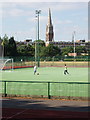
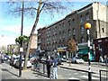
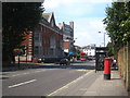
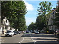
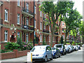
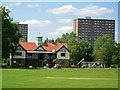
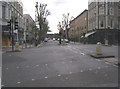
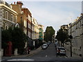
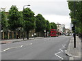
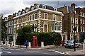
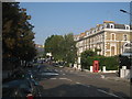
Photos of NW6 5YL

Area Information
Living in NW6 5YL means residing within a specific residential cluster that serves the London postcode district. This small area houses a population of 1,512 people, creating an intimate neighbourhood feel distinct from the wider borough. Daily life here is defined by proximity rather than distance, with residents accessing major transport hubs and retail centres that lie just metres away. The location sits at the intersection of Kilburn and Westbourne Park, offering immediate access to the Northern and Circle lines. You will find yourself surrounded by established infrastructure that supports both local convenience and wider city commutes without needing to travel far for essentials. The compact nature of this postcode means you are never truly isolated, yet you retain a sense of local identity separate from broader statistical trends.
- Area Type
- Postcode
- Area Size
- Not available
- Population
- 1512
- Population Density
- 17399 people/km²
The housing stock in NW6 5YL is characterised exclusively by flats, a fact that defines the architectural landscape of this postcode. With only 21% of households owning their homes, the area functions primarily as a rental market rather than an owner-occupied community. This low ownership rate suggests high demand for tenancies or a preference for investment properties among current landowners. Buyers looking for traditional family homes or detached properties in this specific location will not find them, as the physical structure of the neighbourhood consists of multi-unit residential buildings. The prevalence of flats makes this postcode suitable for singles, couples, or professionals who prioritise proximity to transport links over private gardens. Understanding this market structure is vital for anyone attempting to purchase properties near this location.
House Prices in NW6 5YL
Showing 71 properties
| Address | Type | Beds | Baths | Last Sale Price | Last Sale Date | |
|---|---|---|---|---|---|---|
| 45, Austen House, Cambridge Road, London, NW6 5YL | Flat | - | - | - | - | |
| 50, Austen House, Cambridge Road, London, NW6 5YL | Flat | - | - | - | - | |
| 42, Austen House, Cambridge Road, London, NW6 5YL | Flat | - | - | - | - | |
| 81, Austen House, Cambridge Road, London, NW6 5YL | Flat | - | - | - | - | |
| 54, Austen House, Cambridge Road, London, NW6 5YL | Flat | - | - | - | - | |
| 40, Austen House, Cambridge Road, London, NW6 5YL | Flat | - | - | - | - | |
| 41, Austen House, Cambridge Road, London, NW6 5YL | Flat | - | - | - | - | |
| 61, Austen House, Cambridge Road, London, NW6 5YL | Flat | - | - | - | - | |
| 83, Austen House, Cambridge Road, London, NW6 5YL | Flat | - | - | - | - | |
| 71, Austen House, Cambridge Road, London, NW6 5YL | Flat | - | - | - | - |
Energy Efficiency in NW6 5YL
Residents of NW6 5YL enjoy immediate access to a comprehensive network of amenities while remaining in a residential setting. Five retail outlets operate within practical reach, including Sainsburys Maida, M&S Queens, and Tesco High, ensuring daily shopping needs are met locally. Transport connectivity is exceptional with five metro stations nearby, including Kilburn Park Station, Maida Vale Station, and Westbourne Park Station. You can also utilise five rail hubs such as Queen's Park Station and Kilburn High Road Station for extended journeys. Furthermore, five waterbus stops provide river access, while five bus routes offer additional local mobility. This dense concentration of facilities means you rarely need to leave the immediate vicinity for groceries, commutes, or leisure activities.
Amenities
Schools
Families living in NW6 5YL have direct access to a varied selection of educational institutions. Closest to the residential cluster is Granville Plus Nursery School, catering to the earliest developmental years in the community. For primary education, South Kilburn School serves the local catchment area, providing state-funded schooling for young children. Additionally, the area benefits from independent education options, most notably The School of the Islamic Republic of Iran, which holds a satisfactory Ofsted rating. This mix of nursery, state primary, and independent schooling gives residents multiple pathways depending on their educational preferences. The presence of these specific institutions ensures that immediate learning needs are met without requiring long travel times for daily attendance.
| Rank | School | Type | Entry gender | Ages |
|---|
Explore more schools in this area
Go to Schools tabDemographics
The community profile for NW6 5YL shows a mature demographic with a median age of 47 years. Most residents fall within the adult age range of 30 to 64 years, suggesting a population that has likely settled permanently in the area. Home ownership stands at 21%, indicating that the majority of this cluster operates within the rental market. This high rental uptake aligns with the predominant accommodation type, which consists of flats rather than detached houses or semi-detached homes. The area also reflects significant ethnic diversity, with black residents forming the predominant group. These figures paint a picture of a densely populated urban ward where younger families may rent their flats while older demographics remain in the local housing stock.
Household Size
Accommodation Type
Tenure
Ethnic Group
Religion
Household Composition
Age
Household Deprivation
NS-SEC
Explore more demographic insights in this area
Go to Demographics tabPlanning
Planning Constraints
- Flood RiskPremium
- Ramsar Wetland SitesPremium
- Area of Outstanding Natural BeautyPremium
- Protected Nature ReservePremium
- Protected WoodlandPremium