Area Overview for NW6 5QT
Photos of NW6 5QT
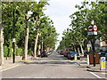


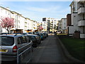
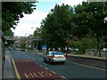
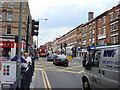
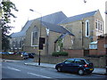
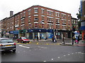
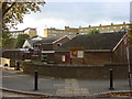
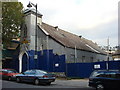
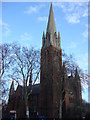
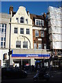
100 photos from this area
Area Information
Key information about the NW6 5QT including its size, population, and administrative classification.
- Area Type
- Postcode
- Area Size
- 9244 m²
- Population
- 2894
- Population Density
- 21170 people/km²
House Prices in NW6 5QT
71
Properties
£407,617
Average Sold Price
£123,454
Lowest Price
£643,000
Highest Price
Showing 71 properties
| Address | Type | Beds | Baths | Last Sale Price | Last Sale Date | |
|---|---|---|---|---|---|---|
| 23A Princess Road, London, NW6 5QT | Flat | 1 | 1 | £435,000 | Mar 2025 | |
| 47A Princess Road, London, NW6 5QT | Flat | 2 | 2 | £510,000 | Jan 2021 | |
| 15A Princess Road, London, NW6 5QT | Flat | - | - | £350,000 | Sep 2019 | |
| 25-A-23-C Princess Road, London, NW6 5QT | Flat | 2 | 1 | £599,950 | Mar 2016 | |
| 49A Princess Road, London, NW6 5QT | Flat | - | - | £430,000 | Sep 2015 | |
| 43A Princess Road, London, NW6 5QT | Flat | - | - | £436,000 | Aug 2015 | |
| 45A Princess Road, London, NW6 5QT | Flat | - | - | £480,000 | Aug 2013 | |
| 55A Princess Road, London, NW6 5QT | Maisonette | - | - | £355,000 | Jan 2012 | |
| 27 Princess Road, London, NW6 5QT | Maisonette | 3 | 2 | £643,000 | Jul 2011 | |
| 53A Princess Road, London, NW6 5QT | Flat | 2 | 1 | £315,000 | Mar 2011 |
Page 1 of 8
Energy Efficiency in NW6 5QT
Amenities
Schools
| Rank | School | Type | Entry gender | Ages |
|---|
Explore more schools in this area
Go to Schools tabDemographics
Household Size
One person
most common
Accommodation Type
Flats
most common
Tenure
13
majority
Ethnic Group
black_total
most common
Religion
N/A
most common
Household Composition
N/A
most common
Age
47
median
Adults (30-64 years)
most common
Household Deprivation
N/A
with no deprivation
NS-SEC
27
in Lower managerial occupations
Explore more demographic insights in this area
Go to Demographics tabPlanning
Planning Constraints
- Flood RiskPremium
- Ramsar Wetland SitesPremium
- Area of Outstanding Natural BeautyPremium
- Protected Nature ReservePremium
- Protected WoodlandPremium