Area Overview for NW6 5NL
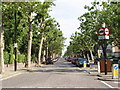
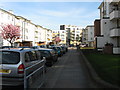
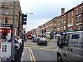
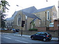
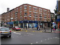
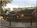
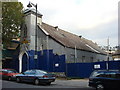
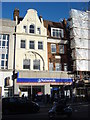
Photos of NW6 5NL


Area Information
Living in NW6 5NL means residing in a very compact residential cluster defined by a specific postcode covering just 3969 square metres. This tiny footprint supports a population of 1915 people, creating a densely populated environment within London. The area represents a small neighbourhood where space is at a premium, yet it maintains a defined local identity. Residents here experience daily life within one of the most concentrated housing zones in the region. The sheer density results in 482489 people per square kilometre, placing NW6 5NL in a category of intense urban living. Despite the small geographical size, the location connects you to wider transport networks and local services. You will find that navigating this specific cluster requires familiarity with its tight boundaries and immediate surroundings. The area serves as a focused point within the broader Kilburn and West Hampstead context. Your daily routine revolves around this concentrated community where proximity to amenities is high but physical space is limited. Buying a home in NW6 5NL offers a direct connection to a bustling slice of the city without the sprawl of larger suburbs.
- Area Type
- Postcode
- Area Size
- 3969 m²
- Population
- 1915
- Population Density
- 19601 people/km²
The property market in NW6 5NL is defined by a heavy reliance on rental accommodation rather than owner-occupied homes. Only 20% of households own their homes, while 80% rent within this postcode. This imbalance indicates a strong demand for rental properties throughout the NW6 5NL area. Flats are the predominant accommodation type, meaning you are looking for high-density urban living rather than houses with gardens. The small area size of 3969 square metres restricts the amount of variety in house styles available to buyers or tenants. This concentration points to a market where efficiency and location trump square footage. If you are searching for homes in NW6 5NL, expect a stock largely composed of purpose-built blocks or converted flats designed for city living. The low home ownership percentage suggests that selling a property here might be more common than buying with a mortgage. Investors and professionals drawn to the connectivity of the area likely drive the rental demand. You must consider the implications of leasehold terms or ground rents if entering the market in this specific cluster.
House Prices in NW6 5NL
Showing 16 properties
Energy Efficiency in NW6 5NL
Your lifestyle in NW6 5NL is heavily shaped by nearby amenities within practical reach. Local retail options include Tesco High, Sainsburys Camden, and M&S Kilburn SF, ensuring you have multiple supermarkets for daily groceries. Travel to the wider city is supported by five nearby rail stations, including Kilburn High Road Station, South Hampstead Station, and West Hampstead Railway Station. For metro access, you are close to Kilburn Park Station, Maida Vale Station, and St John's Wood Station. Water travel is also an option via the Little Venice Waterbus Stop, London Zoo Waterbus Stop, and Camden Lock Waterbus. Public bus services connect London Victoria Coach Station, Green Line Coach Station, and other major destinations. Living in NW6 5NL puts five distinct retail outlets and multiple transport terminals at your fingertips. You can walk to frequent shopping routes or catch trains and tube lines with minimal waiting. This density of services means you rarely need to venture far beyond the immediate/postcode boundaries for essentials. The variety of transport modes offers flexibility for your daily commute or weekend trips. You enjoy the convenience of being surrounded by major travel hubs and retail chains without the need for a car.
Amenities
Schools
| Rank | School | Type | Entry gender | Ages |
|---|
Explore more schools in this area
Go to Schools tabDemographics
The community in NW6 5NL is dominated by adults between the ages of 30 and 64 years. The median age for residents is 47 years, confirming that this is an established neighbourhood rather than a family zone for young children. Home ownership rates stand at 20%, meaning that 80% of households are likely renting their accommodation. Flats are the predominant accommodation type in this postcode. This housing mix reflects an area where tenancy is the norm for the vast majority of people. The predominant ethnic group in NW6 5NL is White, shaping the social fabric of this specific residential block. With over four thousand people living in every square kilometre, the demographic density mirrors the physical density of the streets. You are neighbouring individuals who have largely settled into this urban environment over time. The age profile suggests a population prioritising convenience and accessibility over suburban space. Living here aligns with a demographic that values central location and urban services. Tenants form the backbone of the community, making leasehold agreements the standard financial arrangement for most residents.
Household Size
Accommodation Type
Tenure
Ethnic Group
Religion
Household Composition
Age
Household Deprivation
NS-SEC
Explore more demographic insights in this area
Go to Demographics tabPlanning
Planning Constraints
- Flood RiskPremium
- Ramsar Wetland SitesPremium
- Area of Outstanding Natural BeautyPremium
- Protected Nature ReservePremium
- Protected WoodlandPremium