Area Overview for NW6 4ZG
Photos of NW6 4ZG
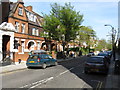
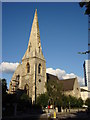
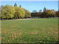
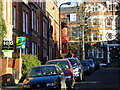
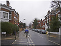
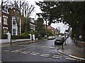
Area Information
Living in the NW6 4ZG postcode offers a distinct experience within a small residential cluster of England. This specific area is home to 1,719 people, creating a tightly knit environment where neighbours often recognise one another. Unlike sprawling suburbs, this postcode functions as an intimate pocket of the wider London neighbourhood, situated near major transport arteries but retaining a quieter residential feel. The daily rhythm here is defined by proximity to significant hubs like Kilburn and Hampstead, allowing residents to access city-wide amenities without being part of the chaotic commute. You will find a range of flats alongside occasional houses, reflecting the area's evolution into a convenient spot for professionals and families who prioritise location over generous square footage. The area avoids the constraints of protected natural sites or flood risks, meaning planning and safety are straightforward concerns for anyone moving here. London Zoo's presence nearby and farenzessels at Camden Lock add a unique layer of interest, offering spontaneous visits for children or adults alike.
- Area Type
- Postcode
- Area Size
- Not available
- Population
- 1719
- Population Density
- 15991 people/km²
The housing stock in NW6 4ZG is defined by specific constraints and opportunities for buyers. Flats dominate the accommodation type, meaning you will not typically find large detached family homes within this specific cluster. Only 31% of residents own their homes, a figure significantly lower than the national average. This imbalance highlights an area where landlords and investors hold a strong presence, likely due to the high accessibility of transport links. If you are looking to purchase a home, your primary options will be within the flat market, which often includes converted luxury apartments or traditional Victorian conversions. The total population of 1,719 suggests a limited inventory, so competition for specific units can be fierce. Prospective buyers should also consider that the area lacks protected woodland or nature reserves, which can mean development pressures are managed differently than in conserved zones. Understanding the home ownership level is crucial; investing here often means buying from a landlord rather than a previous owner-occupier, which can sometimes streamline transactions but may carry different tenure considerations.
House Prices in NW6 4ZG
No properties found in this postcode.
Energy Efficiency in NW6 4ZG
Your daily life in NW6 4ZG is supported by a dense network of amenities just minutes away. Retail choices include Sainsburys Camden, Sainsburys Kilburn, and Marks & Spencer Kilburn South Finchley, ensuring you can stock your weekly groceries or grab urgent items quickly. Public transport options are overwhelming for convenience. You stand within reach of London Victoria Coach Station, bus routes from London Victoria, and Green Line coaches if you need longer-distance travel five days a week. Cultural and leisure activities are integrated into the transport network itself. The nearby stree ferry stops at London Zoo Waterbus, Little Venice Waterbus, and Camden Lock Waterbus turn your commute into a leisure activity twice a week. Living near these specific venues means you can visit the zoo or browse Camden Lock without needing a car. This proximity to specific retail chains and transport nodes defines the practical reality of living in this postcode, offering a blend of urban convenience and residential calm.
Amenities
Schools
Families moving to NW6 4ZG have access to specific educational facilities within practical reach. Rainbow Montessori School stands out as an independent option located very close to the residential cluster. For parents seeking a non-state education path, this school provides a direct alternative to the comprehensive system. While independent institutions often carry higher fees, Rainbow Montessori appeals to those valuing personalised learning approaches. The nearness of this single named school suggests the area attracts families willing to pay for private education or those with flexible schooling arrangements. There is no data provided regarding other local state or primary schools in the immediate vicinity of this specific postcode, so Rainbow Montessori remains the only confirmed educational option to consider. Parents relying on the state system in this postcode will likely need to commute to schools further away, as Rainbow Montessori serves a specific demographic rather than all local children.
| Rank | School | Type | Entry gender | Ages |
|---|
Explore more schools in this area
Go to Schools tabDemographics
The community profile in NW6 4ZG reveals a mature population with a median age of 47 years. Adults between 30 and 64 years represent the most common age range, indicating an area settled by established residents rather than transient students or young professionals just entering the market. With only 31% of households owning their homes, this postcode leans heavily towards the rental sector. The predominant accommodation type is flats, which suits the density of a small cluster housing 1,719 residents. While the predominant ethnic group is White, the area serves as a mix of demographics common to inner London locations. The lack of protected planning constraints like Ramsar sites or Areas of Outstanding Natural Beauty suggests the visual landscape is shaped by urban development rather than preserved nature reserves. Safety scores place the neighbourhood below average for crime, with a specific risk score of 70 out of 100. This statistical detail provides a clear picture of a reasonably secure environment where residents can go about their daily lives without encountering frequent issues.
Household Size
Accommodation Type
Tenure
Ethnic Group
Religion
Household Composition
Age
Household Deprivation
NS-SEC
Explore more demographic insights in this area
Go to Demographics tabPlanning
Planning Constraints
- Flood RiskPremium
- Ramsar Wetland SitesPremium
- Area of Outstanding Natural BeautyPremium
- Protected Nature ReservePremium
- Protected WoodlandPremium