Area Overview for NW6 3ER
Photos of NW6 3ER
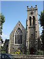
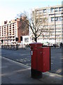
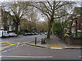
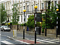
100 photos from this area
Area Information
Key information about the NW6 3ER including its size, population, and administrative classification.
- Area Type
- Postcode
- Area Size
- 6280 m²
- Population
- 1615
- Population Density
- 12442 people/km²
House Prices in NW6 3ER
54
Properties
£2,510,000
Average Sold Price
£40,000
Lowest Price
£3,450,000
Highest Price
Showing 54 properties
| Address | Type | Beds | Baths | Last Sale Price | Last Sale Date | |
|---|---|---|---|---|---|---|
| 181 Goldhurst Terrace, London, NW6 3ER | Terraced | 6 | 4 | £3,325,000 | Aug 2024 | |
| Former 179A, Goldhurst Terrace, London, NW6 3ER | Flat | - | - | £40,000 | May 2019 | |
| 215 Goldhurst Terrace, London, NW6 3ER | house | 5 | - | £3,370,000 | Nov 2018 | |
| 211 Goldhurst Terrace, London, NW6 3ER | house | 5 | - | £3,450,000 | Nov 2013 | |
| 201 Goldhurst Terrace, London, NW6 3ER | Detached | 5 | 3 | £3,200,000 | Mar 2011 | |
| 207 Goldhurst Terrace, London, NW6 3ER | Flat | - | - | £1,675,000 | Mar 2004 | |
| Flat 3, 203 Goldhurst Terrace, London, NW6 3ER | Flat | 2 | 1 | - | - | |
| 197 Goldhurst Terrace, London, NW6 3ER | Flat | 5 | 2 | - | - | |
| Basement Flat, 185 Goldhurst Terrace, London, NW6 3ER | Flat | 2 | 1 | - | - | |
| Basement Flat, 187 Goldhurst Terrace, London, NW6 3ER | Flat | 4 | - | - | - |
Page 1 of 6
Energy Efficiency in NW6 3ER
Amenities
Schools
| Rank | School | Type | Entry gender | Ages |
|---|
Explore more schools in this area
Go to Schools tabDemographics
Household Size
Two person
most common
Accommodation Type
Flats
most common
Tenure
47
majority
Ethnic Group
White
most common
Religion
N/A
most common
Household Composition
N/A
most common
Age
47
median
Adults (30-64 years)
most common
Household Deprivation
N/A
with no deprivation
NS-SEC
70
in Lower managerial occupations
Explore more demographic insights in this area
Go to Demographics tabPlanning
Planning Constraints
- Flood RiskPremium
- Ramsar Wetland SitesPremium
- Area of Outstanding Natural BeautyPremium
- Protected Nature ReservePremium
- Protected WoodlandPremium