Area Overview for NW6 2BE
Photos of NW6 2BE
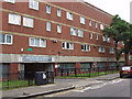
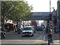
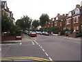
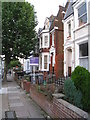
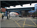
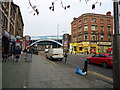
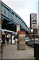
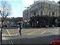
100 photos from this area
Area Information
Key information about the NW6 2BE including its size, population, and administrative classification.
- Area Type
- Postcode
- Area Size
- 3862 m²
- Population
- 1924
- Population Density
- 16473 people/km²
House Prices in NW6 2BE
26
Properties
£301,188
Average Sold Price
£70,000
Lowest Price
£510,000
Highest Price
Showing 26 properties
| Address | Type | Beds | Baths | Last Sale Price | Last Sale Date | |
|---|---|---|---|---|---|---|
| 8 Brassey Road, London, NW6 2BE | Flat | 2 | 1 | £307,500 | Feb 2022 | |
| 5 Brassey Road, London, NW6 2BE | Flat | 2 | 1 | £400,000 | Mar 2017 | |
| 16 Brassey Road, London, NW6 2BE | Terraced | 3 | 1 | £510,000 | Jan 2015 | |
| 10 Brassey Road, London, NW6 2BE | Terraced | 3 | - | £357,000 | Sep 2010 | |
| 24 Brassey Road, London, NW6 2BE | Terraced | - | - | £310,000 | Oct 2005 | |
| 12 Brassey Road, London, NW6 2BE | Maisonette | - | - | £255,000 | Sep 2002 | |
| 14 Brassey Road, London, NW6 2BE | Terraced | 3 | 2 | £200,000 | Feb 2000 | |
| 9 Brassey Road, London, NW6 2BE | Flat | - | - | £70,000 | Mar 1999 | |
| 18 Brassey Road, London, NW6 2BE | Terraced | 3 | 1 | - | - | |
| 20 Brassey Road, London, NW6 2BE | Terraced | - | - | - | - |
Page 1 of 3
Energy Efficiency in NW6 2BE
Amenities
Schools
| Rank | School | Type | Entry gender | Ages |
|---|
Explore more schools in this area
Go to Schools tabDemographics
Household Size
One person
most common
Accommodation Type
Flats
most common
Tenure
23
majority
Ethnic Group
White
most common
Religion
N/A
most common
Household Composition
N/A
most common
Age
47
median
Adults (30-64 years)
most common
Household Deprivation
N/A
with no deprivation
NS-SEC
43
in Lower managerial occupations
Explore more demographic insights in this area
Go to Demographics tabPlanning
Planning Constraints
- Flood RiskPremium
- Ramsar Wetland SitesPremium
- Area of Outstanding Natural BeautyPremium
- Protected Nature ReservePremium
- Protected WoodlandPremium