Area Overview for NW6 2BB
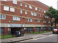
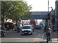
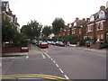
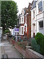
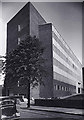
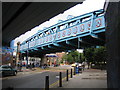
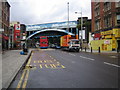
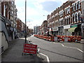
Photos of NW6 2BB
Area Information
Living in NW6 2BB means residing in a very small, densely populated residential cluster within greater London. This specific postcode covers just 5605 square metres yet houses 1924 people. That figure translates to a population density of 343,286 people per square kilometre. You will find this area is defined by intense urban living rather than sprawling gardens or quiet lanes. The character here is one of high concentration where every square metre serves the needs of a large population. Daily life revolves around proximity to major thoroughfares and central hubs rather than secluded escape. The sheer number of residents packed into this tiny footprint shapes the local rhythm. Noise levels, footfall, and the general buzz of city life are inherent to your experience here. While the space is tight, the location ensures you are never far from essential services or transport links. This high-density environment suits those who prioritise urban convenience over spatial luxury. You must consider whether you thrive in a tightly knit, high-volume neighbourhood or prefer the breathing room that lower-density areas provide. The area represents a compact slice of London living where efficiency and accessibility define the daily routine for its occupants.
- Area Type
- Postcode
- Area Size
- 5605 m²
- Population
- 1924
- Population Density
- 16473 people/km²
The property market in NW6 2BB is heavily skewed towards rental living rather than owner-occupation. Specifically, the data shows that only 23% of households own their homes. This significant majority of renters indicates that the local housing stock is dominated by investment properties or houses managed by external landlords. You are more likely to find tenanted accommodations than family homes bought for lifetime residence. Flats constitute the predominant accommodation type in this postcode. This structure aligns with the high population density of 343,286 people per square kilometre found within the 5605 square metres of this area. For buyers looking at this micro-location, expect a high proportion of buy-to-let apartments rather than detached houses. The low home ownership rate suggests a vibrant letting market where competition among rental properties may be intense. If you are considering purchasing, your goal would likely be to join the 23% of owners or to acquire a flat in a building with frequent tenant changes. This market dynamic often affects property values and leasehold terms differently than in owner-occupied estates.
House Prices in NW6 2BB
Showing 45 properties
| Address | Type | Beds | Baths | Last Sale Price | Last Sale Date | |
|---|---|---|---|---|---|---|
| 91 Brassey Road, London, NW6 2BB | Flat | 1 | 1 | £225,000 | Mar 2025 | |
| 78 Brassey Road, London, NW6 2BB | Flat | - | 1 | £225,000 | May 2024 | |
| 85 Brassey Road, London, NW6 2BB | Flat | - | - | £260,000 | Jan 2022 | |
| 113 Brassey Road, London, NW6 2BB | Flat | - | - | £372,500 | Dec 2018 | |
| 76 Brassey Road, London, NW6 2BB | Flat | - | - | £249,000 | Aug 2015 | |
| 116 Brassey Road, London, NW6 2BB | Flat | - | - | £260,000 | Oct 2012 | |
| 104 Brassey Road, London, NW6 2BB | Flat | 1 | 1 | £169,000 | Mar 2006 | |
| 114 Brassey Road, London, NW6 2BB | Flat | - | - | - | - | |
| 95 Brassey Road, London, NW6 2BB | Flat | - | - | - | - | |
| 96 Brassey Road, London, NW6 2BB | Flat | - | - | - | - |
Energy Efficiency in NW6 2BB
Your daily lifestyle in NW6 2BB is defined by immediate access to major commercial and leisure hubs. You look no further than Kilburn Station for your metro needs, supported by the network of Finchley Road and Kilburn Park stations. Retail convenience is addressed by three major supermarket chains situated within reach, including Tesco Kilburn, Sainsburys Kilburn, and Waitrose Little. These options ensure you have quick access to fresh groceries and household essentials without travelling far. Leisure and transport variety add further depth to your routine. Five rail stations, such as Brondesbury and West Hampstead Overground, offer diverse travel options beyond the standard tube network. Five ferry stops provide a unique leisure alternative, allowing you to visit London Zoo, Little Venice, or Camden Lock Waterbus by water. Your bus connections extend beyond local stops to major hubs like London Victoria Coach Station and Green Line Coach Station. This dense combination of five metro stations, five rail stations, five retail points, three bus locations, and five ferry terminals creates a lifestyle where every need is met within a short walk. You live minutes away from the city's pulse.
Amenities
Schools
| Rank | School | Type | Entry gender | Ages |
|---|
Explore more schools in this area
Go to Schools tabDemographics
The community in NW6 2BB reflects an older, established demographic profile distinct from many other London zones. The median age stands at 47 years, indicating a mature neighbourhood where families and individuals in mid-life dominate the scene. Adults between 30 and 64 years represent the most common age range within this postal code. This suggests a stability of long-term residents rather than a transient student or young professional crowd. Housing ownership is relatively low compared to national averages for such an area, with only 23% of households owning their homes outright. The remaining majority likely rents, contributing to a dynamic but potentially less stable residential turnover. Flats are the predominant accommodation type, fitting the high-density nature of this small postcode. While specific data on ethnic diversity exists only as a predominant group, the White demographic is noted as the main classification for this cluster. Understanding this age distribution helps you grasp the typical neighbours you might meet. A 47-year-old median resident implies a community accustomed to established routines, with schools and amenities catering to children and young families rather than solely retirees or singles.
Household Size
Accommodation Type
Tenure
Ethnic Group
Religion
Household Composition
Age
Household Deprivation
NS-SEC
Explore more demographic insights in this area
Go to Demographics tabPlanning
Planning Constraints
- Flood RiskPremium
- Ramsar Wetland SitesPremium
- Area of Outstanding Natural BeautyPremium
- Protected Nature ReservePremium
- Protected WoodlandPremium